Decent Wednesday followed by more rain for Thursday
SUMMARY: A much more active and wet pattern is setting up for us here in north Mississippi and west Alabama this next week. Expect some locally heavy rain Thursday into Friday. A better chance of storms will also exist early next week.
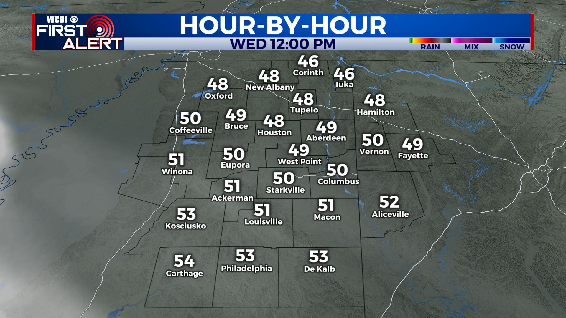
WEDNESDAY: We’re waking up to some wet roads and cloudy skies after yesterday’s rain event. We will see more sunshine today for our Wednesday. Highs in the lower 50s. Winds N/SW 5-10 mph.
WEDNESDAY NIGHT: Turning cloudy this evening with rain returning to the region overnight. Overnight lows in the mid 40s.
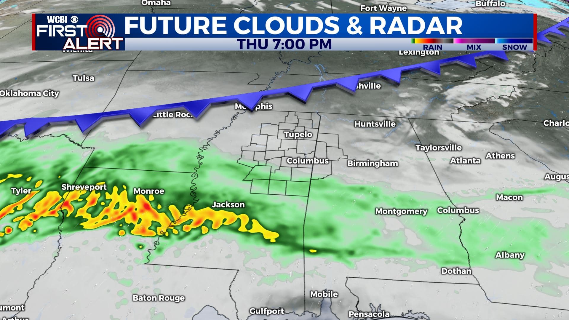
THURSDAY: Areas of widespread rain. Rain could be heavy at times. Highs in the upper 50s to near 60 degrees.
THURSDAY NIGHT: Cloudy. Areas of rain continue. Overnight lows in the 40s.
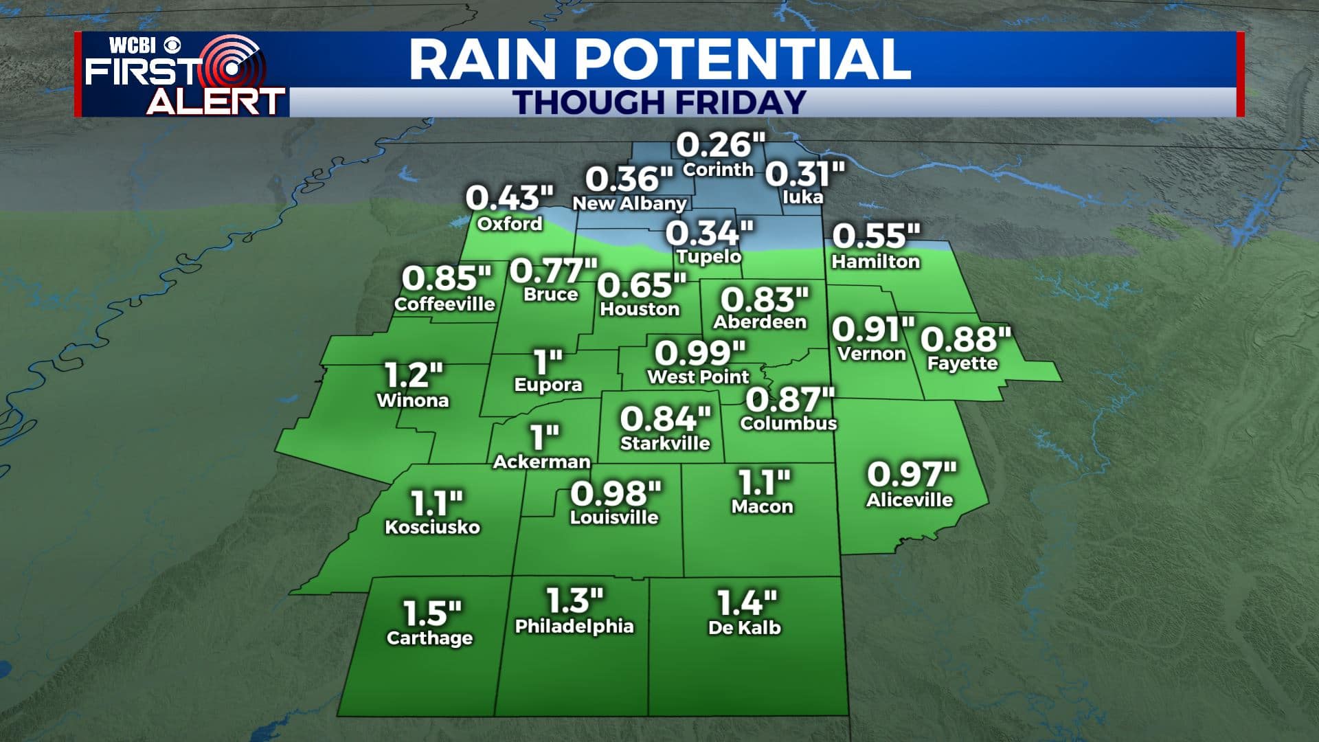
FRIDAY: Mostly cloudy with some rain chances as our system moves out. Highs in the lower to mid 50s. Anywhere from about a quarter of an inch to an inch of rain could fall in our area. Some higher totals are possible to our south.
FRIDAY NIGHT: Skies clearing up a bit. A chilly night as overnight lows fall to the 30s.
SATURDAY: A mix of sun & clouds as we get a break in our weather pattern. Highs in the lower to mid 50s.
SUNDAY: Mostly cloudy with rain showers. Highs in the upper 50s.
EARLY NEXT WEEK: Mostly cloudy. Rain and storms are likely for Monday and some could end up being on the strong side. It’s something we’ll keep watching during the coming days. Conditions should improve on Tuesday. Highs in the lower to mid 60s.
Stay connected with @WCBIWEATHER on Facebook, Twitter, Instagram, and the WCBI News App


Leave a Reply