Drier and less humid weather are moving in
SUMMARY: The rest of the workweek is looking to be fairly quiet, sunny, warm, dry and less humid. Enjoy it while it lasts! The summer heat and the humidity levels bump back up by the weekend.
TUESDAY: An isolated storm will also be possible on Tuesday, but we’ll mostly stay dry. Temperatures will only top out in the mid 80s on Tuesday. Light NW winds.

TUESDAY NIGHT: Mostly clear skies, calm and comfortable. Overnight lows will be in the 60s.
WEDNESDAY-FRIDAY: Mid to late week looks very pleasant and nice with mostly sunny skies and highs in the upper 80s to near 90. Heat and humidity will start to creep back in by Friday. Overnight lows will remain in the mid to upper 60s.
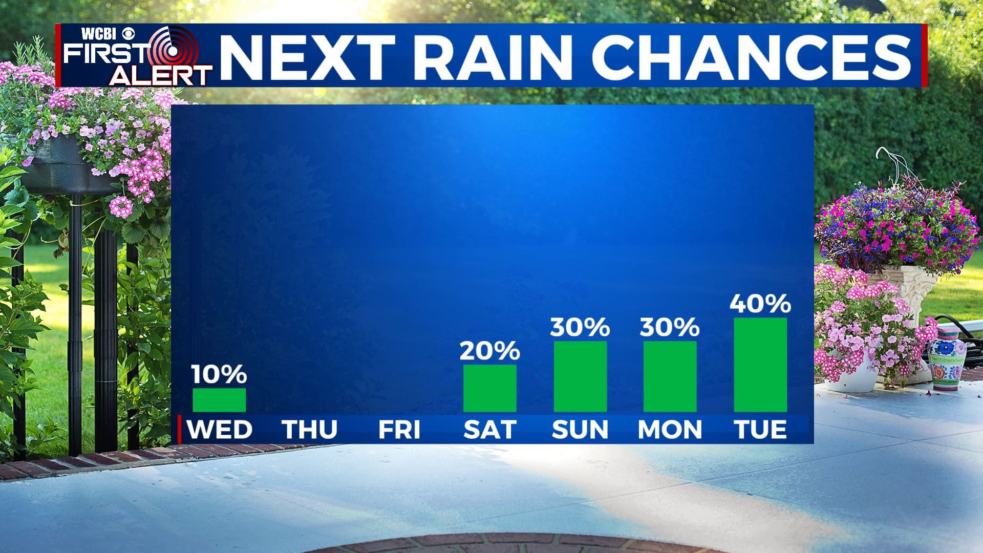
SATURDAY-SUNDAY: It will be hot & humid once again by the weekend as highs return to the mid 90s. There will also be the chance of some isolated pop-up storms on Saturday and Sunday with a mix of sun & clouds.
TROPICS: Hurricane Isaias made landfall in southern North Carolina near Ocean Isle Beach around 11:10 PM EDT Monday as a Category 1 Hurricane with maximum sustained winds of 85 mph. It will now be racing up the East Coast as a Tropical Storm bringing the threat of heavy rain & flooding.
Stay connected with @WCBIWEATHER on Facebook, Twitter, Instagram, and the WCBI News App


Leave a Reply