Drier Wednesday, more rain Thursday
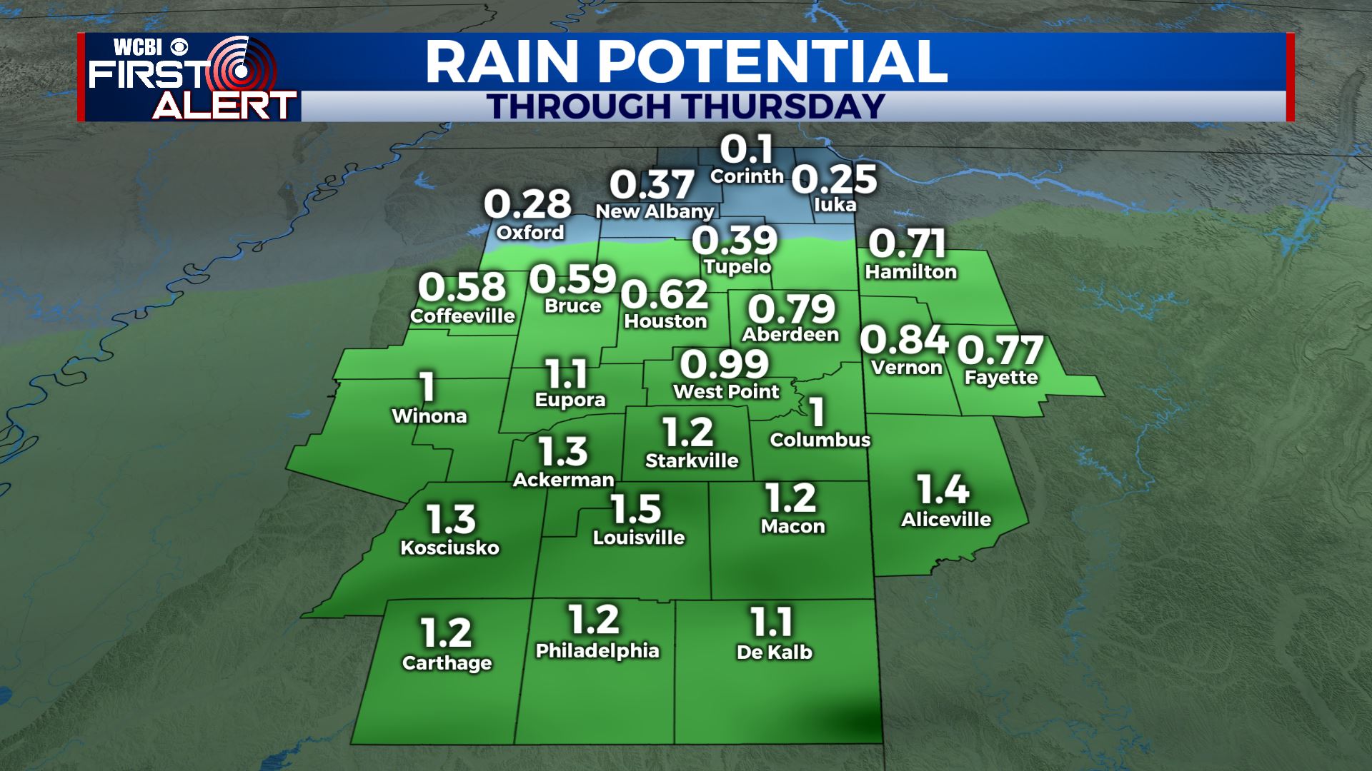
SUMMARY: Rain chances will lower on Wednesday but another system will move through on Thursday. The heaviest rain with this next system will likely stay just to our south but any rain is unwelcome. Cooler and drier air settles in for the end of the work week and the start of the weekend.
TUESDAY NIGHT: Heavy rain early in the evening with lingering showers overnight. Lows in the 40s. Northerly winds 10-15 mph.
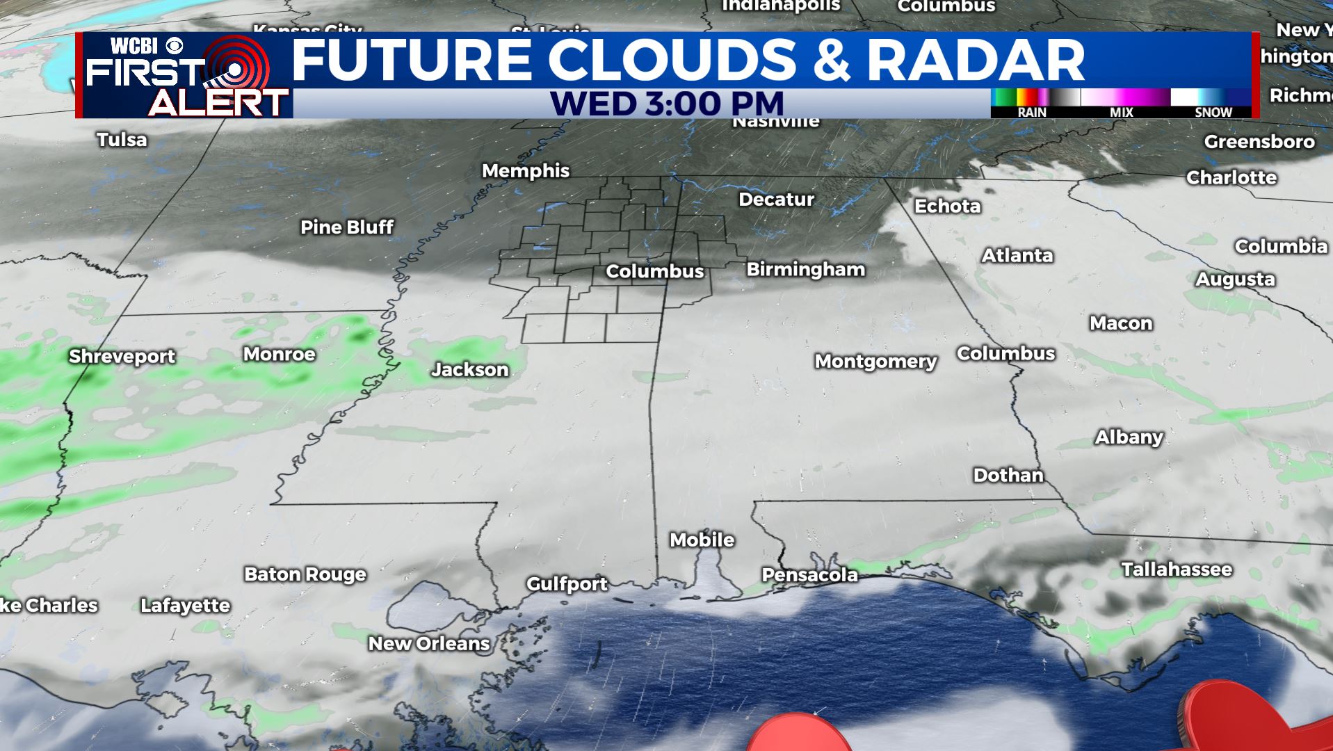
WEDNESDAY: Mostly cloudy and cooler. Highs in the low 50s. Northerly winds around 10 mph.
WEDNESDAY NIGHT: Mostly cloudy. Areas of rain developing. Lows in the low 40s.
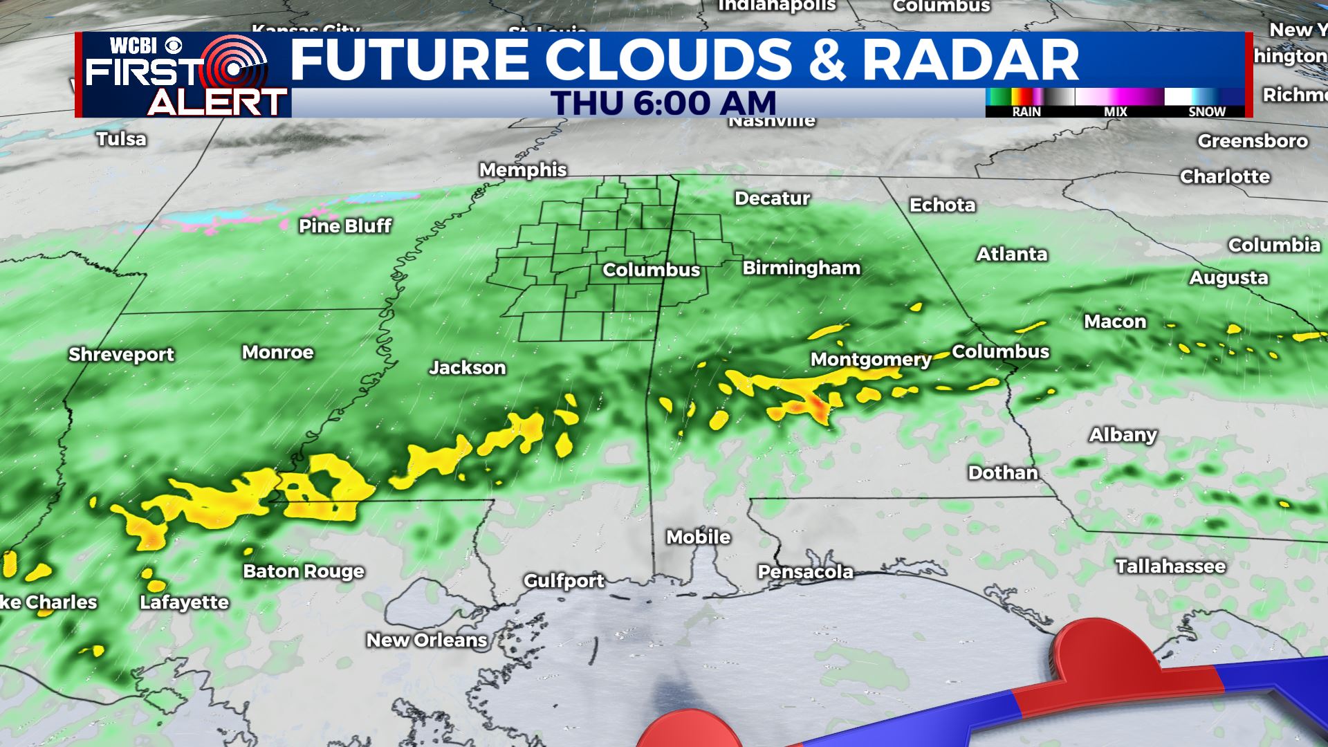
THURSDAY: Areas of rain. The heaviest activity is likely going to be along and south of the I-20 corridor. Some wintry precipitation can’t be totally ruled out across the TN/MS border area in the morning either. No impacts are expected with that, even if it were to happen. Look for highs mainly in the 40s with chilly northerly winds continuing. Skies will clear from north to south during the afternoon.
THURSDAY NIGHT: Clear and cold. Lows in the upper 20s.
FRIDAY: Sunny. Highs in the upper 40s.
FRIDAY NIGHT: Clear and cold. Lows in the mid 20s.
SATURDAY: Mostly sunny. Highs in the low 50s.
SATURDAY NIGHT: Partly cloudy. Lows in the upper 30s.
SUNDAY: Increasing clouds. Rain possible in the afternoon and evening. Highs in the low 50s.
MONDAY: Areas of rain. Perhaps a storm. Highs around 60.
Follow @WCBIWEATHER on Facebook, Twitter, Instagram, and the WCBI News App


Leave a Reply