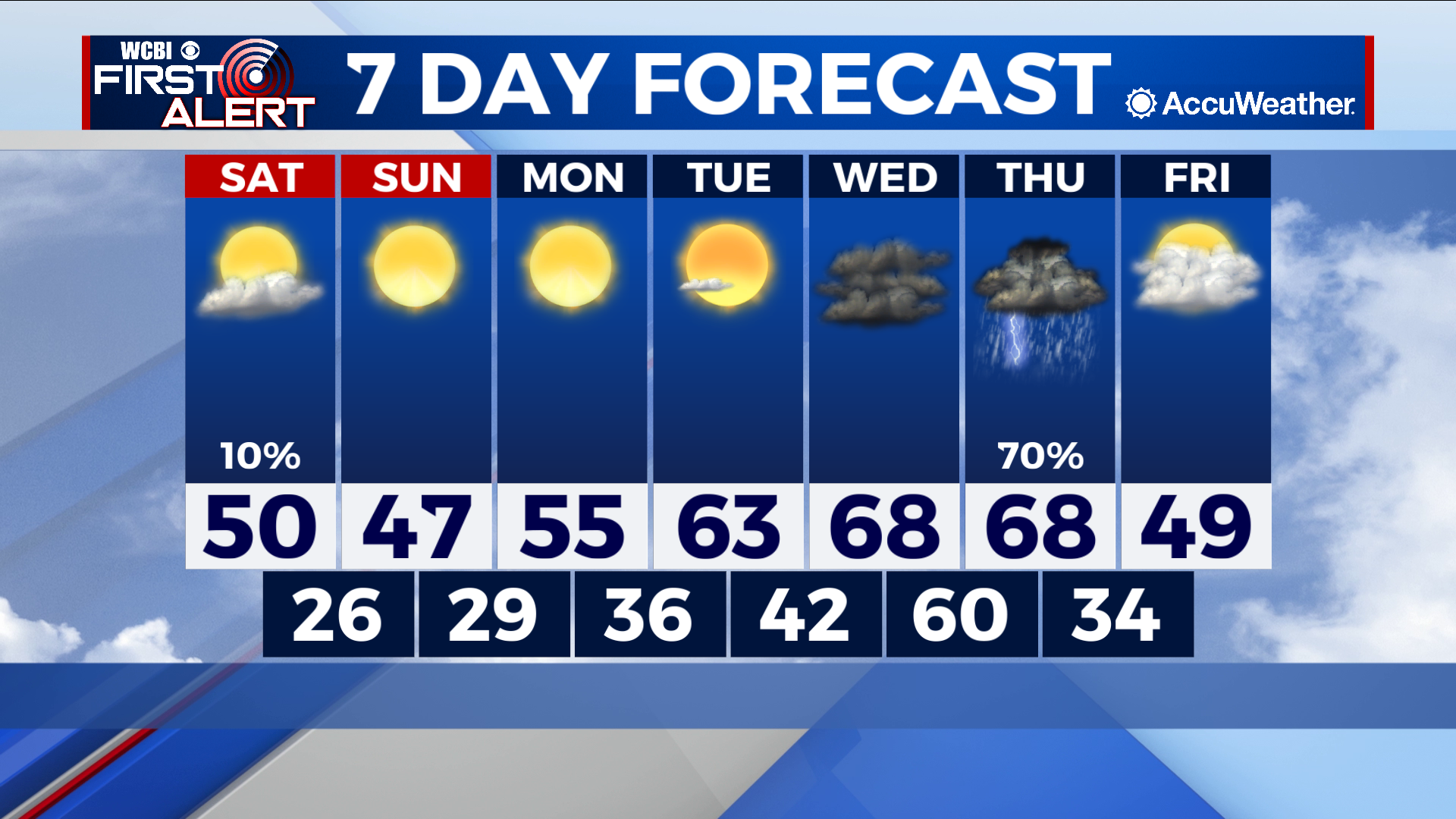
Early cold front Saturday provides temporary reality check
COLUMBUS – SUMMARY: An cold front rushing through the region Saturday morning drops lows back into the 20s for the duration of the weekend before recovery begins next week. A pattern of clear skies setting up on Sunday and remaining through Tuesday will aid a rapid warmup, bringing highs back into the high 60s by Wednesday. Thunderstorms Thursday will bring the only major rain chance of the next 7 days with some potential for severe storms to this point.
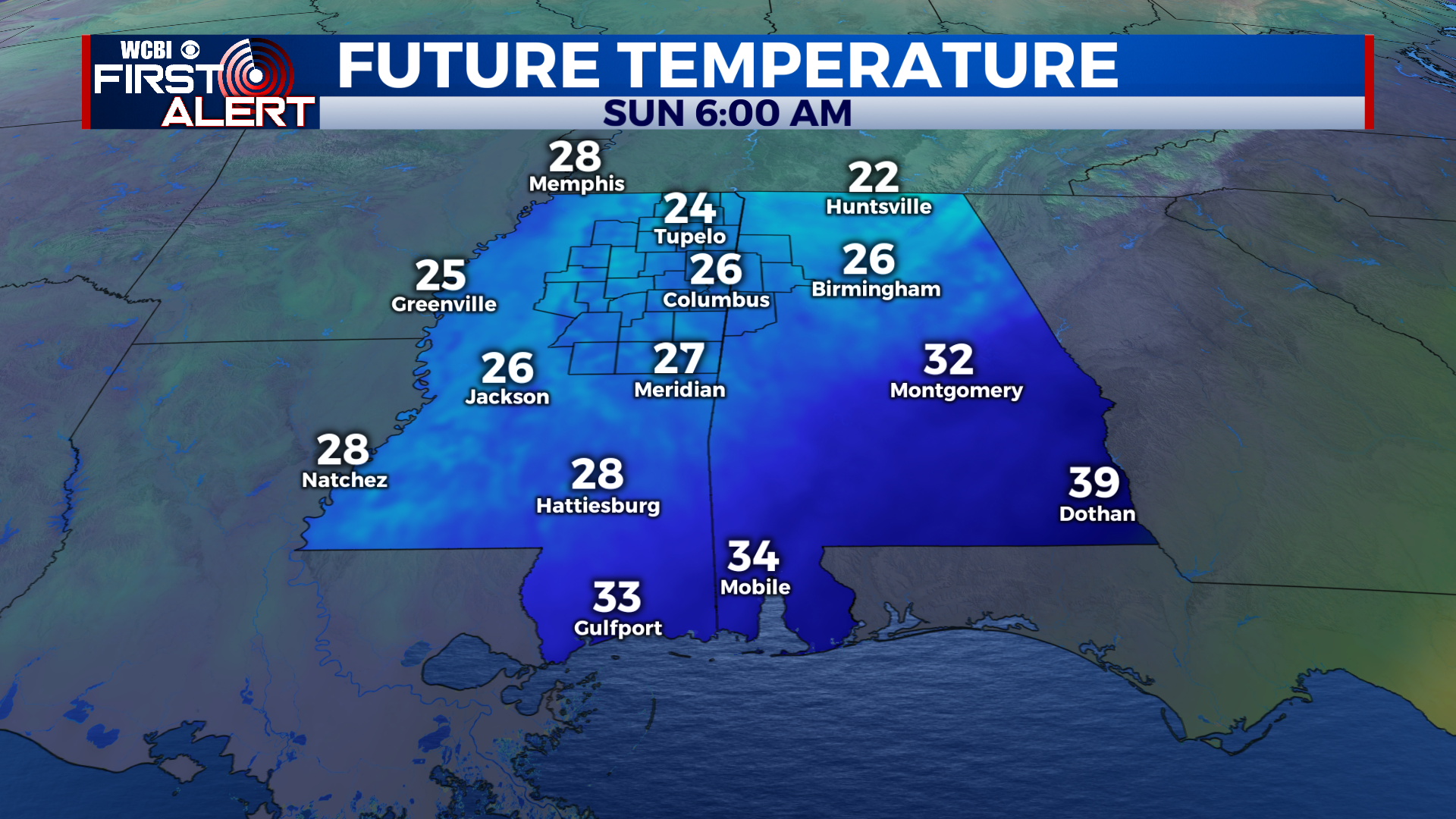
SATURDAY: Our cold front Saturday will have made its way through Northeastern Mississippi by the late morning hours, stifling any chance for significant warming to occur. Some clouds will be present and the stray shower cannot be ruled out, however, many of us will stay dry. Lows will be most effected by our weekend event, with temperatures dropping into the mid 20s overnight.
SUNDAY: While much more beautiful outside sky-wise, it really will not feel particularly comfortable outside Sunday. Highs only bump into the upper 40s, as temperatures begin their slow climb back to the mild range. Lows improve slightly, but bottom out in the upper 20s.
NEXT WEEK: The clear pattern established Monday will continue until Wednesday, when clouds make a return to the area with gusto. Temperatures in the meantime will have ample opportunity to warm rapidly back into the highs 60s and potentially into the 70s by Wednesday. Lows, likewise will improve into the 60s by the overnight hour on Wednesday. The big fish that everyone is watching next week is the severe storm possibility coming up on Thursday. Thunderstorms at this point are likely but the big question mark with Thursday’s event are what the atmospheric ingredients will be looking like. Fuel for storms is looking rather modest right now while the “spin” required for supercell formation is looking favorable. Conditions can and do change however, and we will keep you updated on the situation as it evolves.


Leave a Reply