Elevated fire danger for Thursday
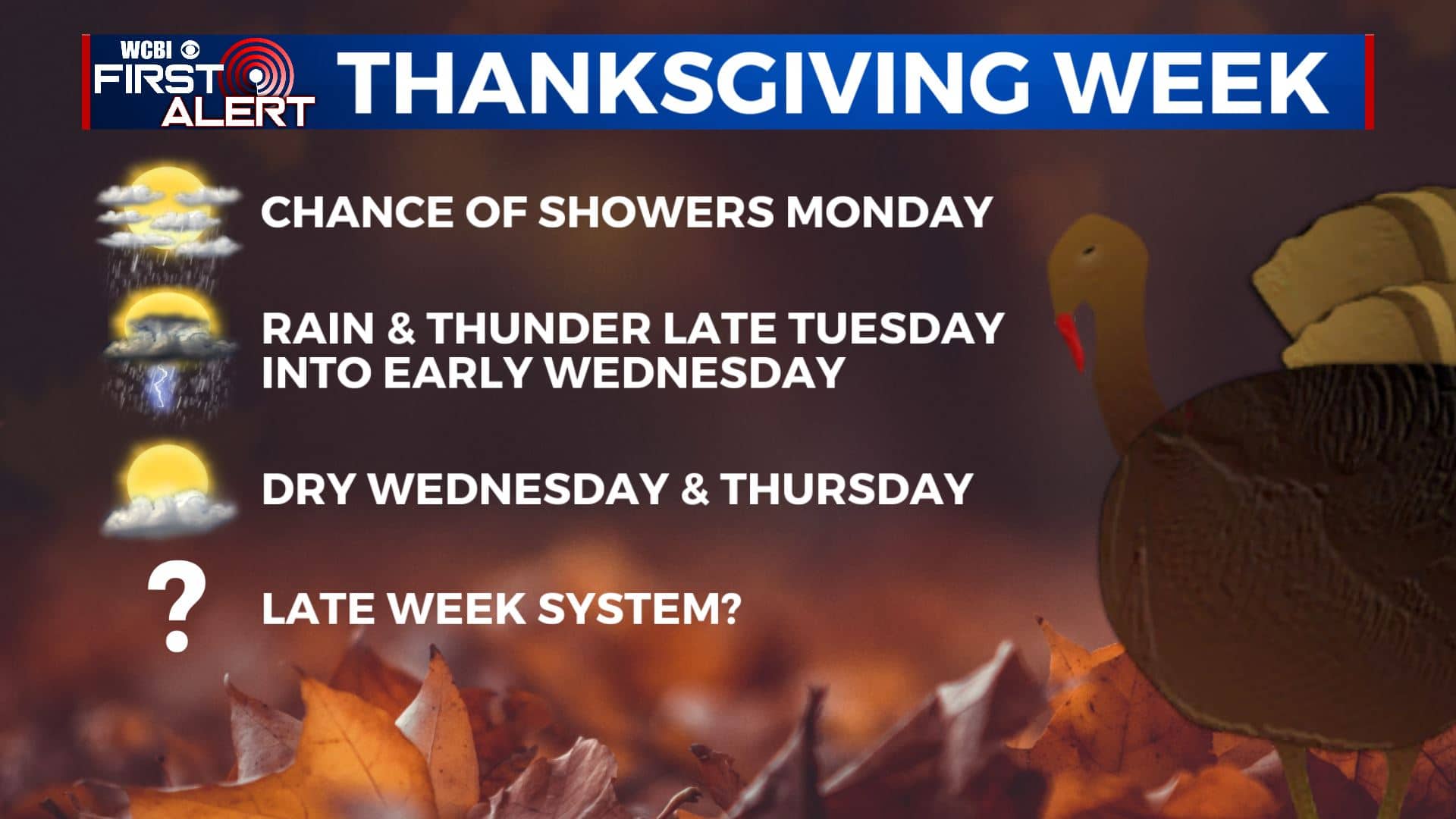
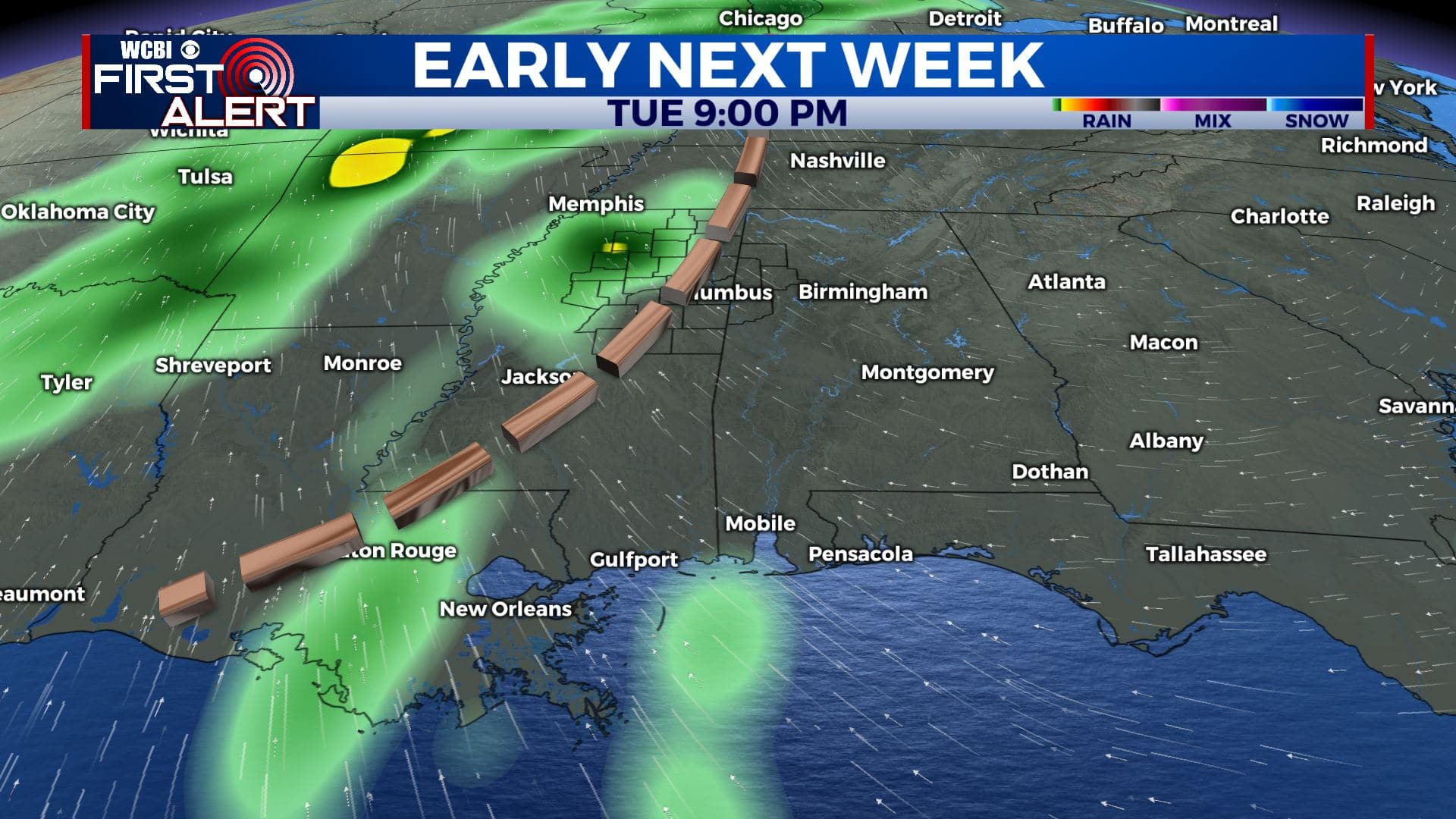
SUMMARY: We’re staying sunny and quiet with our weather for a few more days. Warmer temperatures and an active weather pattern are making a return as we head into the weekend and early next week. A system on Tuesday could bring us a better chance of rain and storms. We’ll need keep an eye on that one for the chance of strong storm activity. It’s still too early to tell if anything will come of it but the setup bears watching. Stay tuned!
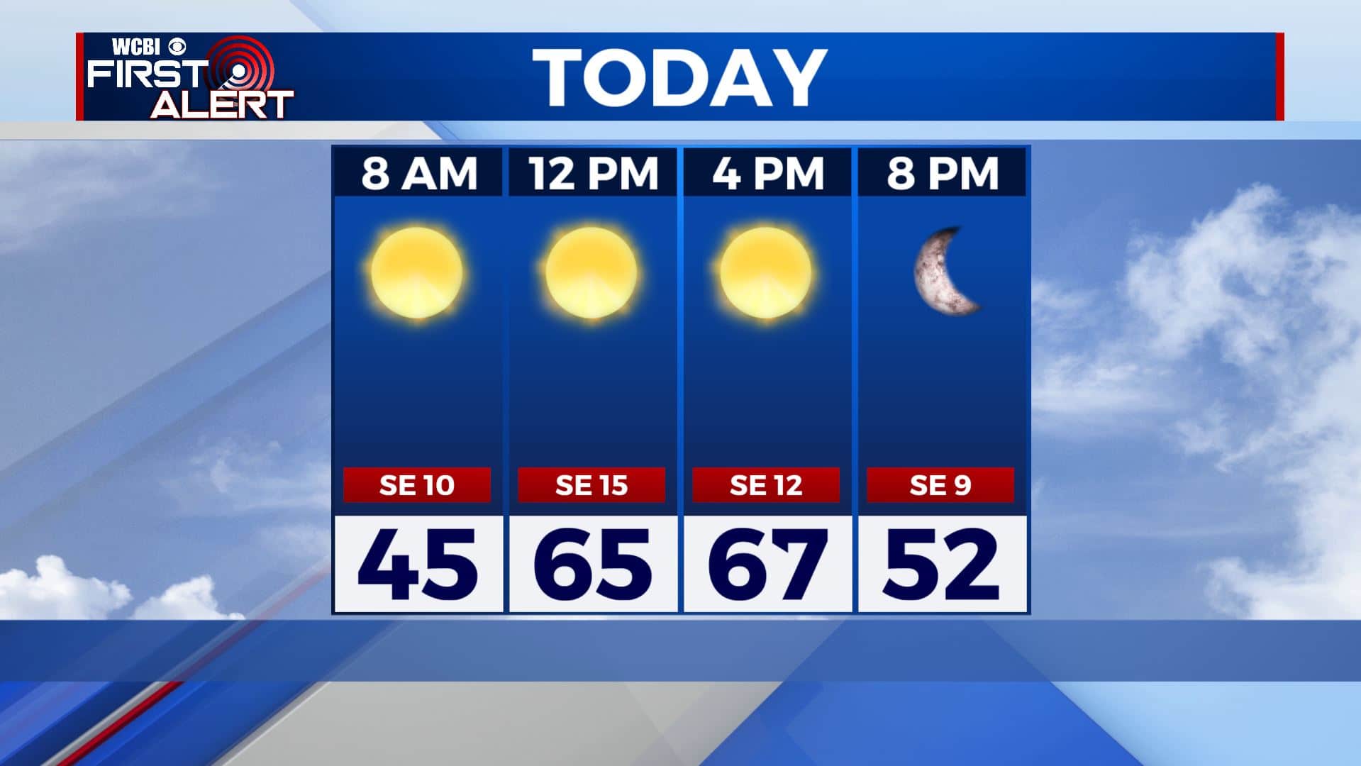
THURSDAY: We’re staying sunny once again for our Thursday. Highs will slowly start warming back up in the mid to upper 60s thanks to a breezy SE wind 5-15 mph. Fire conditions will be elevated so it’s best not to do any burning out due to the gusty breezes & low humidity.
THURSDAY NIGHT: Clear skies. Not as chilly with overnight lows in the 40s.
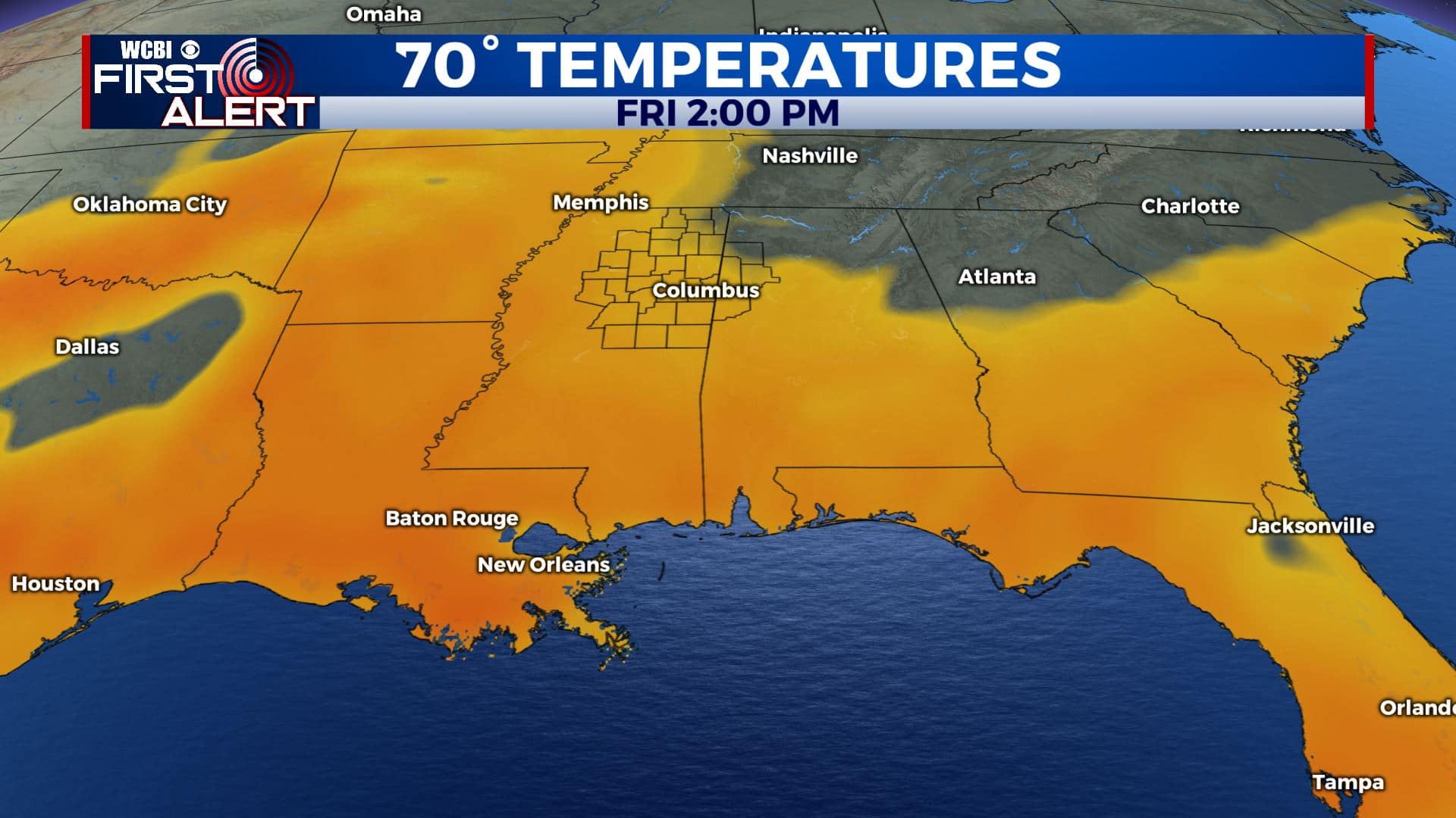
FRIDAY: Sunny and clear blue skies. Highs continuing to warm up to around 70 degrees. Evening temperatures in the 50s so will need the jackets for high school football.
FRIDAY NIGHT: Mostly clear skies. Overnight lows in the 40s.
SATURDAY: Mostly sunny skies. Highs in the lower 70s.
SATURDAY NIGHT: Mostly clear. Overnight lows near 50 degrees.
SUNDAY: A mix of sun & clouds. Highs in the lower 70s. A chance of late day and evening showers as our next cold front is set to push through the region.
MONDAY: A mix of sun & clouds after some possible morning showers. Highs cooling back down to the 60s.
TUESDAY: A mix of sun & clouds with rain and thunder likely during the evening into the overnight hours. Something we’ll have to watch. Highs around 70.
WEDNESDAY & THANKSGIVING DAY: A mix of sun and clouds. Looking to be a dry and mild holiday. Highs in the 60s.
Stay connected with @WCBIWEATHER on Facebook, Twitter, Instagram, and the WCBI News App


Leave a Reply