Excessive Heat Warning for Tuesday, but Relief is on the Way!
SUMMARY: Another dangerously hot and humid day is on tap for Tuesday but some afternoon and evening storms may provide some relief. A cold front will push through either Tuesday night or Wednesday and it will usher in lower humidity for the end of the work week.
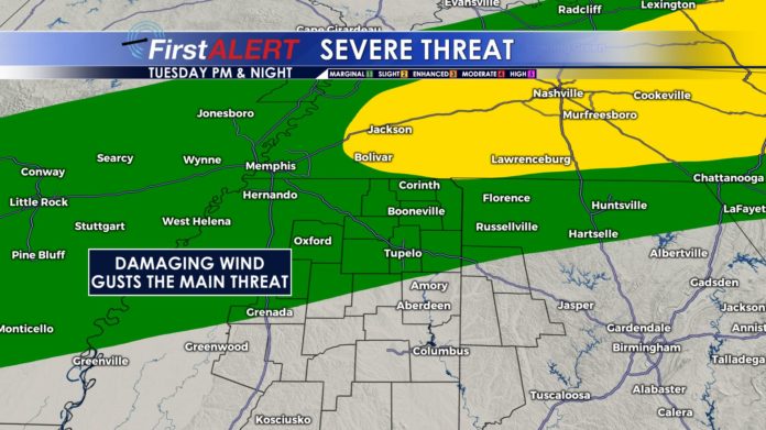
TUESDAY: Hazy, hot, and humid. Highs in the mid to upper 90s with heat index values ranging from 105-115 during peak heating. Limit your exposure to the sun, stay hydrated, and stay indoors in air conditioning if you can. There may be a few afternoon and evening showers and storms with heavy downpours, lightning, and perhaps some damaging wind gusts.
TUESDAY NIGHT: Scattered showers and storm chances continue. Lows in the mid 70s.
WEDNESDAY: Some showers and storms are possible, especially across the southern 1/2 to 1/3 of the WCBI coverage area. Northern locations may stay dry the entire day. Slightly cooler highs around 90 are expected as northeasterly breezes develop and usher in less humid air.
WEDNESDAY NIGHT: Mainly clear and quiet. Lows in the upper 60s to around 70.
THURSDAY-SATURDAY: Pretty quiet weather is currently anticipated. Humidity levels will be lower than recent days so the heat index may only be in the upper 90s to near 100. Actual highs are still expected to be in the low to mid 90s.
SUNDAY-MONDAY: Spotty showers and storms are possible with the chance of rain at 30%. Highs stay in the 90s.
Follow @WCBIWEATHER on Facebook, Twitter, and Instagram


Leave a Reply