Excessive Heat Warnings in effect for Friday; Stay safe & cool
SUMMARY: An Excessive Heat Warning and a Heat Advisory remains in effect for our Friday as the dangerous heat and humidity will hang around through the weekend. Heat indices could be as high as 115 so be sure to limit your exposure to the extreme conditions. Take the proper precauti
ons to stay cool & hydrated to help prevent heat stress or heat exhaustion issues! Some relief is on the way as a cold front will push through Sunday into Monday, bringing us rain & cooler temperatures next week. 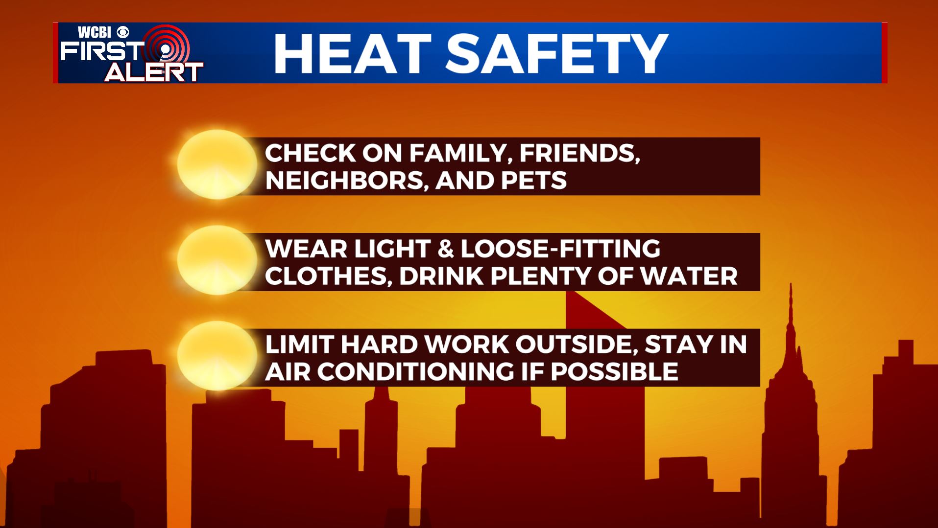
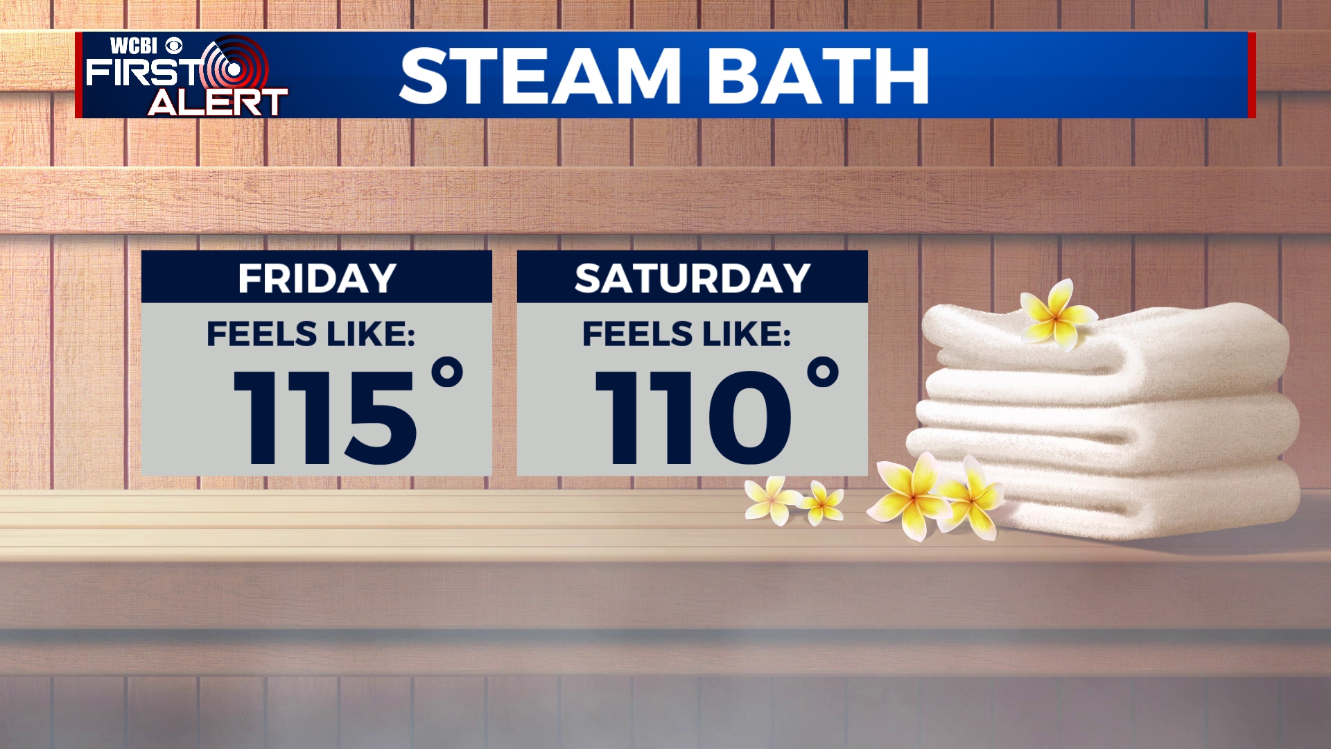 FRIDAY: Mostly sunny, hot, and humid. Highs in the mid to upper 90s with heat indices as warm as 115 during peak heating. A few spotty afternoon and evening storms are possible across far northern Mississippi and Alabama.
 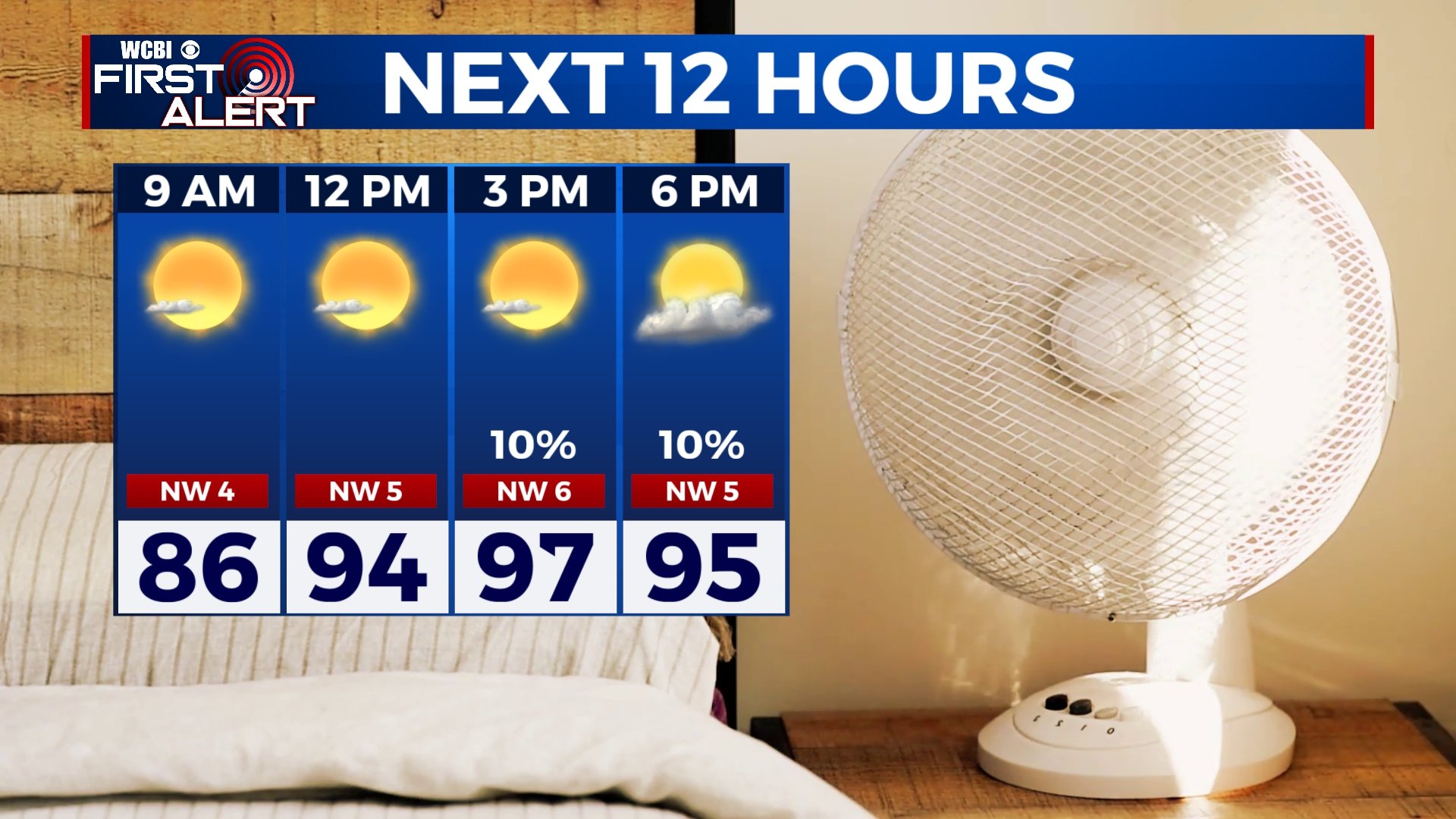 FRIDAY NIGHT: Partly cloudy skies, quiet, and muggy. Overnight lows in the mid 70s. SATURDAY: Mix of sun & clouds. A chance of pop-up showers and storms during the day. Highs in the mid to upper 90s with heat indices between 105-115. SUNDAY: Rain and storm chances go up. Afternoon highs should remain in the mid 90s with heat indices well into the 100s.
 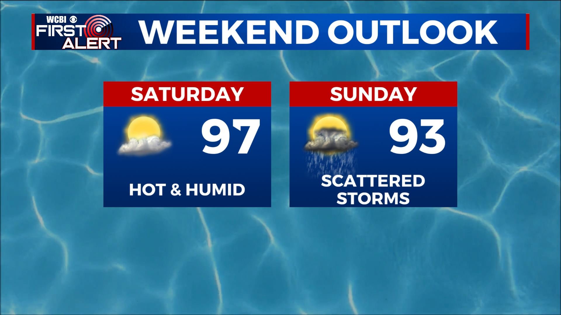 MONDAY: Rain and storms are possible as a cold front finally pushes through here providing us relief from the summer heat. Much cooler with highs in the mid to upper 80s. TUESDAY – THURSDAY: Mostly sunny skies with a stray shower or storm chance possible. Highs in the mid to upper 80s. Overnight lows in the 60s. Stay connected with @WCBIWEATHER on Facebook, Twitter, Instagram and the WCBI News App


Leave a Reply