All Eyes on Hurricane Delta, Issues Here Saturday
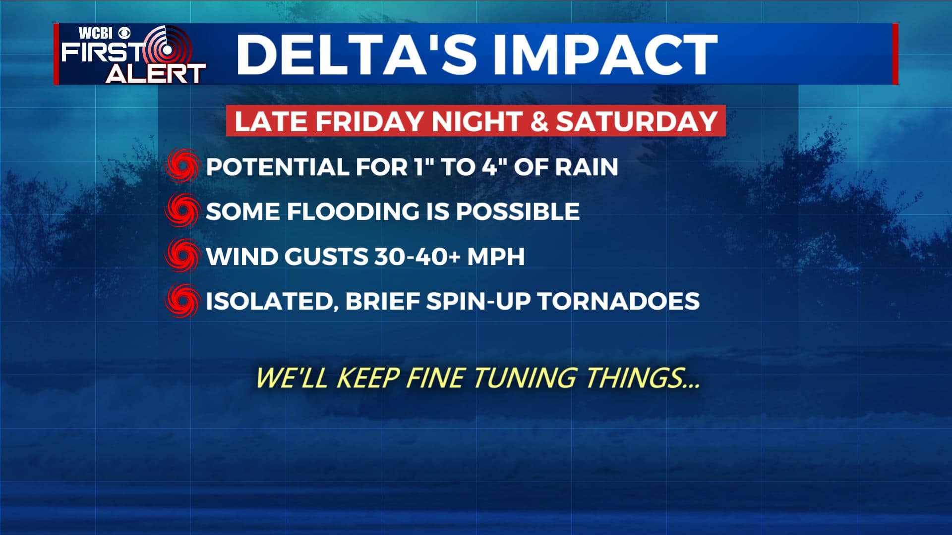
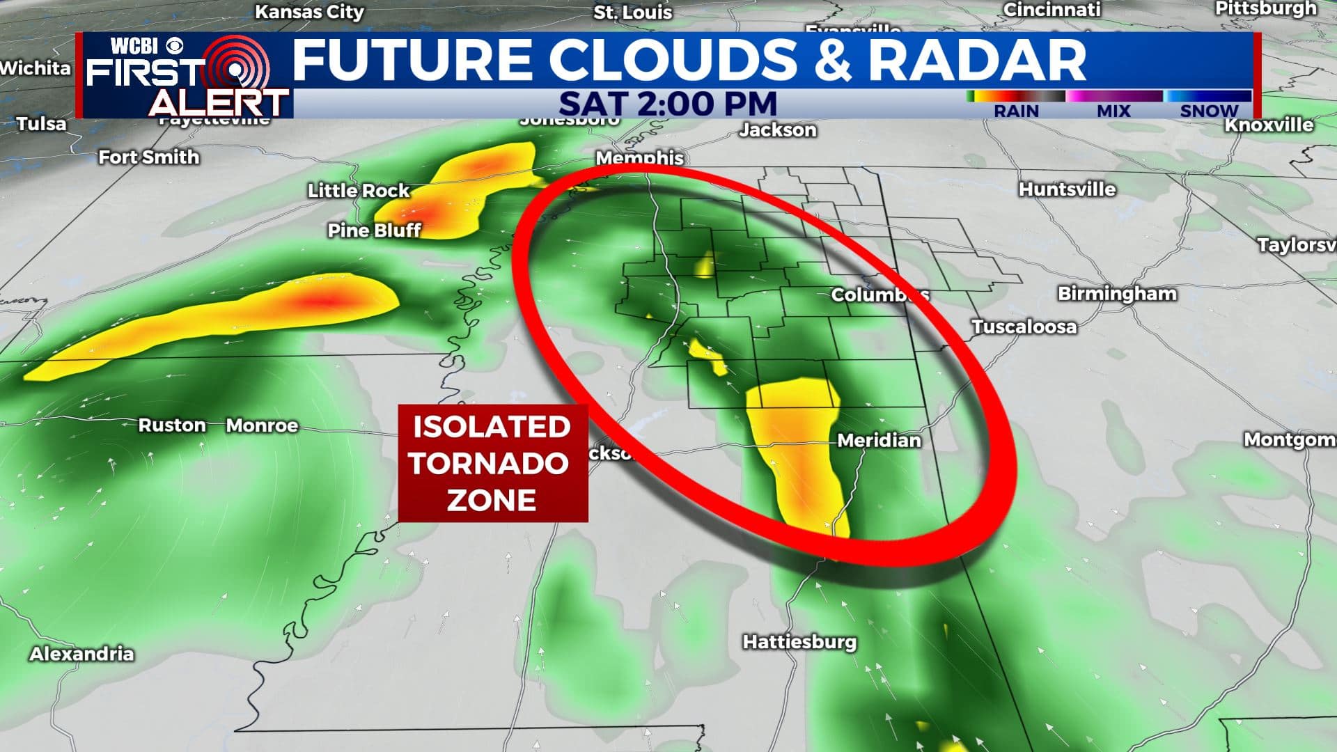
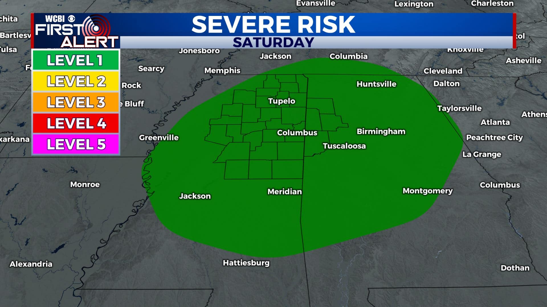
HURRICANE DELTA: This powerful storm will make landfall in SW Louisiana late Friday. The center of circulation will then move through the Mississippi River Valley and into north Mississippi by late Saturday and early Sunday. Heavy rain, possible flooding, gusty winds, and isolated tornadoes are possible in our area from late Friday night through Saturday.
THURSDAY NIGHT: Mostly cloudy with a few spotty showers possible. Lows in the 60s. Light winds.
FRIDAY: Mostly cloudy with areas of rain and showers. The chance of rain is 50%. Highs top out in the upper 70s. Easterly winds 5-10 mph.
FRIDAY NIGHT: Cloudy with areas of showers possible. Increasing SE breezes. Milder lows around 70.
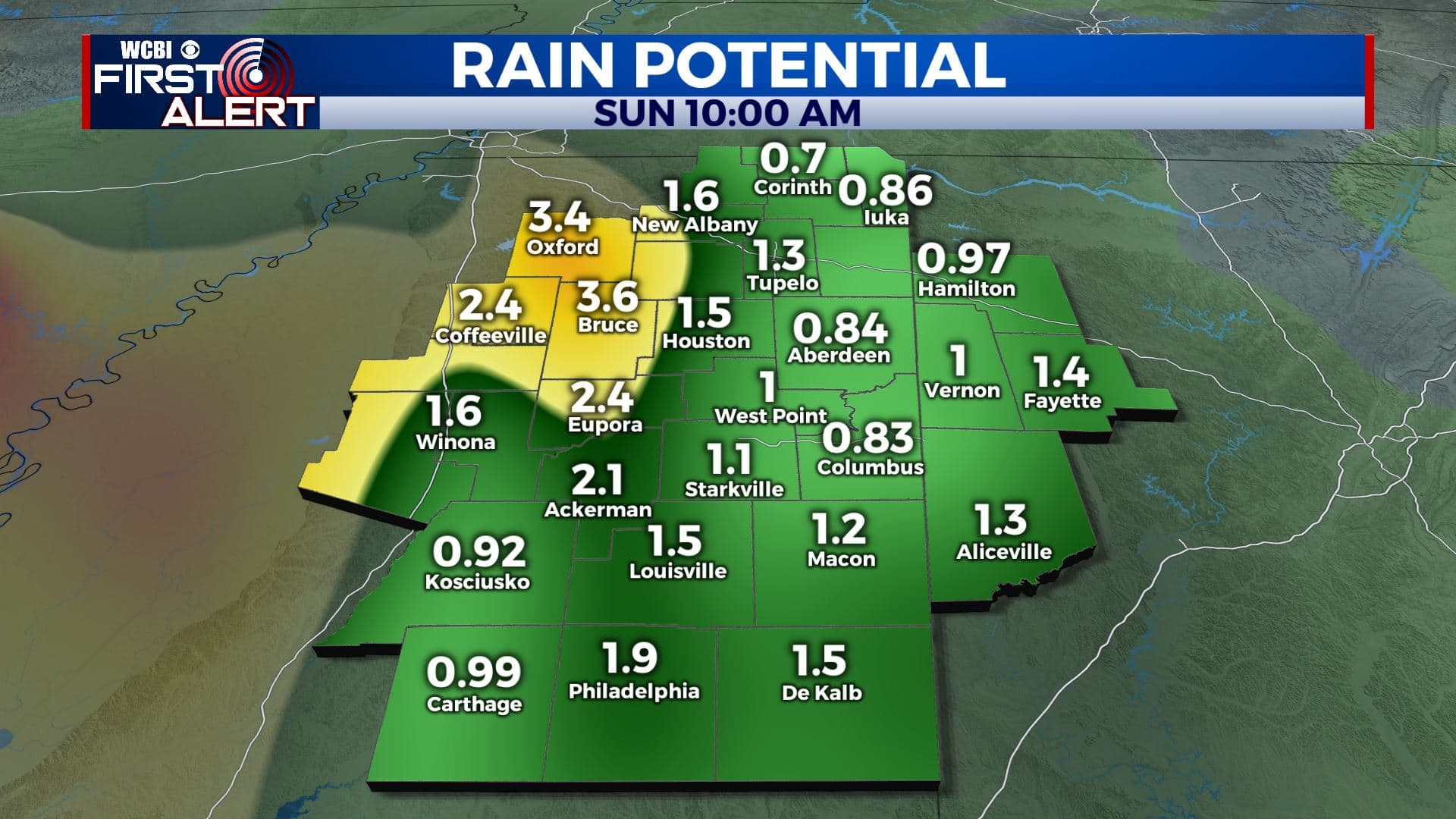
SATURDAY: The remnants of Delta swirl into our region. Rainfall between 1-4″, wind gusts 30-40+ mph, and isolated, brief tornadoes are all possible from about sunrise through the evening hours. Most areas will not have any major issues but some folks could experience flooding and scattered power outages. Highs top out in the mid to upper 70s.
SATURDAY NIGHT: Cloudy with areas of rain. Lows around 70.
SUNDAY: Mostly cloudy. Some showers may linger, especially during the first half of the day. Highs in the mid to upper 70s.
NEXT WEEK: Recent data suggest that warmer temperatures may win out and that could mean more 80s are in our future. Some rain can’t be ruled out with a cold front late Monday into Tuesday.
Follow @WCBIWEATHER on Facebook, Twitter, Instagram, and the WCBI News App


Leave a Reply