More fall-like, still watching the Gulf
SUMMARY: High pressure will keep cooler and less humid air flowing into our area through the weekend and into early next week. Comfortable highs each day will range from the upper 70s to lower 80s while overnight lows fall into the 50s.
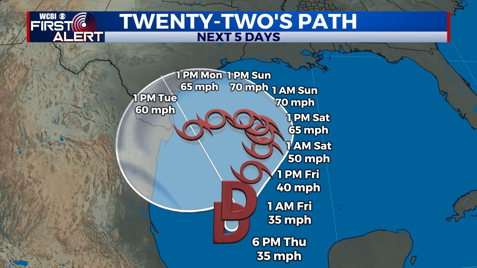
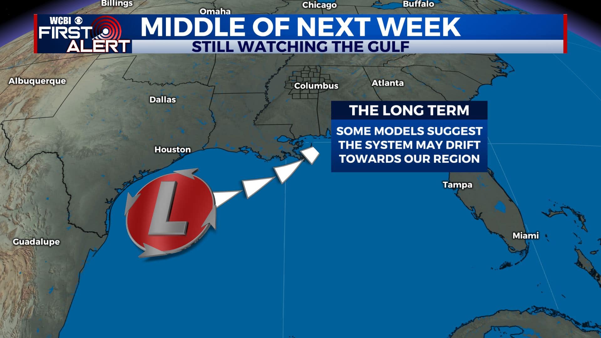
TROPICS: Tropical Depression #22 has formed in the southwestern Gulf of Mexico. The system is likely to meander around the western Gulf through the weekend but it’s still not out of the question that it could move towards the northern Gulf by the middle of next week. Stay tuned for updates.
THURSDAY NIGHT: Scattered high clouds and cooler. Lows in the middle 60s. Northerly winds 4-10 mph.
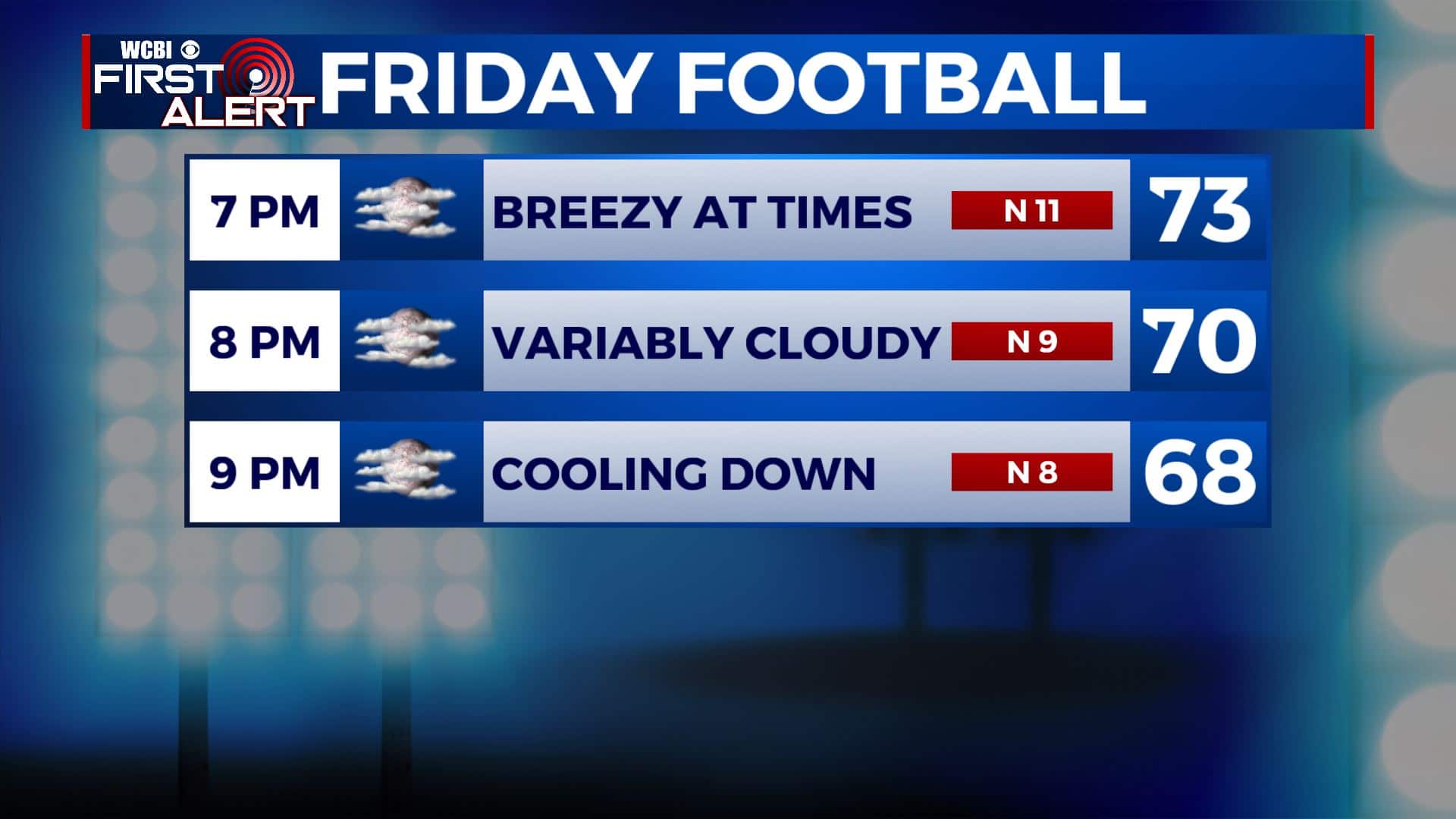
FRIDAY: A mix of high clouds and sunshine. Highs ranging from the upper 70s to lower 80s. Breezy northerly winds at 10-15 mph. Temperatures start out in the low 70s for high school football with 60s developing during the games.
FRIDAY NIGHT: Variably cloudy. Lows in the upper 50s.
SATURDAY: Clouds & sunshine. Refreshing highs mainly in the upper 70s.
SATURDAY NIGHT: A few clouds and quiet. Lows in the 50s.
SUNDAY-TUESDAY: Mostly sunny to partly cloudy. Highs from the upper 70s to lower 80s. Lows in the 50s.
Follow @WCBIWEATHER on Facebook, Twitter, Instagram, and the WCBI News App


Leave a Reply