Few isolated summer storm chances for Thursday; More is on the way
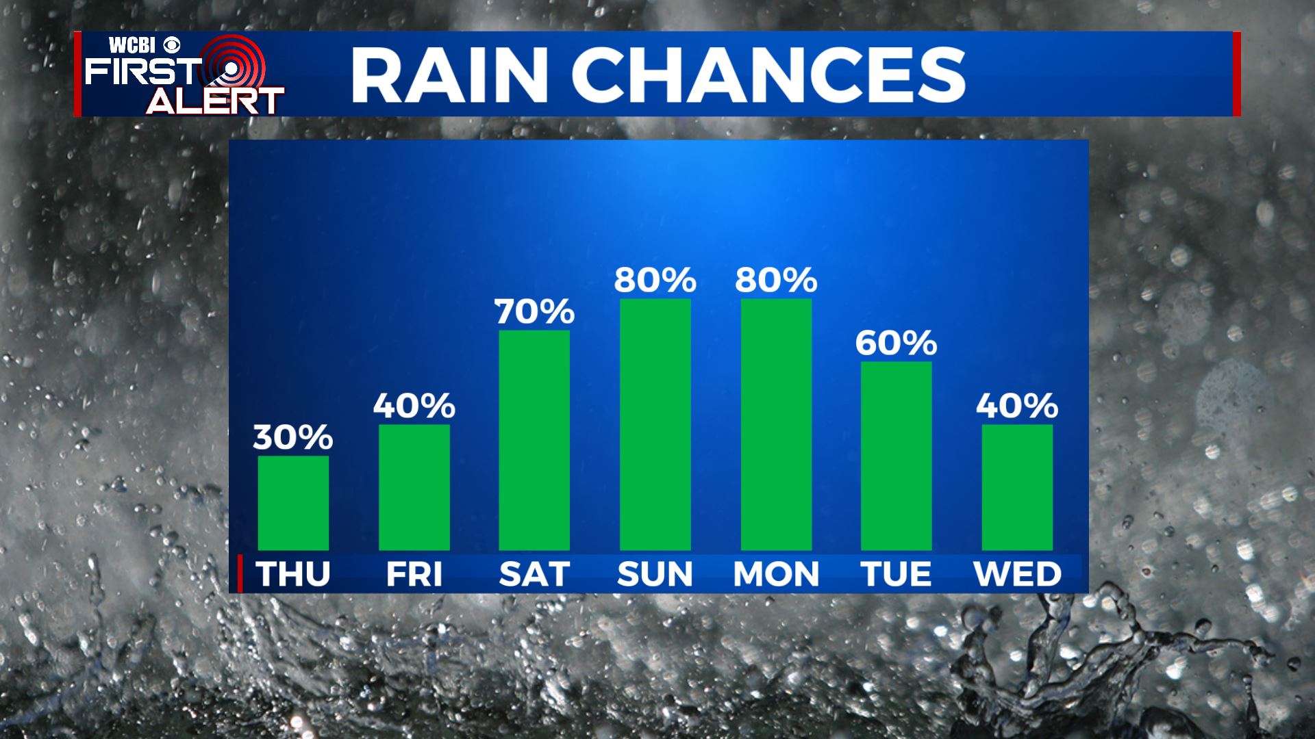
SUMMARY: Shower and storms chances will continue be isolated to very scattered as we end the workweek. Highs will be hot & humid in the lower 90s. A cold front will approach then stall out to the north beginning Sunday and continuing into next week that will increase our chances for showers & storms in the forecast.
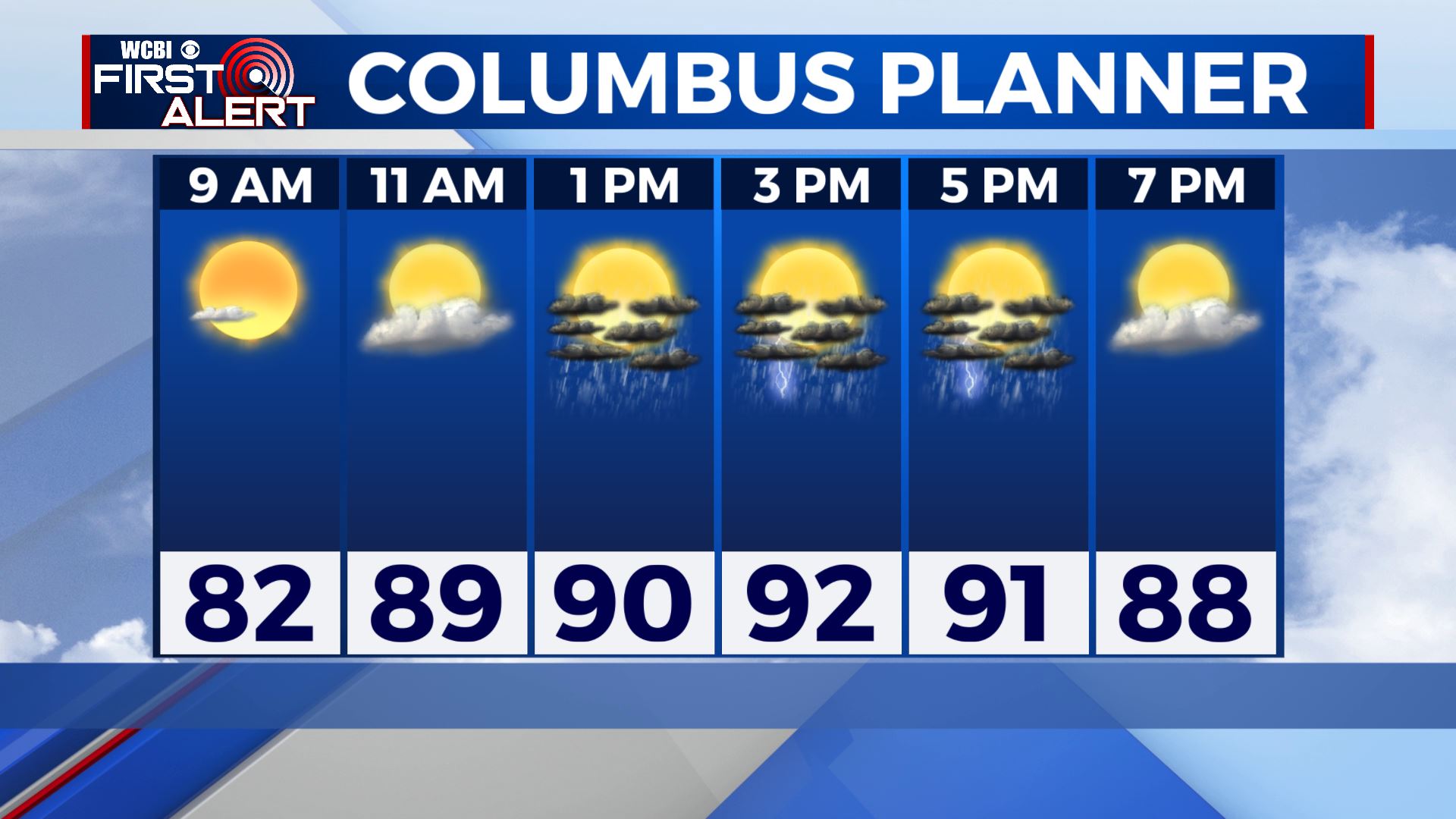
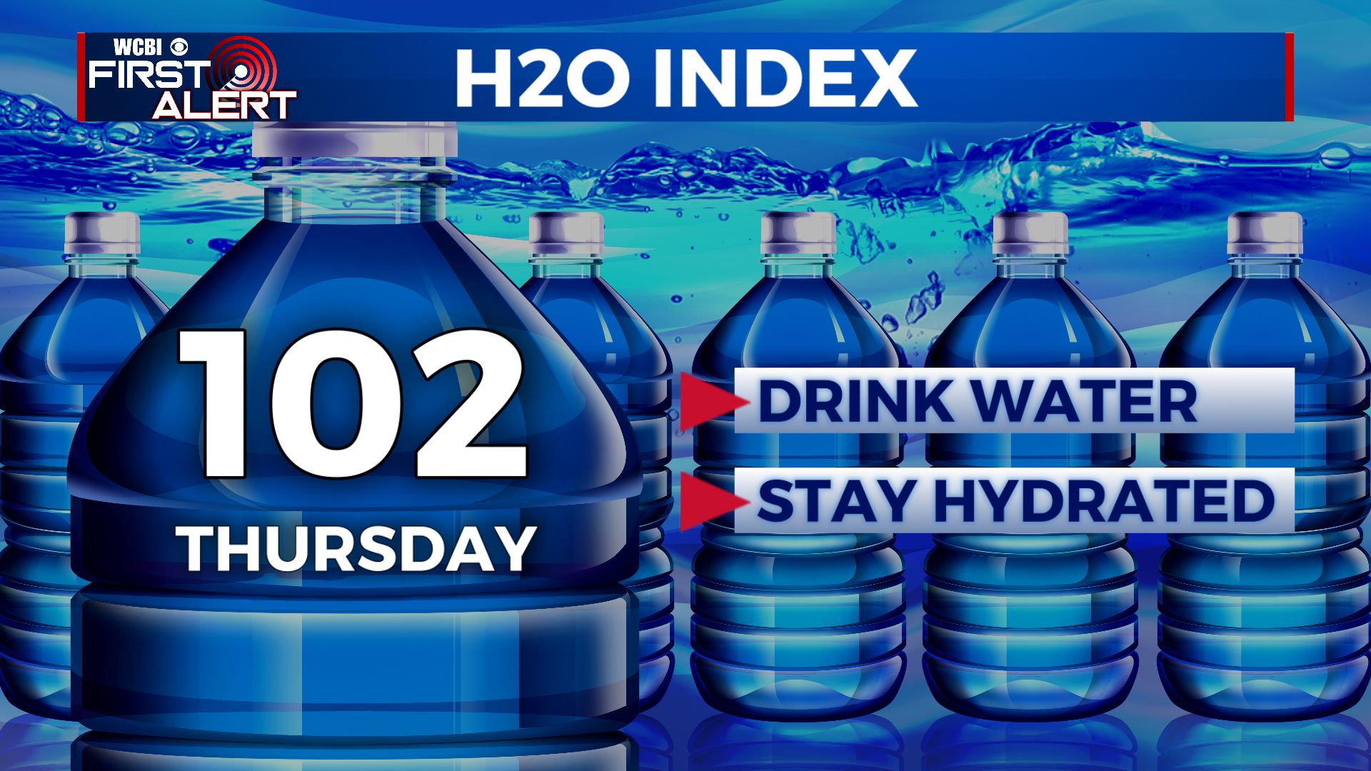
THURSDAY: We’re starting off our Thursday with mostly clear skies. Mild with temperatures into the mid to upper 70s. Most of the area will stay dry, but can’t rule out the chance of seeing an isolated shower or storm. Hot and humid with highs in the lower 90s. The heat index will make it feel like 100 degrees out there. Stay cool & hydrated!
THURSDAY NIGHT: Any showers and storms will quickly dissipate after sunset. Mostly clear skies expected with lows in the low 70s and calm winds.
FRIDAY: We’re starting off our Thursday with mostly clear skies. Mild with temperatures into the mid to upper 70s. Most of the area will stay dry, but can’t rule out the chance of seeing an isolated shower or storm. Hot and humid with highs in the lower 90s.
SATURDAY: Chances of those showers & storms starts increasing as a cold front nears us. Staying warm & humid overall. Highs in the upper 80s to lower 90s. Overnight lows in the lower 70s.
SUNDAY-TUESDAY: A cold front will stall out on Sunday, bringing us more widespread chances showers and storms as we head into the new workweek. The cloud cover will keep those high temperatures a bit cooler in the mid to upper 80s. Overnight lows will be right around the 70 degree mark.
WEDNESDAY: We’ll still have a chance of showers & storms, but won’t be as high. Temperatures staying in the mid to upper 80s.
Stay connected with @WCBIWEATHER on Facebook, Twitter, Instagram and the WCBI News App


Leave a Reply