Finally thawing out this weekend as warmer air moves in
Finally…sunshine and warmer air will return this weekend! Unfortunately, we will still dip below freezing for the next couple of nights so until the roadways are completely clear, the potential for black ice will exist. Use caution on bridges and overpasses. Our next chance of rain will be Sunday night.
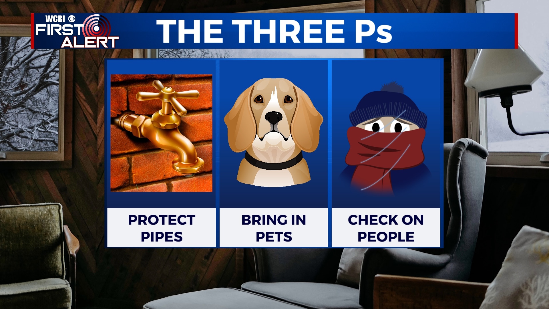
FRIDAY NIGHT: Mostly clear and bitterly cold. Temperatures will once again fall into the upper teens. Black ice is likely on the roads, so use extreme caution if you have to be out at all. Also, remember your pets, pipes, and other people in this extreme cold. Some patchy freezing fog is also possible.
SATURDAY-SUNDAY: Sunshine will return this weekend with highs in the upper 40s on Saturday and near 60 on Sunday. Overnight lows will still be below freezing Sunday morning, so look out for black ice. Overall, much nicer weather is in store for the weekend. Rain showers will move in Sunday night.
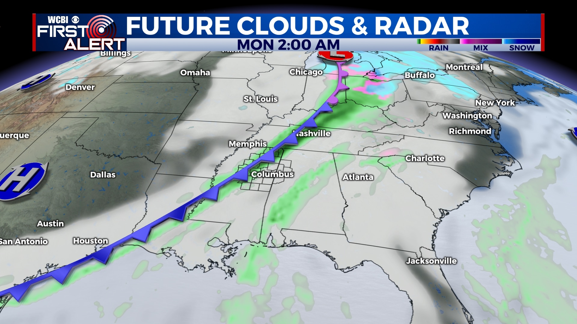
MONDAY: Rain showers are possible Monday morning, but it appears most of the day will be dry with a mix of sun and clouds. Highs will be in the mid 50s with morning lows near 40.
TUESDAY-WEDNESDAY: Mostly sunny skies will continue through the middle of the week as warmer air moves in. Highs will be in the mid 60s with lows in the 30s.
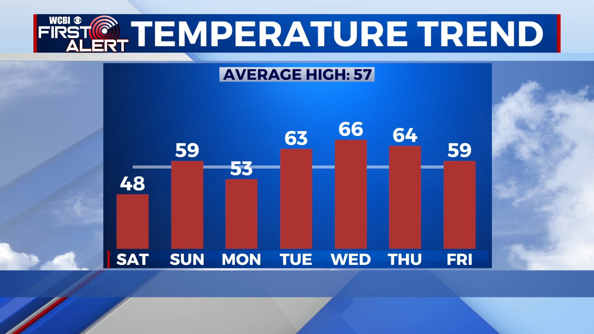
THURSDAY-FRIDAY: Our next chance of rain showers will be on Thursday with some possibly lingering into Friday morning. Temperatures will stay just above average with afternoon highs in the 50s and 60s. Lows will remain in the 40s.
Follow WCBI Weather on Facebook, Twitter, and Instagram
Follow Meteorologist Trevor Birchett on Facebook and Twitter


Leave a Reply