Flash flood threat through Thursday, finally drying out this weekend
SUMMARY: Another couple days of very wet and stormy weather in store for us, which will not help out the major flooding issues across Northern MS. Rain chances begin to diminish by Friday and Saturday, with just scattered afternoon storms. By Sunday, rain chances really drop off and as we start next week only a stray afternoon storm or 2 looks possible. Highs in the mid to upper 80s this week, warming into the low 90s to start next week.
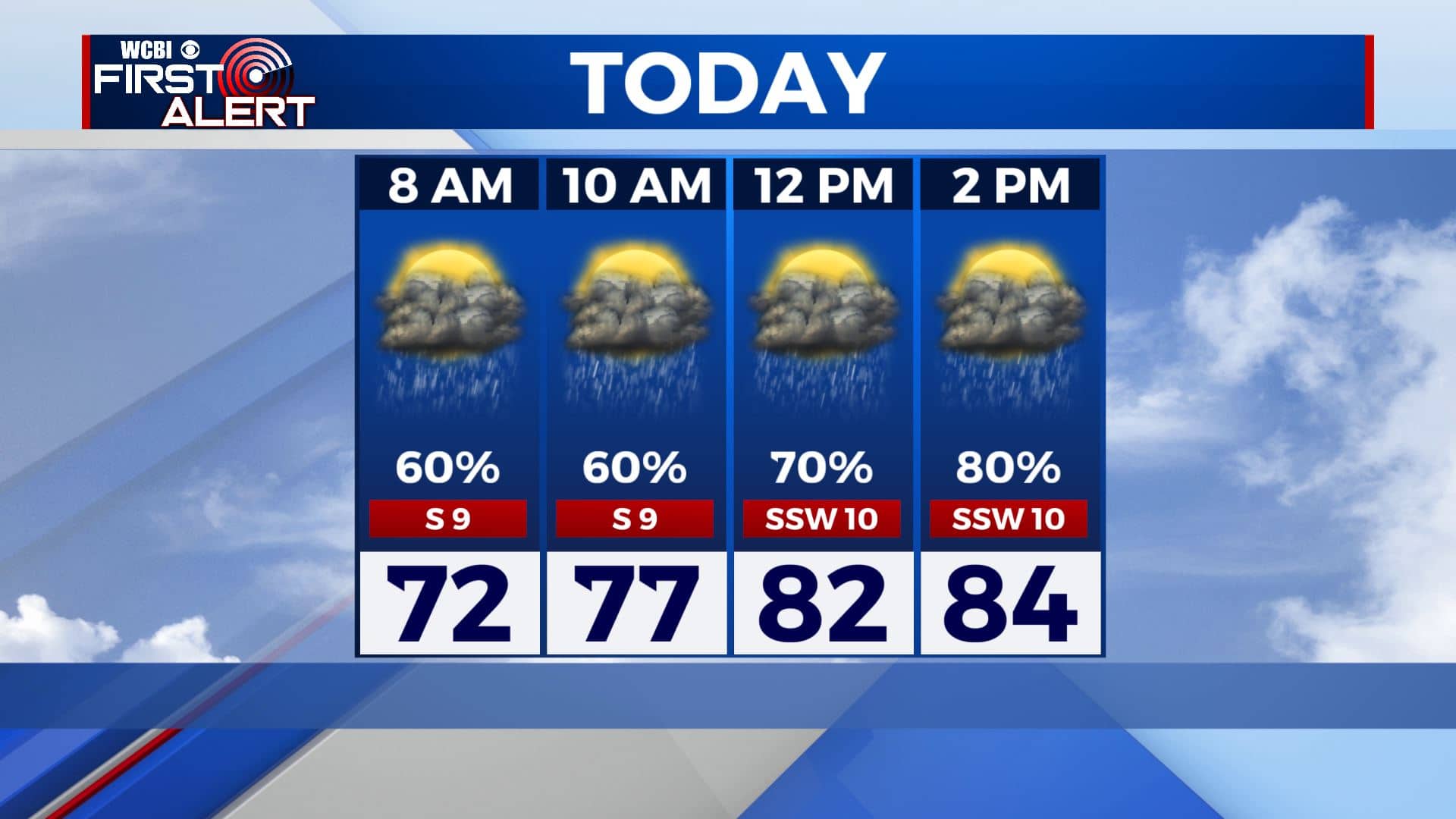
TODAY: Another very wet and stormy day across Northeast MS. Expect widespread heavy afternoon showers and storms, which have the potential to train over the same areas quickly leading to flash flooding. Definitely a day to take it easy out there. Highs held down by rain and cloud cover, ranging from around 80 to the mid 80s.
WEDNESDAY NIGHT: A very muggy and warm night in store. With so much moisture, temps will only bottom out around 72 degrees. Rain and storms should begin to wane as the night goes on, but if the last few nights are any indication of how tonight will go showers and storms could again be widespread. Flooding threat continues, and dense fog will be possible.
THURSDAY: Slightly lower rain chances for Thursday, but still another day of heavy showers and storms looks likely. Flash flooding will again be a big threat, especially after several days of extremely heavy rainfall. Clouds and rain once again will keep our highs in the low to mid 80s.
THURSDAY NIGHT: Things should begin to calm down Thursday night. Rain chances will diminish overnight, but once again with all the humidity lows will be around 72 degrees. Fog also possible.
FRIDAY TO TUESDAY: A much needed break from widespread storms begins Friday. Temps warm as we should see more sunshine, topping out in the mid to upper 80s. Still a good chance of scattered afternoon storms, but much lower than we have been seeing. Saturday looks to lower rain chances a bit more, with a high approaching 90 degrees. Scattered afternoon T-storms possible again. Rain chances really decrease for Sunday, and under partly cloudy skies expect highs near 90. A stray afternoon shower or storm is possible. Similar weather for Monday and Tuesday, with highs in the low 90s.
CONNECT WITH @WCBIWEATHER ON TWITTER , FACEBOOK AND INSTAGRAM


Leave a Reply