Friday Showers, Friday Night Storms Still Possible
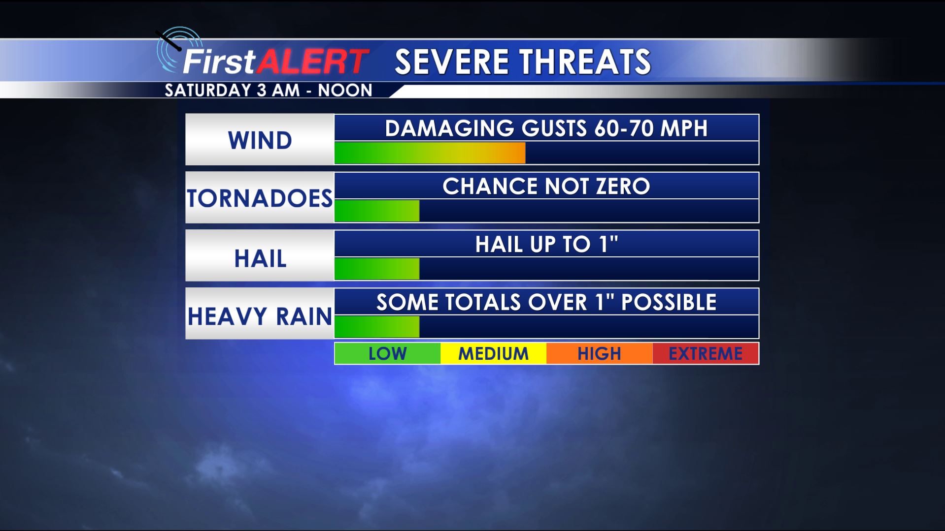
Storm Threats
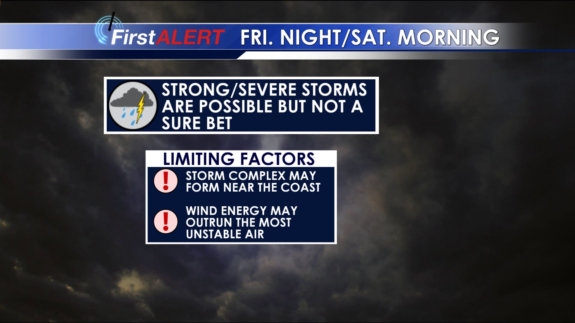
Storm Limiting Factors
THURSDAY NIGHT: Mainly cloudy with passing showers. Chance of rain 40%. Southerly winds between 10 and 15 mph with lows around 60.
FRIDAY: A 50% chance of rain exists as passing showers move through the region. Even with the clouds and rain chances high temperatures are still expected to be around 70. Southerly winds continue around 10 mph.
FRIDAY NIGHT-SATURDAY MORNING: Showers and storms remain possible in our area but questions remain as to whether or not any of them will become severe. The prime window of strong activity, IF it were to occur, looks to be between 3 a.m. and noon Saturday. Once again, IF storms become severe damaging wind gusts would be the primary threat with an isolated tornado or two the secondary threat. Limiting factors in severe weather include 1) a complex of storms that could develop along the Gulf Coast (which would rob moisture that could move into northeast Mississippi and west Alabama) and 2) the best wind energy in the atmosphere outrunning the most unstable air. At this point we’re going to lean towards a lower impact type event in our area due to these limiting factors. Keep in mind things may change as the event draws near so be sure to stay tuned for additional updates.
SATURDAY AFTERNOON: A gradual decrease in clouds and rain coverage is expected. Breezy/gusty SW winds should allow for highs well into the 70s across our part of the world.
SATURDAY NIGHT: Variably cloudy skies continue. Temperatures fall down to around 50.
SUNDAY: A pretty nice day is on track with plentiful sunshine and highs around 70. If you haven’t put up any holiday decorations yet this could be the day to do it.
NEXT WEEK: We continue to expect relatively quiet and much cooler conditions. Highs by the middle of the week may struggle out of the 40s while overnight lows dip back below freezing.
Follow @WCBIWEATHER on Facebook, Twitter, Instagram, and Snapchat


Leave a Reply