Frost possible tonight, rain on the way
A late-season cool snap will bring the potential for frost to the area tonight as temperatures fall into the mid 30s. Sunshine continues Thursday, but heavy rain is possible late Friday night and early Saturday morning.
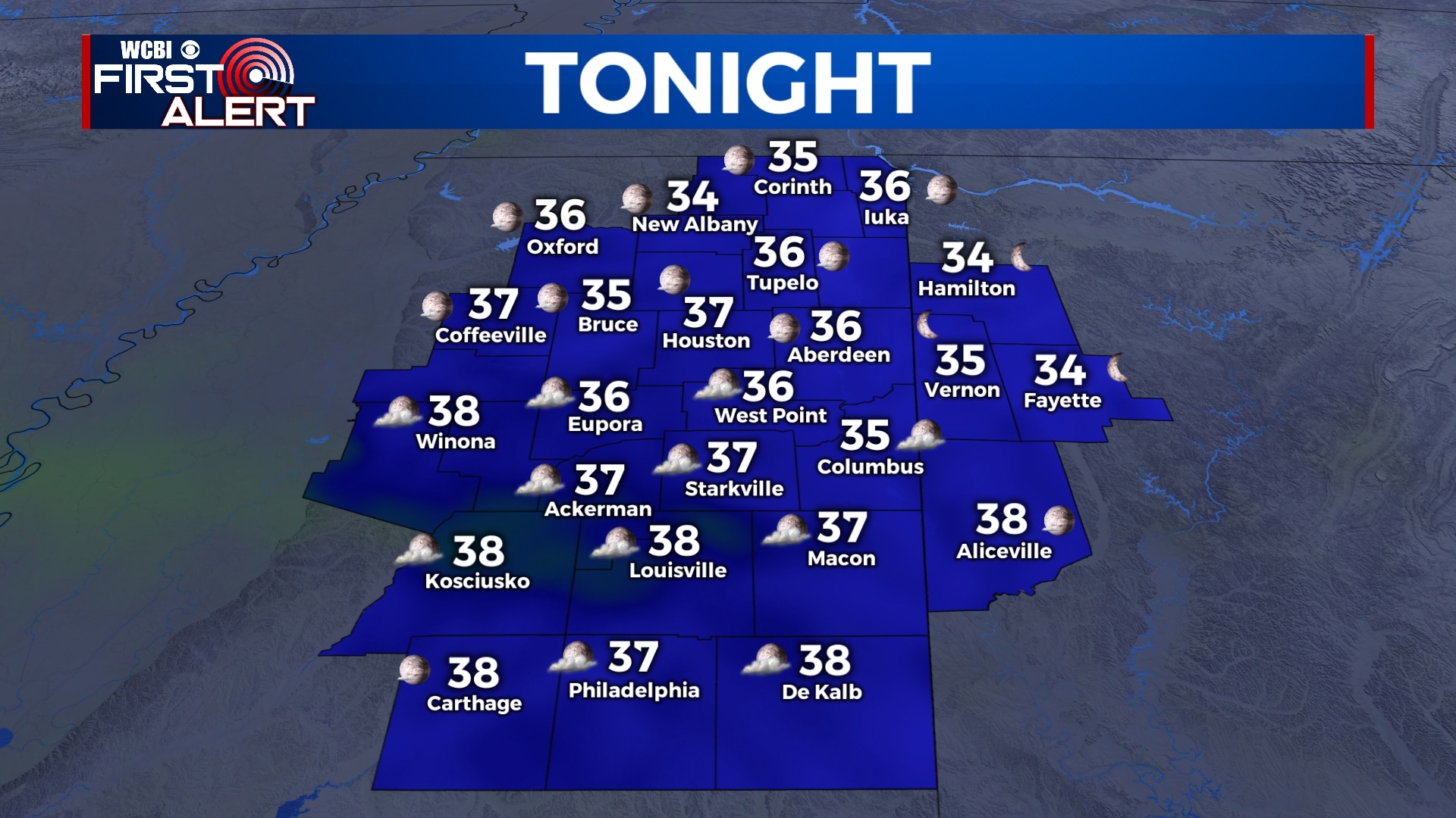
WEDNESDAY NIGHT: Skies will remain mostly clear tonight with just a few clouds passing overhead. Lows will be in the mid 30s with a calm wind, so some patchy frost is possible. Cover up or bring in your sensitive plants!
THURSDAY: We’ll see a mix of sun and clouds for Thursday as temperatures remain cool. Highs will be in the mid 60s with a light and variable wind.
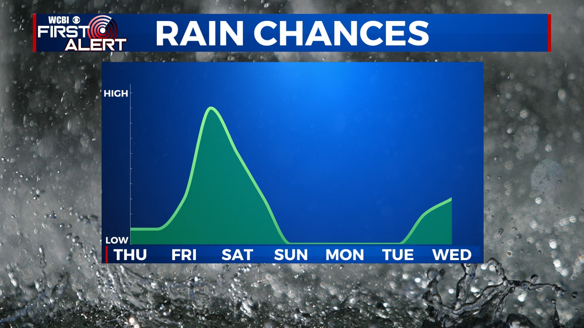
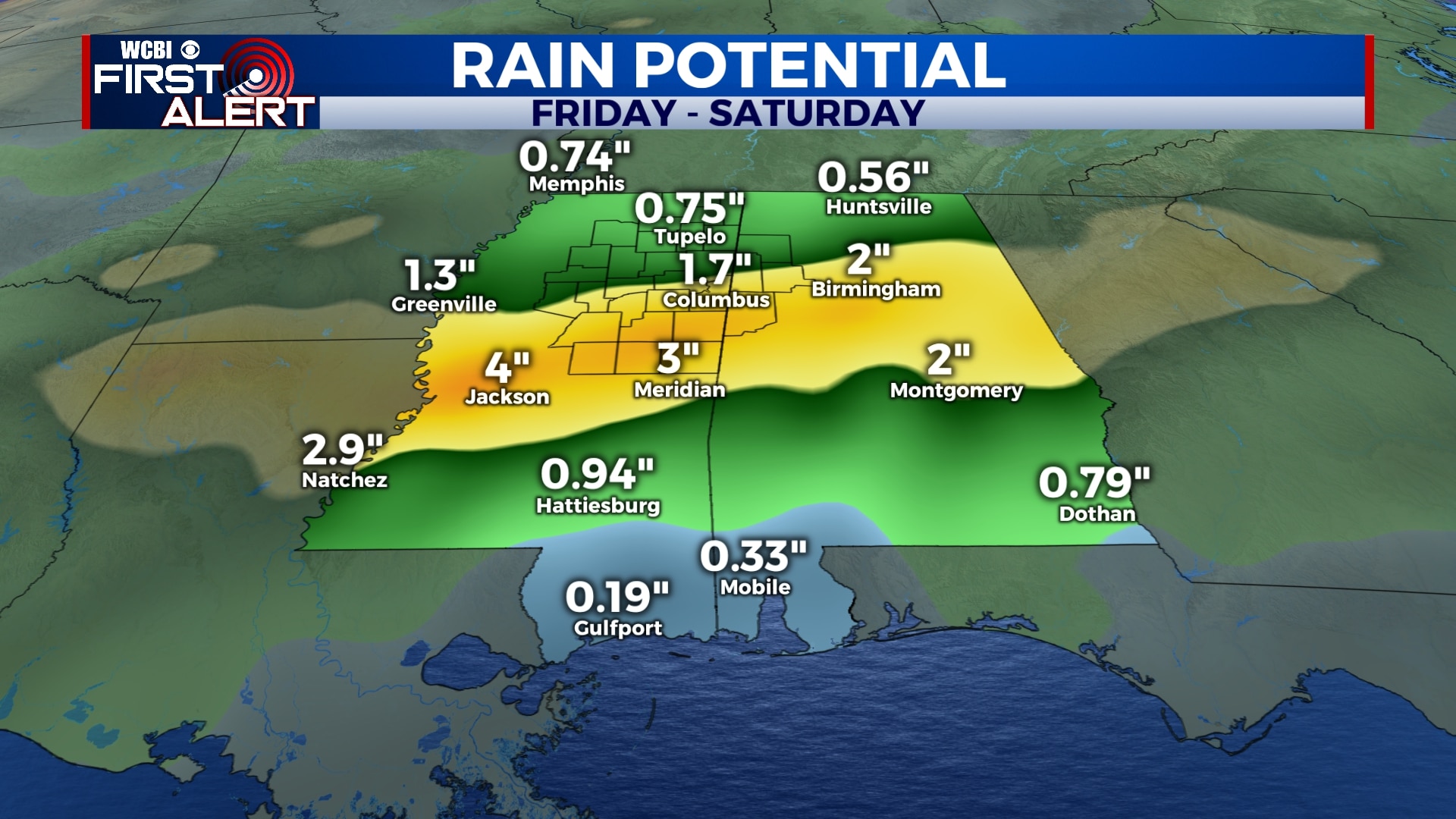
FRIDAY-SATURDAY: Clouds will return to the area on Friday with highs in the mid to upper 60s. Any showers will likely hold off until after sunset Friday night, but rain will become more steady and heavy overnight. This rain could last into early Saturday morning before gradually slacking off through the day. Some rain could be heavy with totals approaching 2″ in some spots. However, it appears any severe weather will remain just to our south. Saturday morning lows will be in the mid 50s with afternoon highs in the mid 70s.
SUNDAY-TUESDAY: Sunshine will return for Sunday and early next week with highs back into the 70s and 80s. Overnight lows will be in the 40s and 50s.
WEDNESDAY: Rain chances return to the forecast on Wednesday with highs in the mid 70s.
Follow WCBI Weather on Facebook, Twitter, and Instagram
Follow Meteorologist Trevor Birchett on Facebook and Twitter


Leave a Reply