Good rain chances return this workweek; Watching Zeta
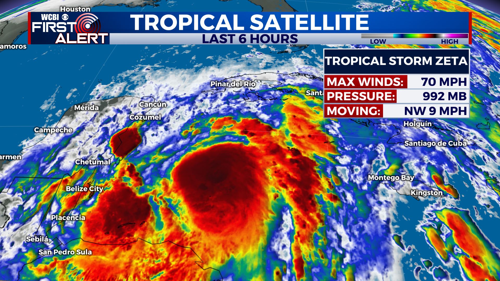
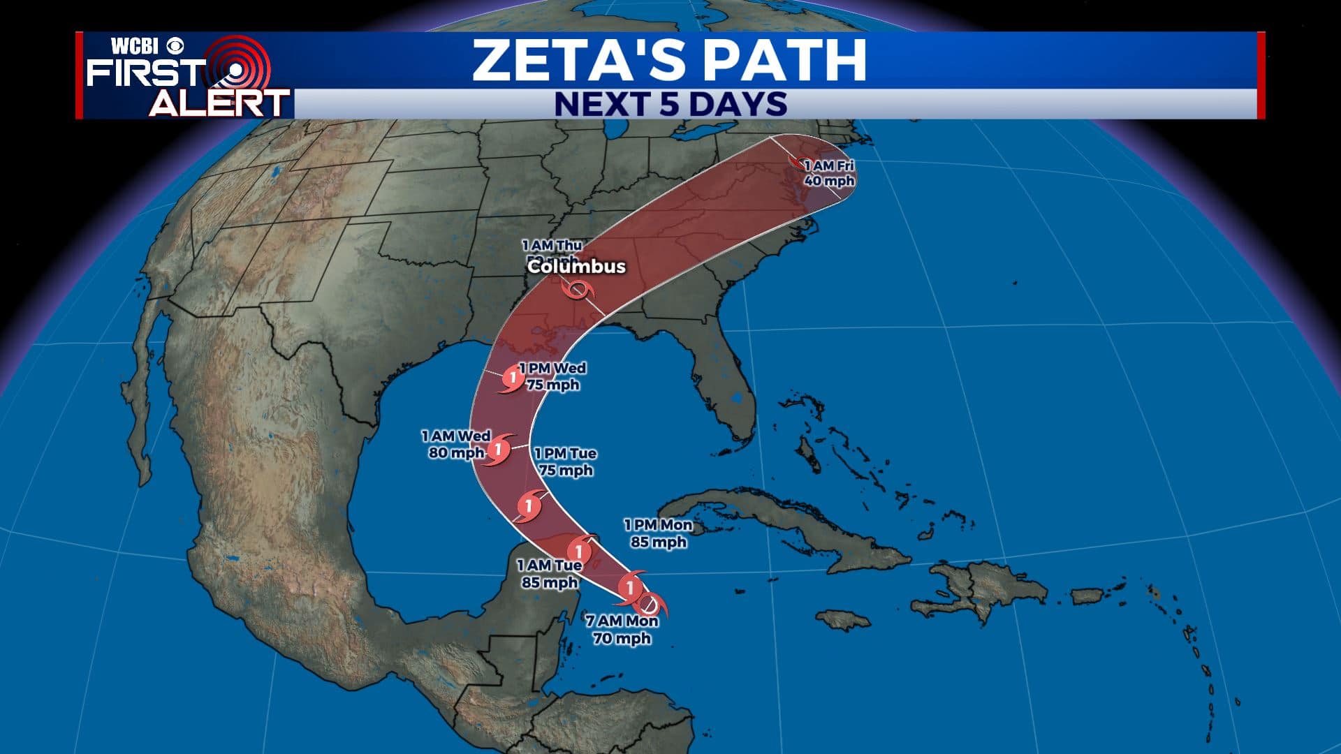
TROPICAL UPDATE: Here’s the latest on Tropical Storm Zeta as of Monday morning. It remains a strong tropical storm with winds at 70 mph as of the latest advisory from the National Hurricane Center. The storm is expected to enter the Gulf and intensify into a Category 1 hurricane by Tuesday. Still forecast to make landfall along the northern Gulf Coast Wednesday. We could get some gusty winds & heavy rainfall from the storm midweek. Recent data takes the center up along the I-20/59 corridor, putting us on the NW side. The isolated tornado threat would stay to our SE in this scenario. Anything can still change with this forecast. Stay tuned!
MONDAY: After a dreary, cloudy & cool weekend for us, we are once again dealing with those conditions this Monday morning along with some drizzle & mist. Expect the cloud cover and the cool temperatures to continue for our Monday with highs only near 70. NE winds 5-10 mph.
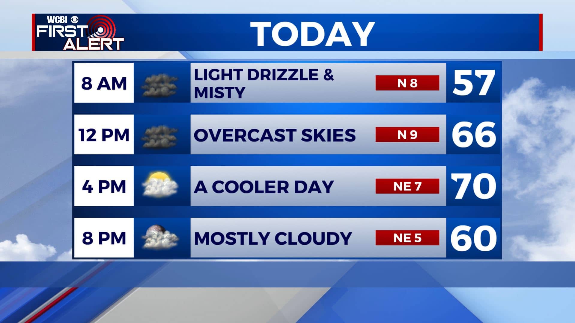
MONDAY NIGHT: Mostly cloudy skies continue overnight. Lows will remain in the mid 50s tonight with light NE winds.
TUESDAY: While most of Tuesday will be dry a mix of clouds with some sunshine, some showers from Tropical Storm Zeta and a strong late October winter storm system west of us could move in by the evening. Highs warm back up a bit into the upper 70s. NE winds 5-10 mph.
WEDNESDAY-THURSDAY: Our best chance for heavy rain and some storms will be through the day Wednesday as a strong cold front approaches from the west. Depending on how close Zeta comes to us, we could also see some gusty winds Wednesday, but no severe weather/tropical tornado threat is expected as of now. Rain chances will decrease by Thursday with some scattered showers. Skies will remain mostly cloudy with highs in the 70s. Morning lows will be in the low 60s.
FRIDAY-SUNDAY: The end of the workweek and the weekend will be drier, mostly sunny and boo-tiful which is good news for any Halloween plans you may have. Temperatures will be feeling much cooler with highs only in the mid 60s and overnight lows in the 40s and 50s.
Stay connected with @WCBIWEATHER on Facebook, Twitter, Instagram, and the WCBI News App


Leave a Reply