Heat, Scattered Storms, Tropical Threat
4 p.m. Wednesday Storm Track
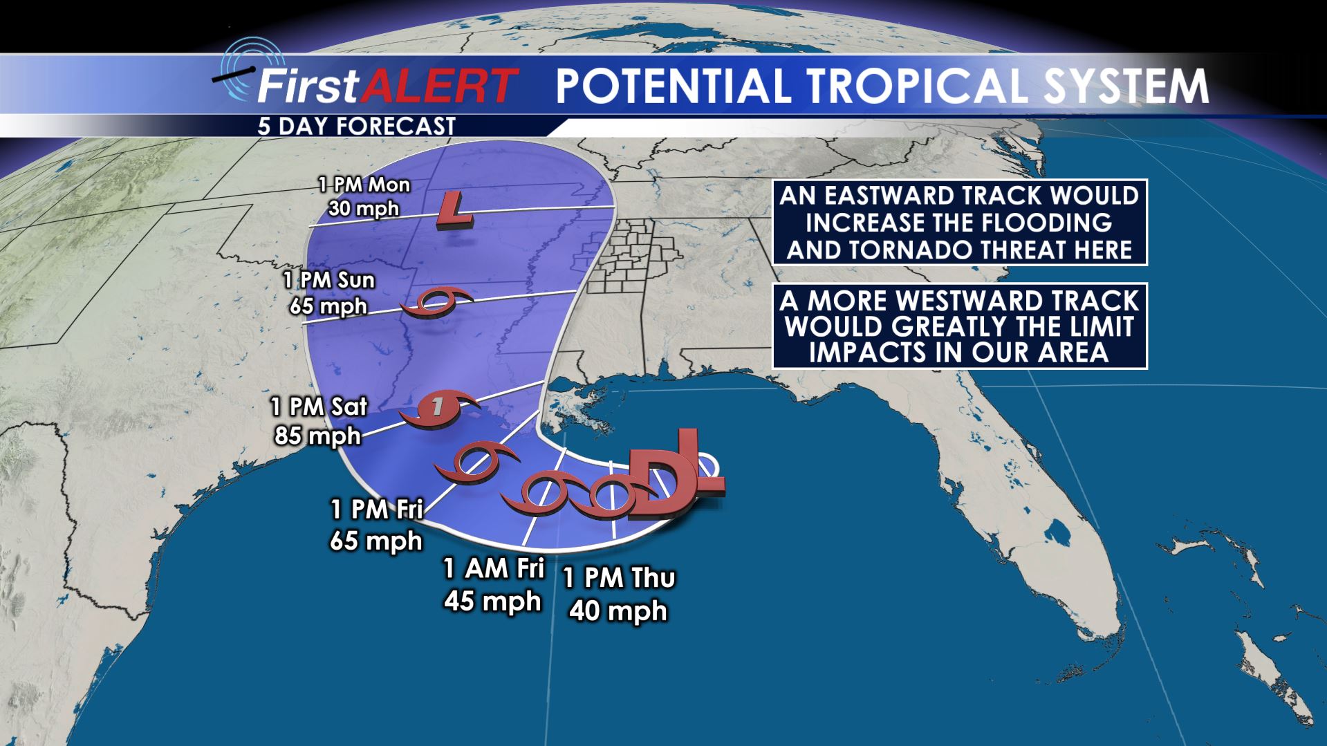
SUMMARY: More heat and humidity is on tap for Thursday and Friday with a continuing chance for scattered storms. Highs stay in the 90s with heat indices in the triple digits. A tropical depression or storm may form over the next 24 hours in the northern Gulf and approach the Louisiana coast by Friday night and Saturday morning as a hurricane. Our region may or may not be directly affected by the remnant low this weekend but heavy rain and an isolated tornado threat can’t be totally ruled out if the system takes the eastward track through the Mississippi River Valley.
WEDNESDAY NIGHT: Mainly clear to partly cloudy. Some isolated evening showers and storms are possible and we can’t totally rule out one or two lingering during the night. Most spots will not get rain. Lows bottom out in the mid 70s.
THURSDAY: Partly cloudy, hot, and humid. Daytime highs will be in the low to mid 90s with heat indices possibly surpassing 105 again. A weak cold front will move into the region so we’re bumping up the storm chance to 40-50%. Hopefully more of you will get some temporary relief from the heat.
FRIDAY: Slightly cooler highs in the low 90s are more likely due to the chance of scattered storms and clouds. Heat index values may still be in the upper 90s to around 100 outside of any storm that develops.
SATURDAY-MONDAY: The weekend forecast around our area is all based on what happens with a likely Tropical Storm or Hurricane Barry. Projections as of Wednesday afternoon take the system into Southwestern Louisiana by Saturday. After that all bets are off. Some data suggest the system will drift back to the northwest (which would limit impacts in the WCBI coverage area) while other data suggest it will drift through the Mississippi River Valley. If it take the eastern track our area would be susceptible to several inches of rain, flooding issues, and perhaps some isolated tornadoes. The trade off would be cooler temperatures. We honestly do not know exactly where this disturbance will end up so be sure to get frequent updates on the forecast during the next few days.
Follow @WCBIWEATHER on Facebook, Twitter, and Instagram


Leave a Reply