Heavy Rain Arrives on Monday
Heavy rain is headed our way. It will arrive late Sunday night, and last all throughout the day on Monday.
SUNDAY NIGHT: Clouds will continue to increase as we go throughout the overnight hours on Sunday. Rain chances will also begin to increase across our area from southwest to northeast. The clouds and rain will keep us a little more mild overnight, with lows only dropping down into the lower 40’s. Winds will be out of the east-northeast between 5 and 10 MPH.
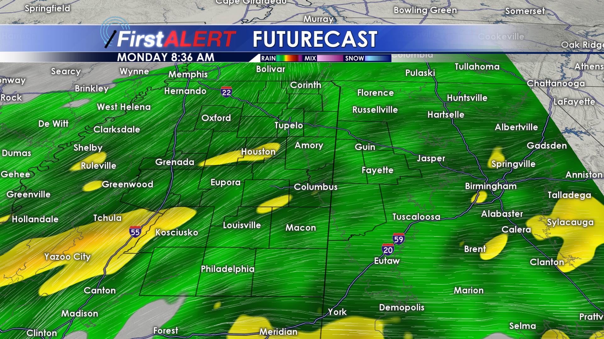
MONDAY/TUESDAY: Monday is going to be a wet, nasty day. Heavy rainfall will fall all throughout the day on Monday, leaving some locations with 2+ inches of rain.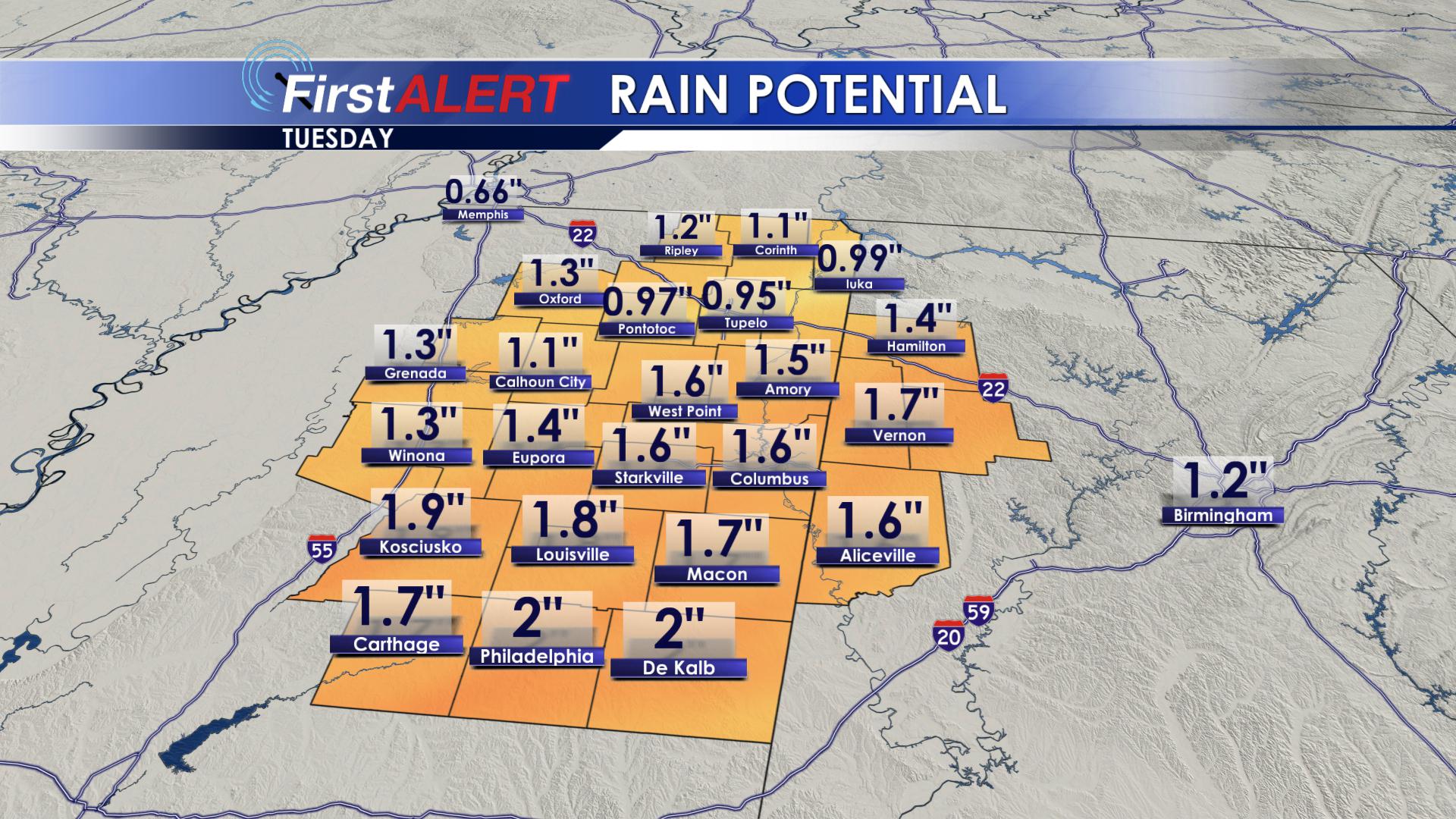
Flash flooding will be possible in urban and low lying areas. Highs on Monday will struggle to make it into the lower 50’s. Temperatures will stay pretty steady throughout the day, with winds out of the northeast around 10-15 MPH. Overnight Monday into Tuesday morning, the rain will begin to leave our region, and we will drop down to into the lower 40’s across southeastern portions of the area, and middle to upper 30’s across northwestern portions of the area. Tuesday, winds will shift to the north, bring in colder air. Clouds will stick around on Tuesday, as highs drop into the lower 40’s.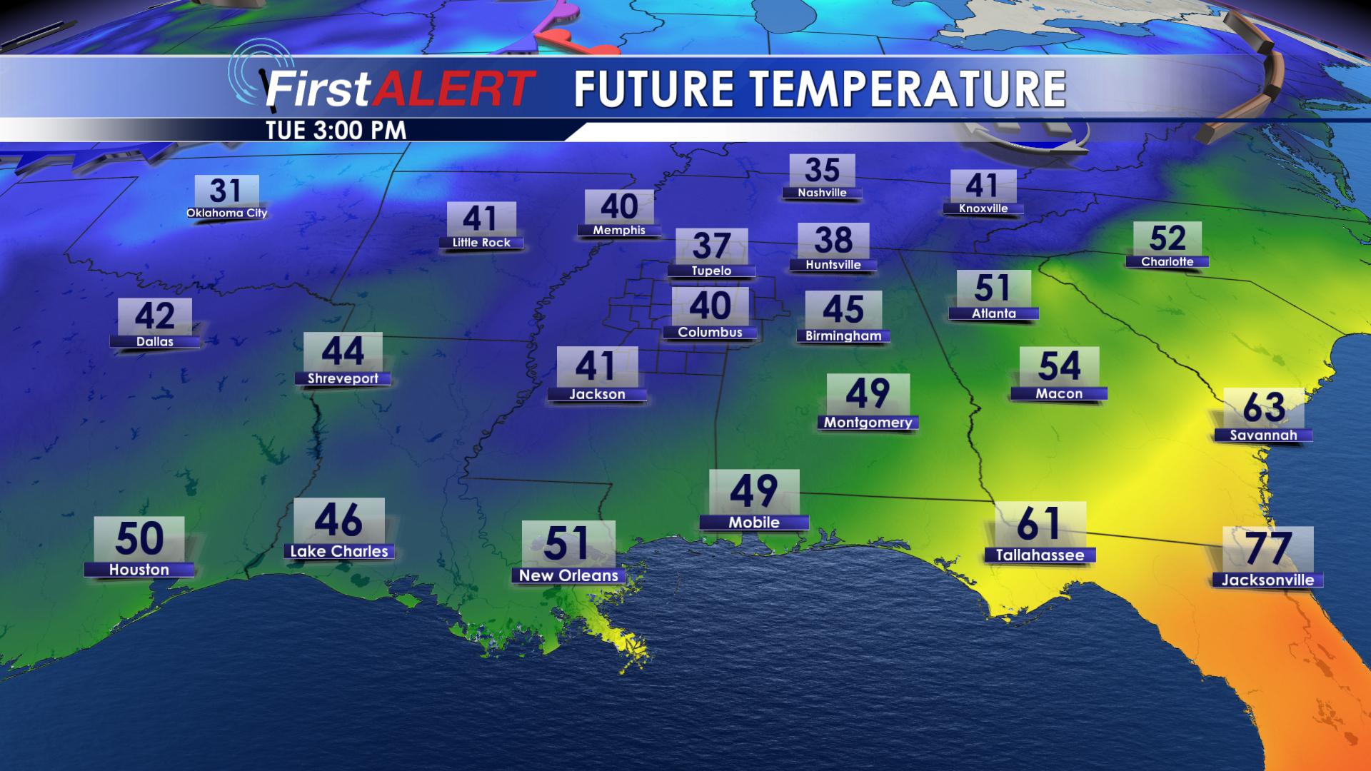
Most of us will see our high temperature early in the morning hours on Tuesday. Tuesday night, our lows will drop down into the lower 30’s and upper 20’s across the region.
WEDNESDAY/THURSDAY/FRIDAY: Clouds are going to hang around on Wednesday, and that will allow our high temperatures to remain in the middle 40’s. Rain chances will remain near zero, but portions of western Alabama could see a few showers later in the day on Wednesday. Wednesday night, showers will increase over eastern portions of the area as lows drop down into the middle to lower 30’s. Thursday, showers could cover western Alabama, all of the way over to the Golden Triangle Region and points north. Highs on Thursday will warm into the middle and upper 40’s. Western counties will be just a tad warmer, with a few locations seeing highs in the lower 50’s. Thursday night into Friday morning, showers will clear our region, and clouds will slowly begin to break. Overnight, we will drop down into the lower 30’s. Friday, we will warm into the middle 50’s as clouds begin to clear across our region. Rain chances will remain at 0% Friday. Friday night, lows will drop down into the middle and upper 30’s.
SATURDAY/SUNDAY: Saturday will start off with clear skies, allowing highs to top out in the upper 50’s. Clouds will move in Saturday night and last throughout the day on Sunday. Rain looks to hold off this weekend, with highs on Sunday reaching the upper 50’s. Overnight lows on both nights will drop down into the upper 30’s.
FOLLOW US ON FACEBOOK, INSTAGRAM AND TWITTER: @WCBIWEATHER


Leave a Reply