Heavy rain & storms coming
SUMMARY: Great fall weather will continue Thursday. This is good news for all of the high school football games that have been moved to Thursday. Heavy rain is possible Friday into Saturday with 2-4″ or more possible. There is also a small chance for a few strong to severe storms Friday night into Saturday depending how things develop.
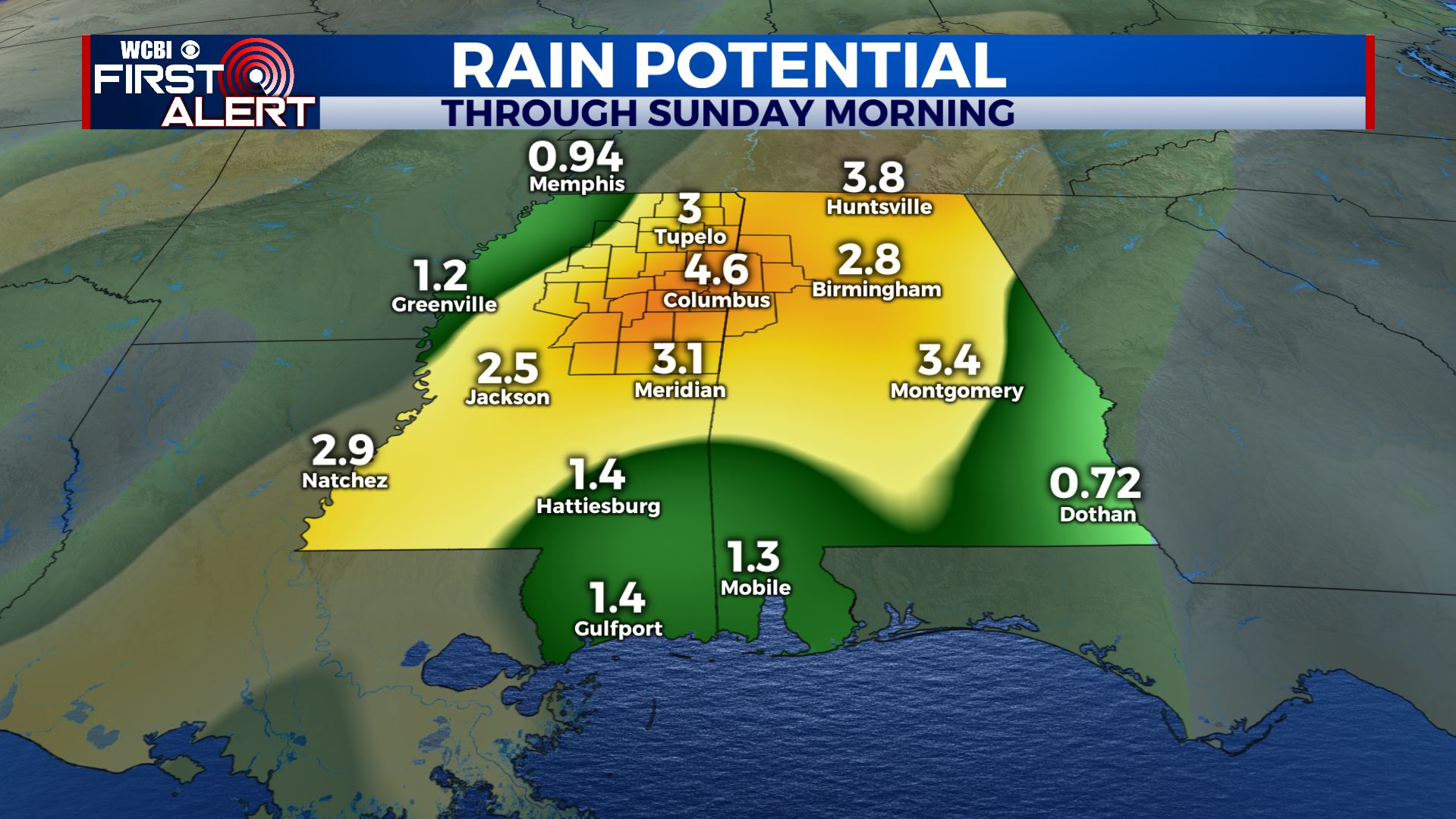
GFS Model Rain Projections
WEDNESDAY NIGHT: Clear and cool. Lows in the lower 40s with some upper 30s possible.
THURSDAY: Mostly sunny to partly cloudy. Highs in the low 70s with SE winds 5-10 mph. Plan on 50s for high school football during the evening hours.
FRIDAY: Cool, cloudy, and wet conditions are expected. A few rumbles of thunder can’t be ruled out. Highs should top out in the 60s.
FRIDAY NIGHT-SATURDAY: Rain will continue. Some storms are also possible depending how unstable the atmosphere can become. There is the potential for some severe weather in the region depending on how things set up so stay tuned for updates. Temperatures will hold steady in the 60s Friday night with highs in the upper 60s to around 70 on Saturday.
SUNDAY: Drier weather should return. Highs stay in the upper 60s.
NEXT WEEK: We’re going to keep a low end chance of a few showers in the forecast Monday and Tuesday. Data suggest a better chance of rain by midweek with another strong cold front coming our way. Much colder air may settle in for Halloween.
Follow @WCBIWEATHER on Facebook, Twitter, and Instagram


Leave a Reply