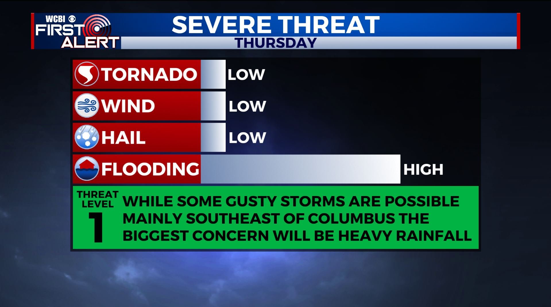
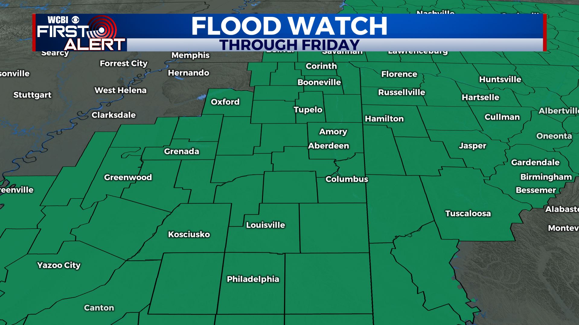
Heavy rain Thursday
SUMMARY: Widespread rain will develop Thursday and some of it may become quite heavy. Total rainfall Thursday and Friday may range from 1 1/2″ to over 5″. Soil is pretty wet from recent rains and additional excessive rainfall will cause more flooding around the region. There is still the outside chance of some strong storms southeast of Columbus Thursday afternoon and evening but it’s still very much in doubt how far north the most unstable air can get.
WEDNESDAY NIGHT: Mostly cloudy with rain developing by sunrise. Lows in the mid 40s. Winds SSE 5-15 mph.
THURSDAY: Areas of rain and perhaps a few storms. Rain may become heavy and cause flooding. Temperatures will range from the 50s in Tupelo to the 60s south of the US 82 corridor. Winds S 10-15 mph. Some gusty storms are POSSIBLE mainly southeast of Columbus during the afternoon and evening but it’s still iffy if our coverage area will get in on the action. The most unstable air is likely to remain along and south of the I-20/59 corridor. Stay tuned for updates.
THURSDAY NIGHT: Cloudy with areas of showers. Lows in the mid 50s.
FRIDAY: Mostly cloudy with a 60% of showers. Highs in the low 60s.
FRIDAY NIGHT: Mostly cloudy. Lows near 40.
SATURDAY: Mostly cloudy. Highs in the upper 40s.
SATURDAY NIGHT: Clearing skies. Colder. Lows near freezing.
SUNDAY: Mostly sunny. Highs in the upper 50s.
MONDAY: Mostly cloudy. A 30% chance of showers. Highs in the mid 50s.
TUESDAY-WEDNESDAY: Mostly sunny. Highs in the 50s.
Follow @WCBIWEATER on Facebook, Twitter, Instagram, and the WCBI News app


Leave a Reply