HEAVY RAIN THIS WEEKEND
Thursday was a sunny and cold day. Friday will be about the same, with increasing clouds throughout the day. Unfortunately, this weekend looks miserable.
THURSDAY NIGHT: Clouds will be on the increase late Thursday night. Overnight lows will drop down into the upper 20’s and lower 30’s across the area! Winds will come out of the north around 5 MPH, helping to cool things off.
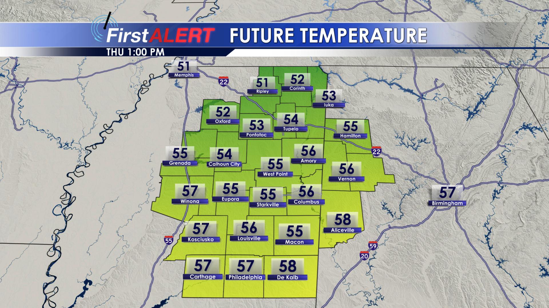
FRIDAY: Friday will start off cold! Clouds will increase throughout the day on Friday. Highs will top out in the lower 50’s. As we move into the late afternoon and evening hours, our next weather system will begin to move into our northern and western counties. These areas could see cold rain showers Friday night. Overnight lows on Friday will drop down into the upper 30’s and lower 40’s.
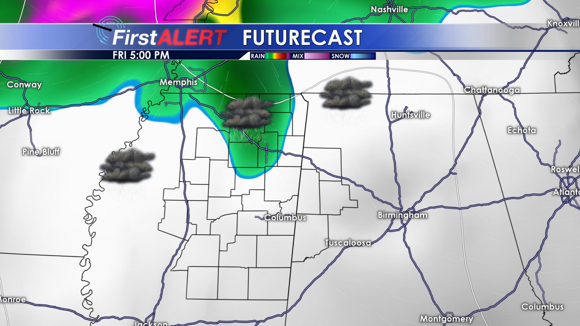
Rain Friday PM
SATURDAY: Heavy rainfall will be possible on Saturday. A line of showers will push through our area during the morning hours Saturday. Most of the rain should leave our area by the early evening hours. Highs on Saturday will top out in the upper 40’s and lower 50’s. Most locations will pick up between 0.50″ and 0.75″. A few isolated showers will be possible Saturday night, with overnight lows dropping into the upper 30’s lower 40’s.
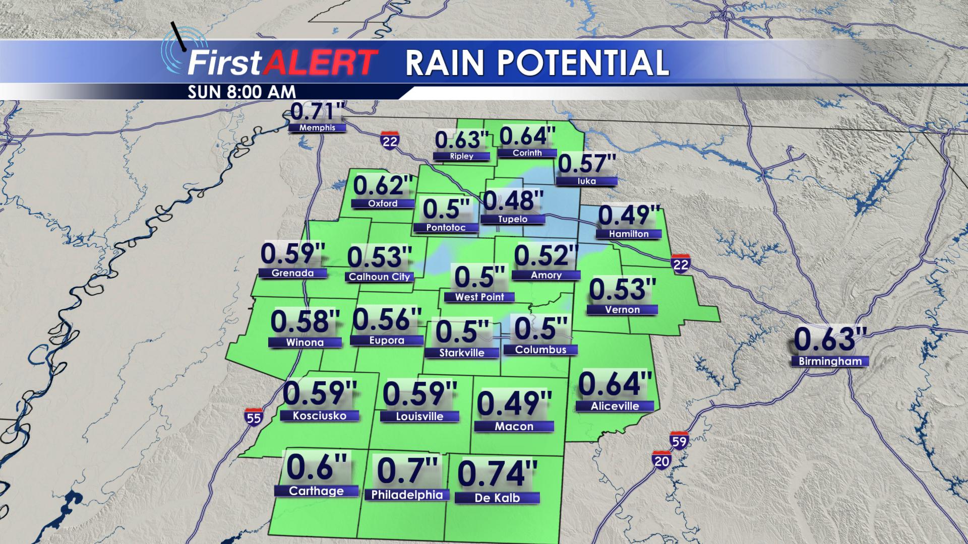
Rainfall Totals
SUNDAY: On Sunday, the back edge of the storm system will exit our region. As it does so, it will pull in colder air from the northwest. Temperatures will fall throughout the day on Sunday. Highs will occur early in the morning.
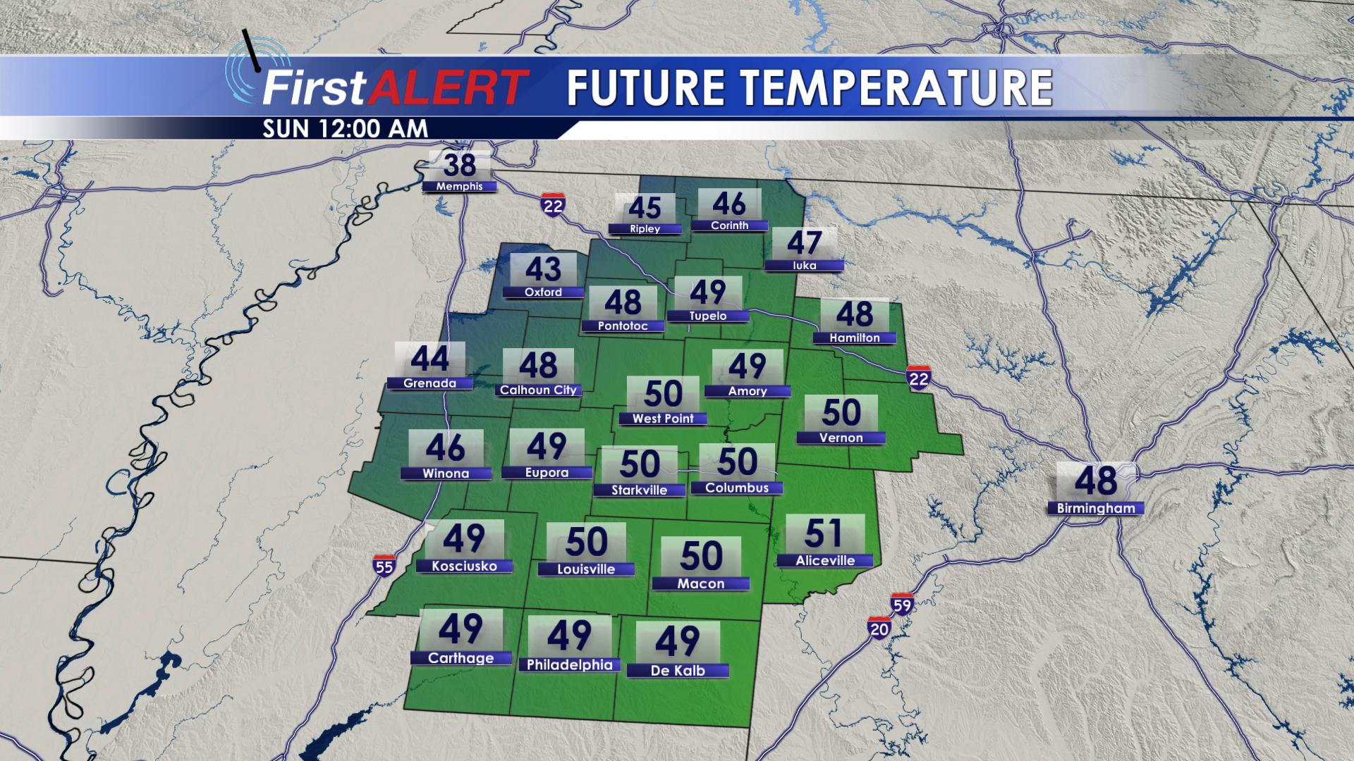
Highs Occur at Midnight
Highs Sunday will be in the upper 40’s and lower 50’s. Sunday will remain mostly cloudy. As we approach Noon on Sunday, temperatures will drop into the lower 40’s! Sunday night, lows will drop down into the middle 30’s.
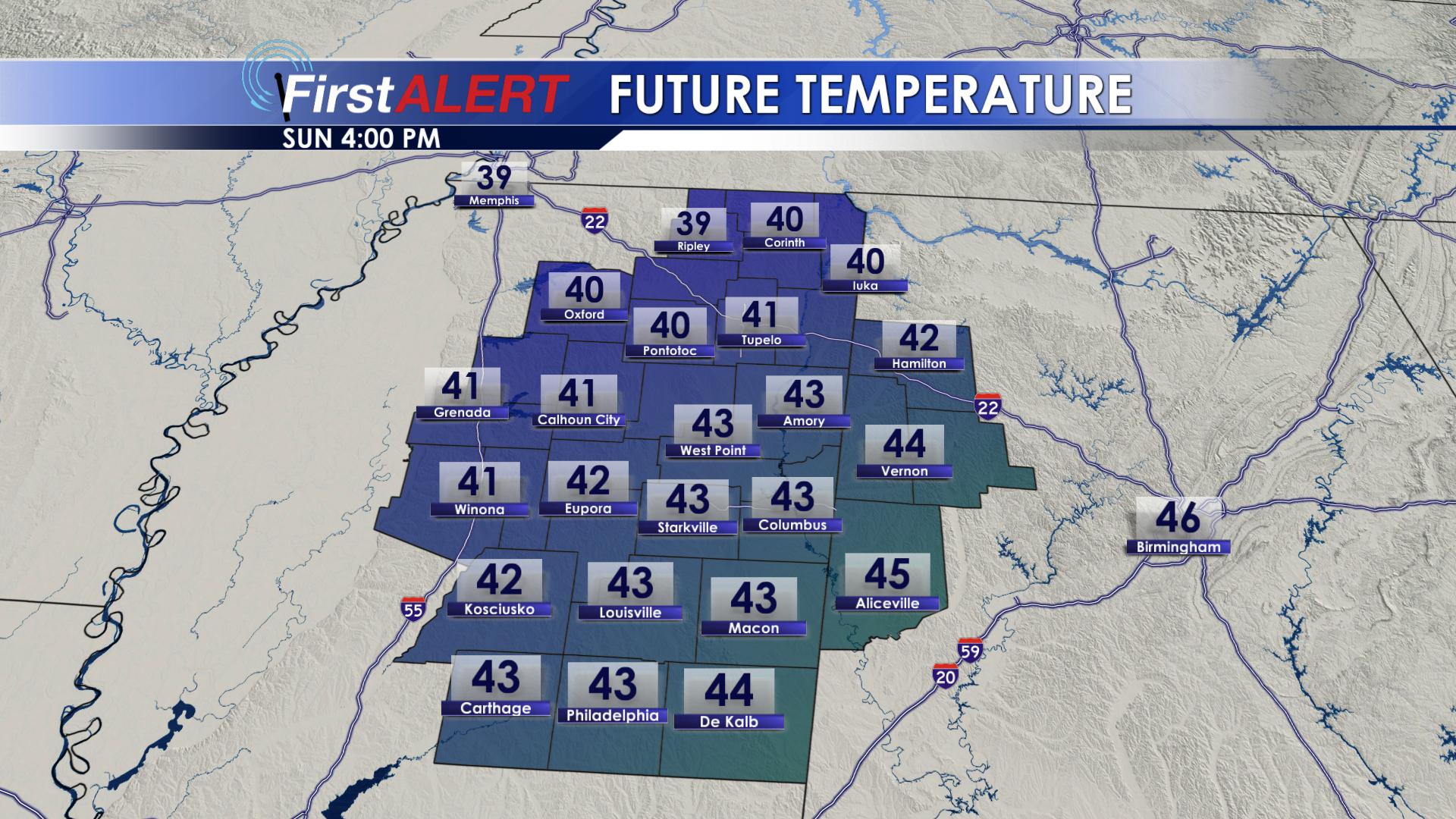
Temps Sunday Evening
MONDAY: Monday will remain dry and mostly cloudy, with daytime highs peaking in the middle 40’s. Monday night will be cold, with lows dropping into the upper 20’s and lower 30’s.
TUESDAY: Sunshine will return to the area on Tuesday, allowing things to warm up just a little. Highs on Tuesday will be in the lower 50’s. Tuesday night will not be as cold, with lows in the lower to middle 30’s.
WEDNESDAY & THURSDAY:Clouds begin to return on Wednesday. Highs will top out in the middle 50’s, with overnight lows in the lower 40’s. Thursday will remain mostly cloudy, with highs in the upper 50’s! Rain chances will begin to increase on Thursday, as our next weather system approaches our area.
Warmer Thursday
Follow us on Facebook, Twitter, Instagram and Snapchat @WCBIWEATHER


Leave a Reply