HELLO WARMING TREND!
Tired of the freezing temperatures? I have some good news for you! Friday starts the first day of our warming trend! By this weekend, highs will return to the 60s! We could even see some 70s sneak their way into the forecast next week. The warmth will be nice, but it could be accompanied by some clouds and rain.
THURSDAY NIGHT: Temperatures will be chilly across northeast Mississippi and west Alabama tonight. Thankfully, those 20s are out of here for the time being! We will drop down into the lower 30s tonight. Skies will remain mostly clear.
FRIDAY: Hello Friday! Friday will be a pleasant day across the region. Winds out of the south east around 10 MPH will help to bring in some warmer air, allowing us to top out in the upper 50s on Friday. With this increase in moisture, we will likely see more clouds move into the area. Overnight lows will dip down into the upper 30s.
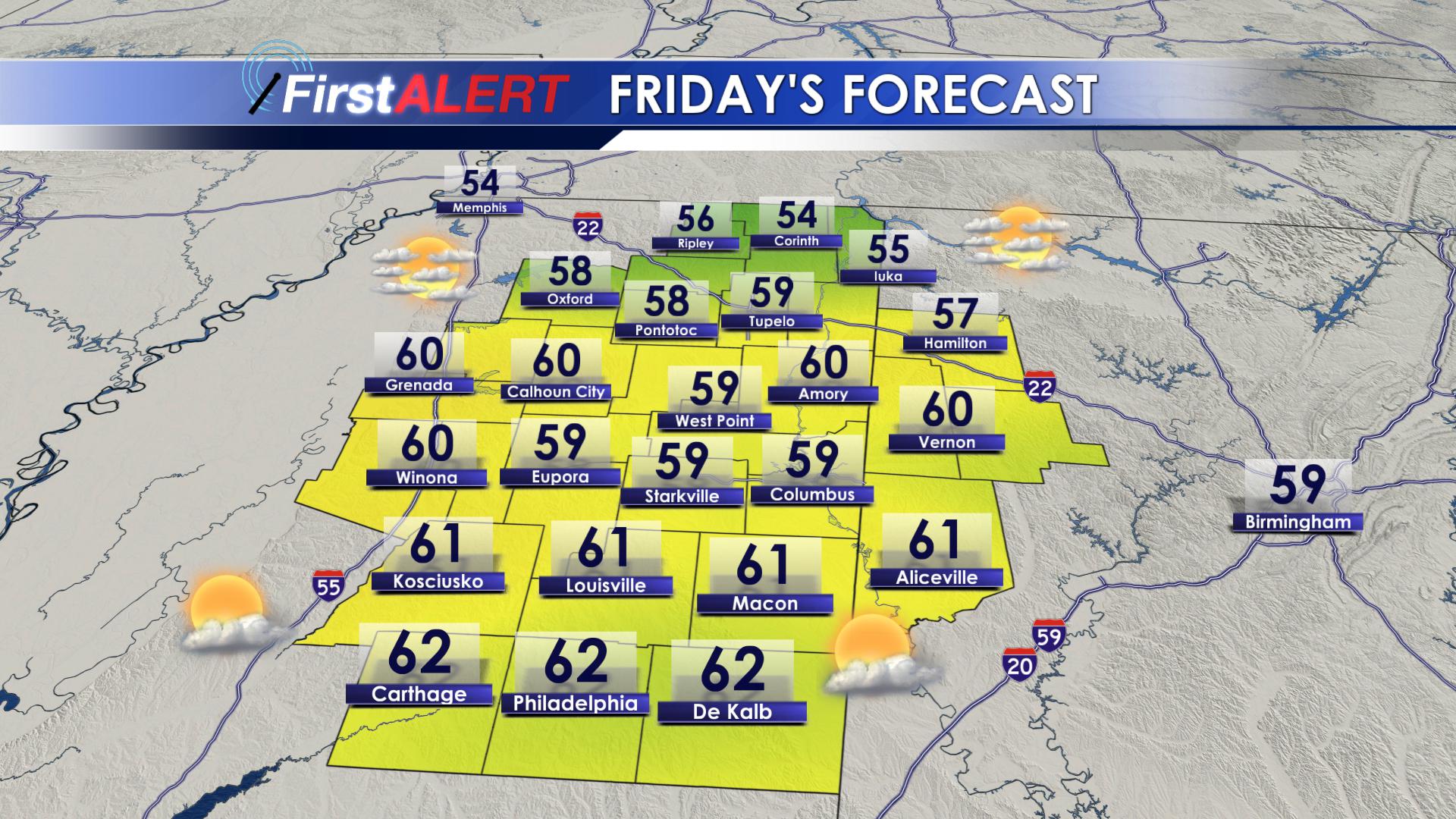
Friday’s Forecast
SATURDAY: 60s are back! Saturday will be a lovely day across the region. Skies will remain partly cloudy, with a stray sprinkle or two during the evening hours. Highs will reach the middle 60s across the area. A few sprinkles will be possible overnight as lows remain mild, only getting down to the upper 40s and lower 50s.
SUNDAY: We will see more clouds across the area on Sunday, but that will not keep it from being warm. Highs will be above average, topping out in the middle 60s once again. A stray shower or two will be possible across the area throughout the day, and even into the overnight hours. Lows will be warm, staying in the middle 50s.
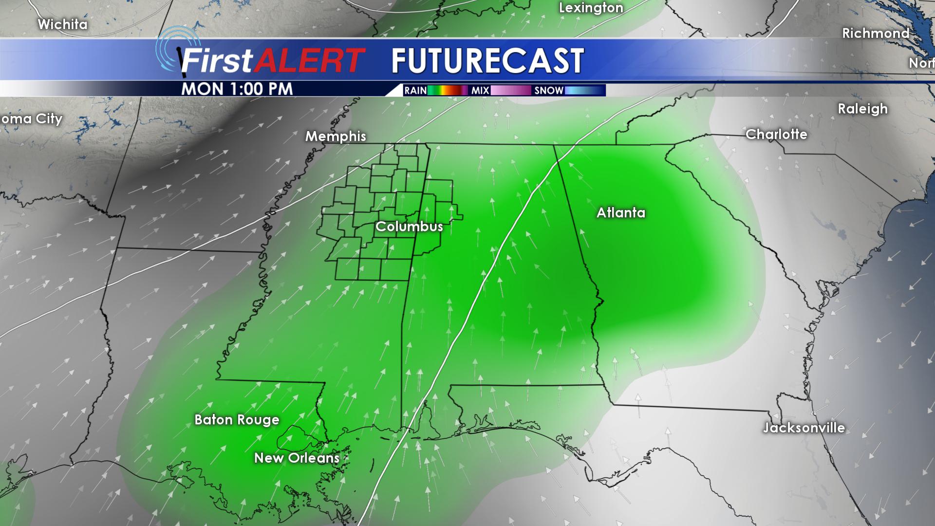
MONDAY and TUESDAY: Monday and Tuesday will be nearly identical. Highs both days will top out in the lower 70s, with overnight lows in the upper 50s and lower 60s. Isolated showers on Monday will become more widespread on Tuesday. We may even hear a few rumbles of thunder across the area.
Rain Returning
WEDNESDAY: Scattered showers and storms will remain across our area on Wednesday, with highs continuing to climb. Expect daytime highs in the lower 70s, with overnight lows in the lower 60s.
THURSDAY: Our temperatures will begin to fall on Thursday, but we will remain warm. Highs on Thursday will make it to the middle 60s, but we are going to see our rain chances increase just a little bit. Scattered showers and storms will be associated with a cold front moving through, that will drop our temperatures as we head into next weekend.
FOLLOW US ON Facebook, Twitter, Instagram and Snapchat @WCBIWEATHER


Leave a Reply