HERE COMES THE COLD
Tuesday was our last warm day for the foreseeable future! A much colder air mass is working its way towards northeast Mississippi and west Alabama. It’s time to bring the coats out once again.
TUESDAY NIGHT: Skies will remain clear overnight on Tuesday. Winds will be out of the northwest between 5 and 10 MPH. This will help usher colder air into the area. Overnight lows Tuesday night will drop down into the middle and upper 30’s.
WEDNESDAY: The sun will shine Wednesday, but it will be a bit misleading. Winds will persist out of the northwest on Wednesday around 10 to 15 MPH, with gust over 20 MPH at times. Highs on Wednesday will top out in the lower 50’s and upper 40’s, but it is going to feel colder than that thanks to the winds! Wind chills on Wednesday will be in the lower 40’s and upper 30’s. Overnight lows on Wednesday will plummet into the middle and upper 20’s! Winds will continue to blow out of the northwest Wednesday night, making it feel like the lower 20’s, and even upper 10’s in a few spots!
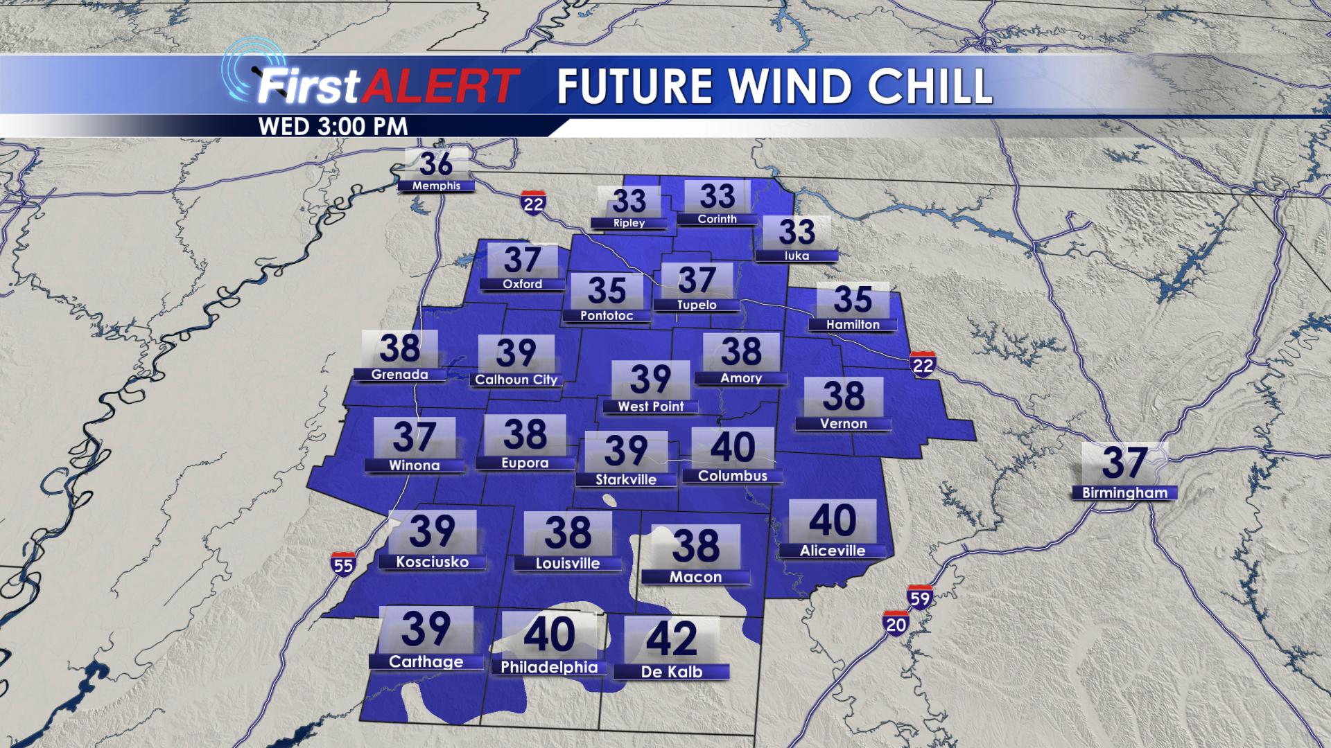
Wind Chill on Wednesday
THURSDAY: Thursday morning will start off bitter cold! North winds will be blowing out of the north around 10 MPH. Wind chill values will be in the lower 20’s as you head out the door Thursday morning, so be sure you bundle the kids up as they wait for the bus. A northerly wind will continue throughout the day on Thursday, making it feel like we are in the lower 40’s. Daytime highs on Thursday will top out in the upper 40’s. Clouds will begin to increase later in the day on Thursday, as our next weather system begins to move into our area. Thursday night, overnight lows will drop back down into the upper 20’s.
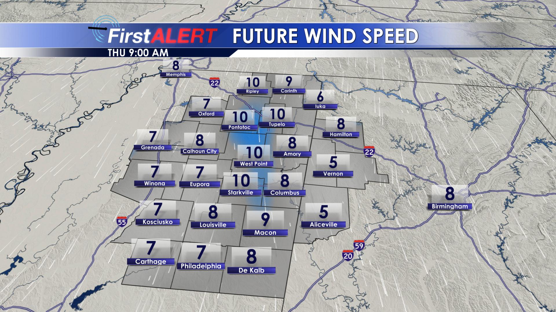
Wind Speeds Thursday AM
FRIDAY: Clouds will increase throughout the day on Friday. Highs will top out in the upper 40’s area-wide. As we get into the evening hours, rain showers will begin to increase from northwest to southeast across our area. As rain moves in, temperature will remain in the upper 30’s and lower 40’s. Therefore, only a cold rain is expected across our region. Rain will increase throughout the overnight hours, and temperatures will remain steady in the upper 30’s and lower 40’s.
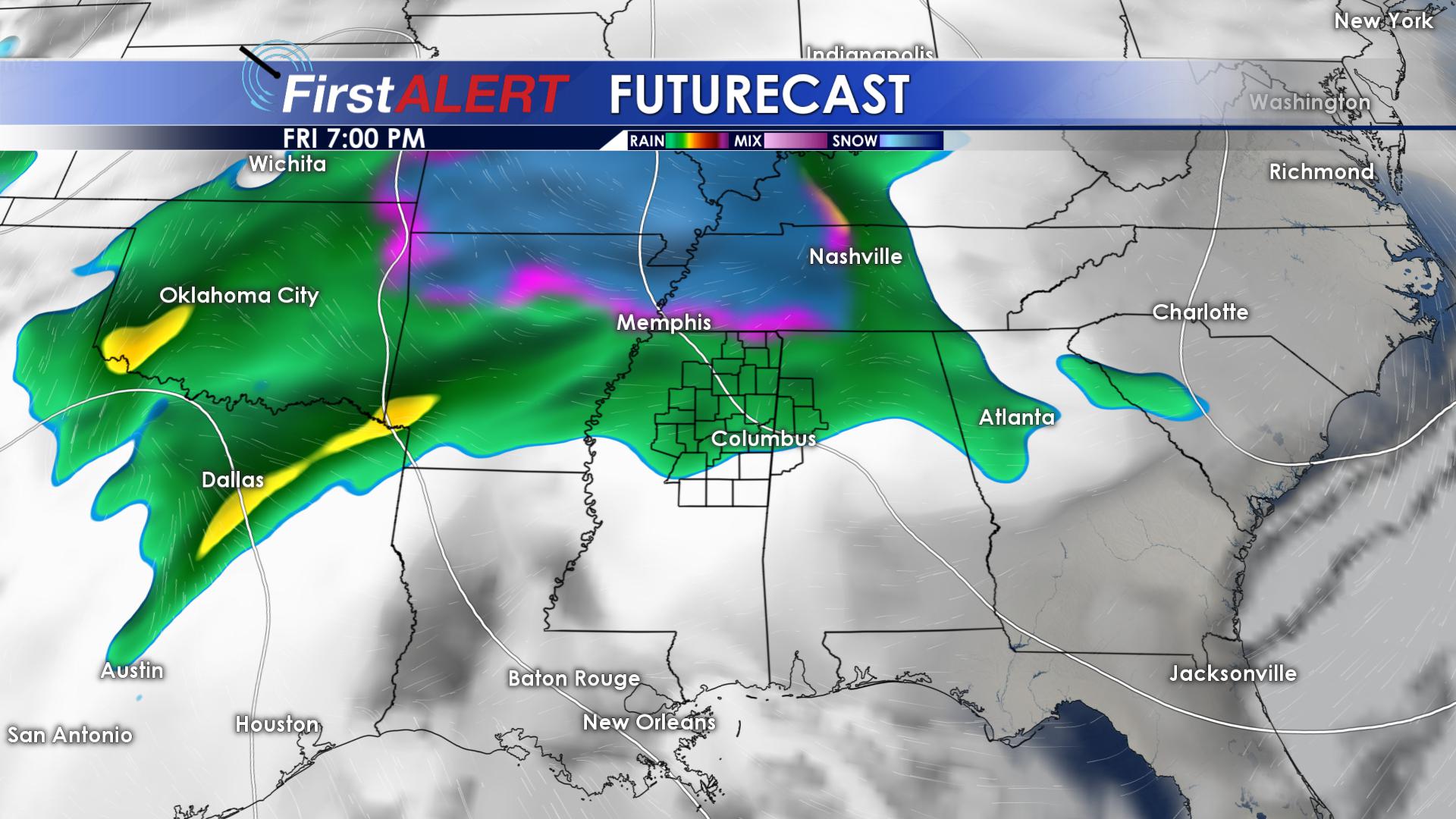
Rain Friday PM
SATURDAY: Saturday is going to be a down right nasty day. The heavy rain that moved in Friday evening will last throughout the day on Saturday. Before all is said and done with, some locations could pick up over an inch of rainfall! Highs on Saturday will be in the upper 40’s and lower 50’s. Overnight lows will drop down into the lower 40’s.
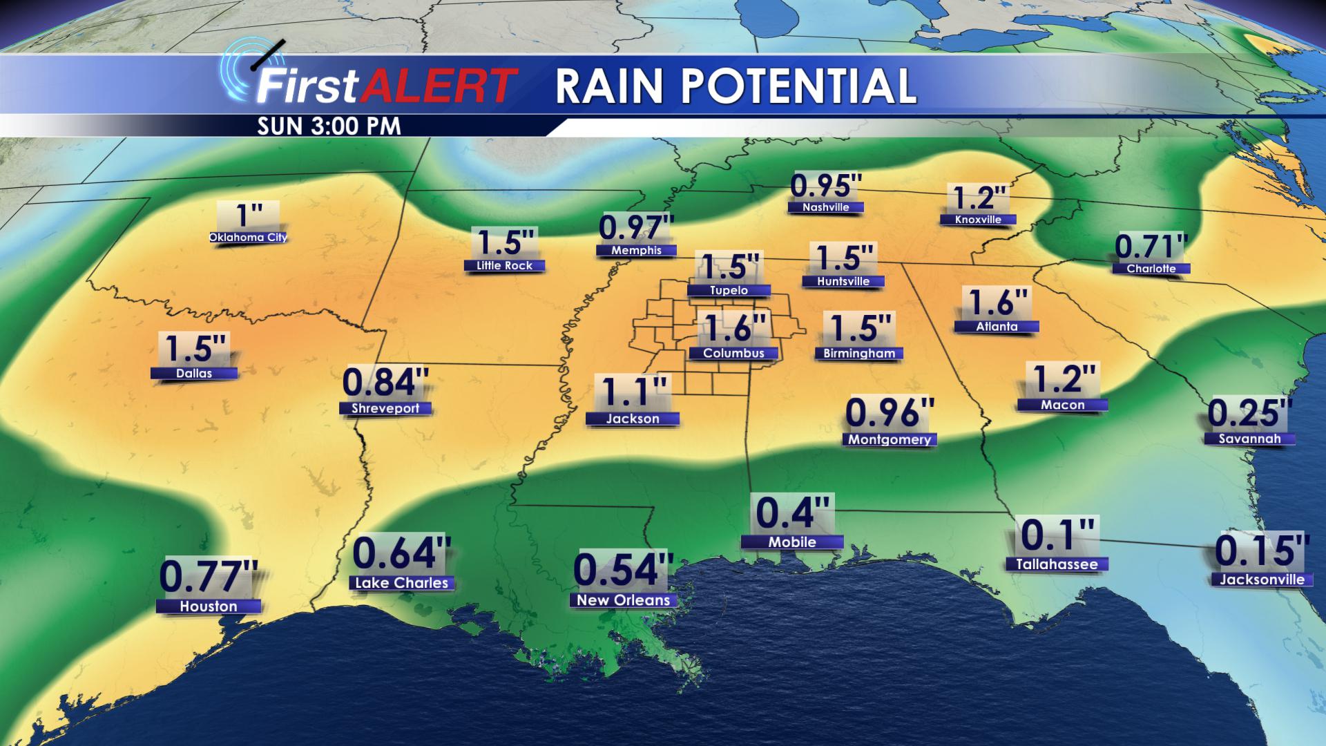
Rainfall Totals Through Sunday AM
SUNDAY, MONDAY & TUESDAY: Showers will exit our region early Sunday morning. Clouds will hang around for most of the day. Highs on Sunday will remain in the upper 40’s, with overnight lows in the lower to middle 30’s. Monday, sunshine returns, but highs remain in the middle 40’s. Monday night, lows will drop into the lower 30’s. On Tuesday, highs will return to the lower 50’s, with sunshine remaining across the area.
Follow us on Facebook, Twitter, Instagram and Snapchat @WCBIWEATHER


Leave a Reply