High fire danger Tuesday, Thursday severe threat
COLUMBUS, Mississippi (WCBI) – Warm, dry weather leads to increased fire danger Tuesday. Increasing moisture and a cold front bring a severe threat to the region Thursday.
TUESDAY: A cool start to the day gives way to much warmer weather later in the day. Highs will reach near 70 degrees, but with increasing southerly breezes, fire danger will be quite elevated today. Grass fires can start and spread quickly in this environment, so outdoor burning is very much discouraged today.
WEDNESDAY: Warm weather sticks around, but as moisture finally begins to increase, fire danger should decrease. Clouds will build in thanks to increasing moisture, and an isolated shower is possible. Highs will stay in the upper 60s.
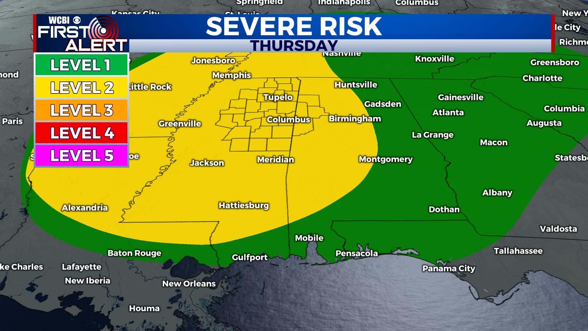
THURSDAY: A strong storm system and associated cold front will sweep across the Deep South during the day. The current forecast hasn’t changed much – widespread rain and storms are forecast, and with impressive wind energy, storms could contain damaging winds and a few tornadoes. Any increase in temperature/storm energy would result in an increased severe threat. Highs will reach the 70s, but temperatures drop quickly behind the front. The main time frame to watch for active weather is midday – late afternoon, 11a-6p.
FRIDAY: Morning temperatures are likely to start near freezing. Temperatures will reach near 50 degrees by afternoon despite clearing sky conditions.
WEEKEND: Mostly sunny and mild conditions are expected each day. Highs will be in the upper 50s Saturday and middle 60s Sunday. Moisture increases yet again late Sunday, and rain chances could pick up early next week.


Leave a Reply