A high risk for severe weather on Thursday
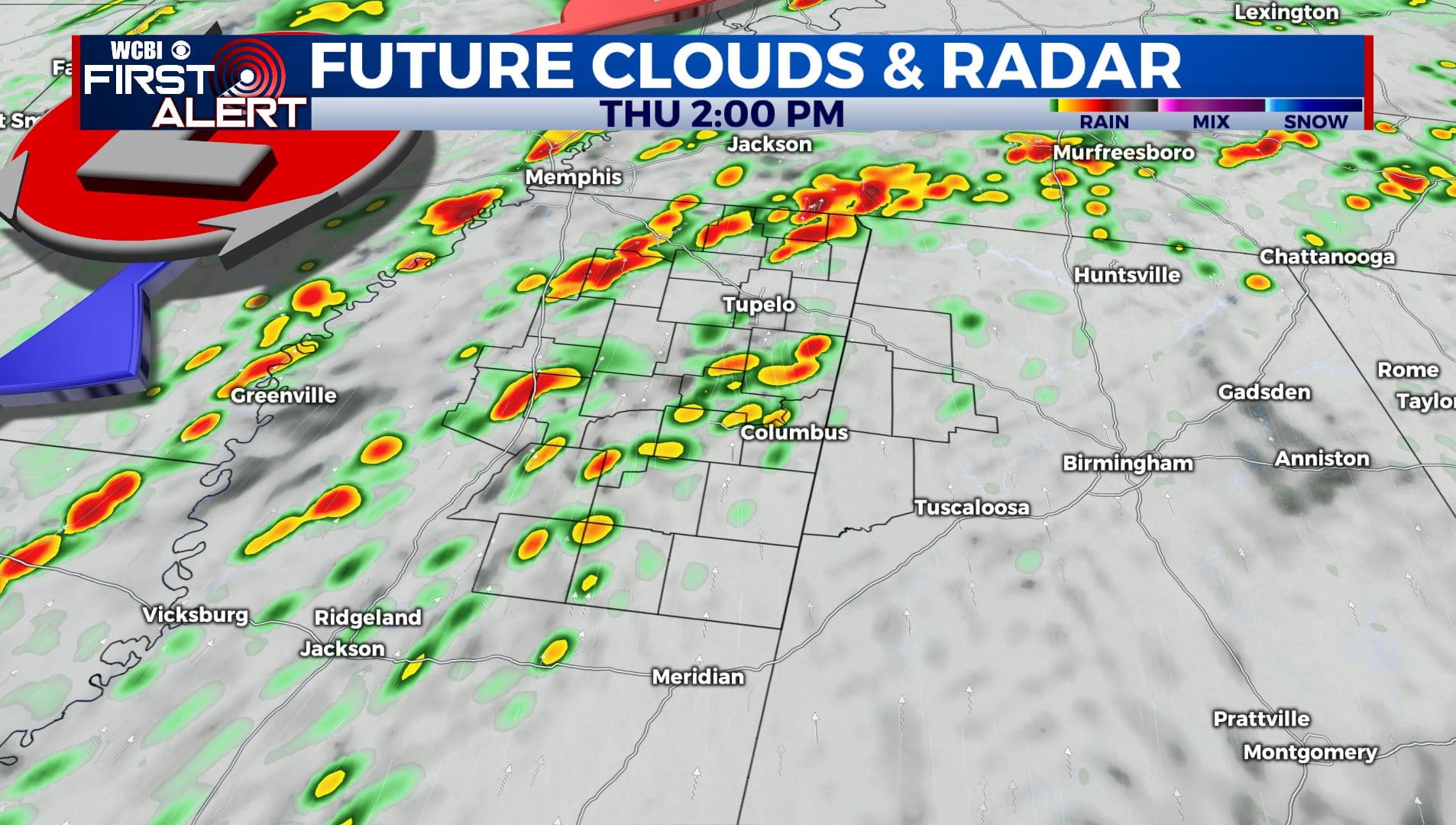
SUMMARY: Storm chances will continue during the day as now we are under a Level 5 Risk. The greatest risk of severe weather will be from early Thursday afternoon into the early evening. All modes of severe weather, including tornadoes, are likely. Stay weather aware and once again get your severe weather safety plans ready. Stay tuned!
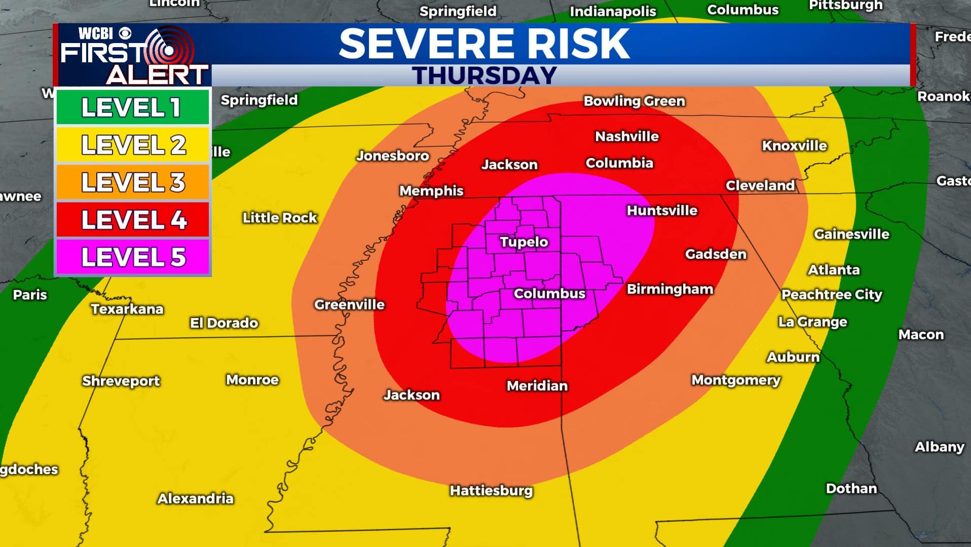
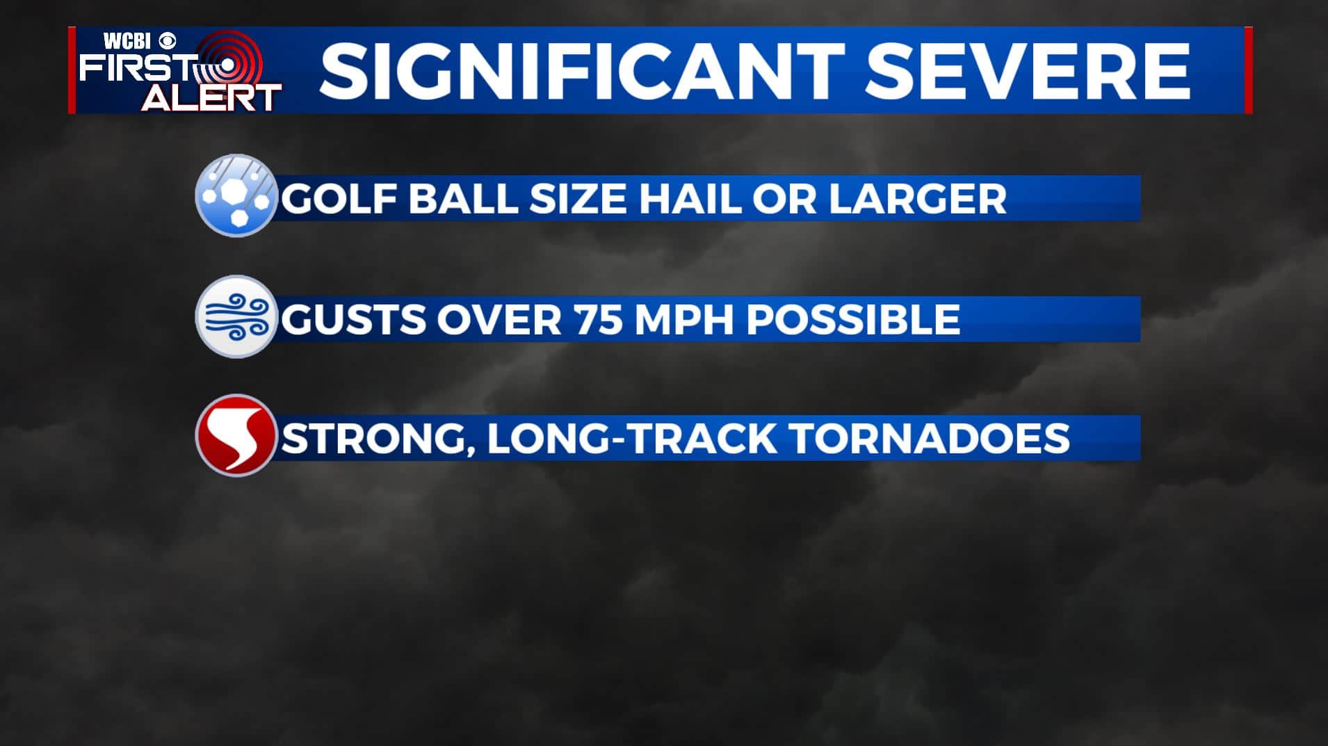
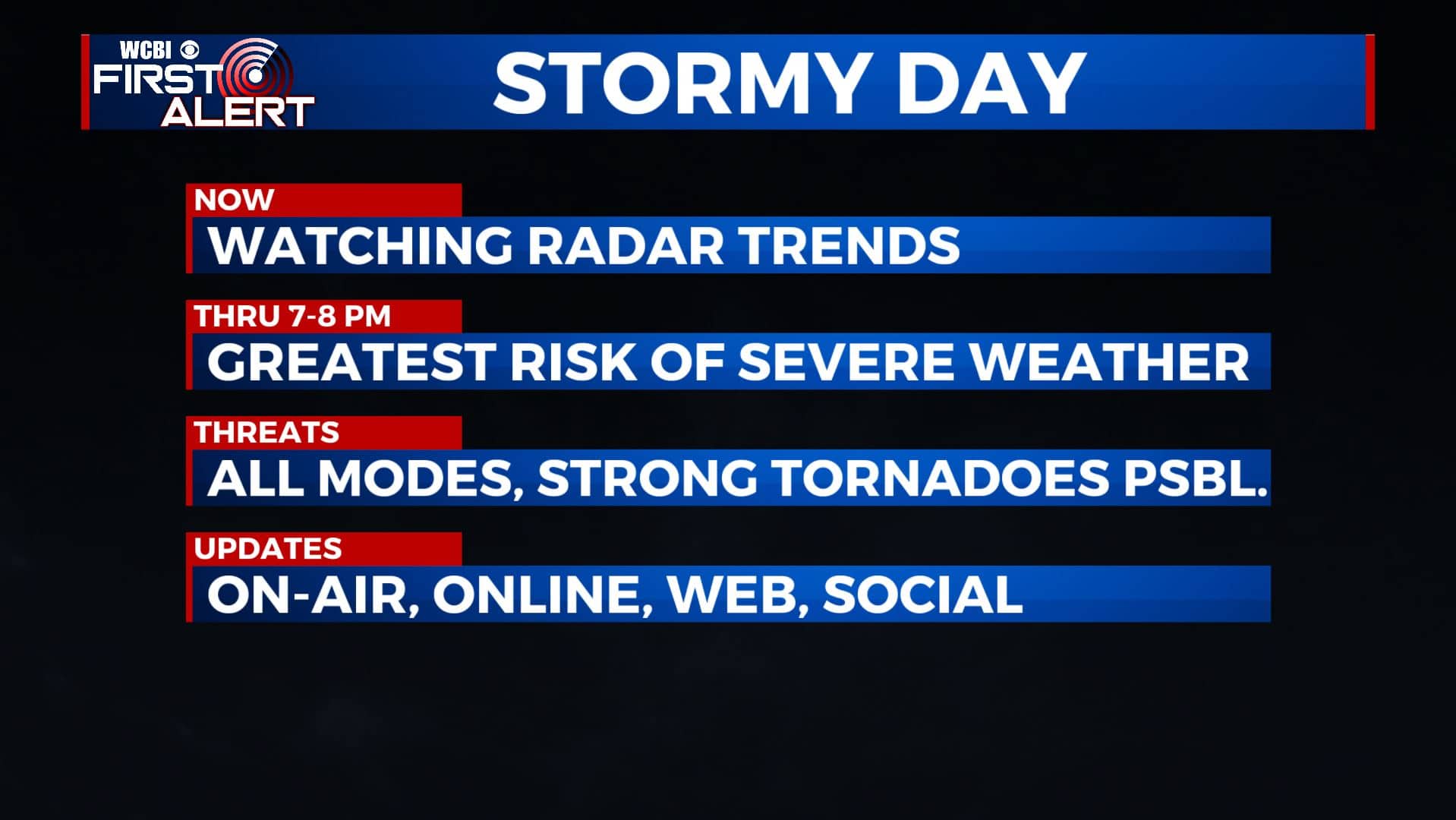
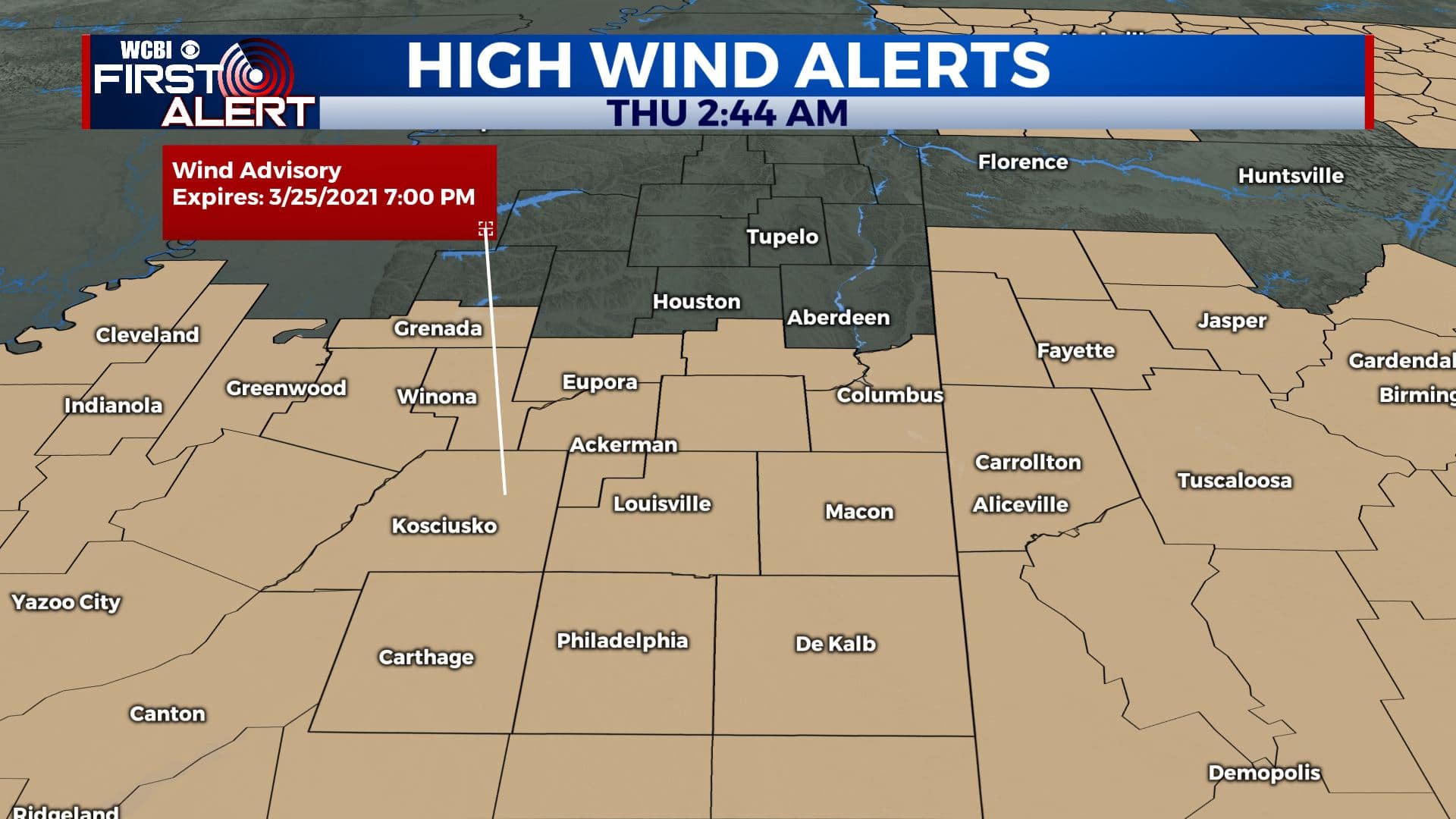
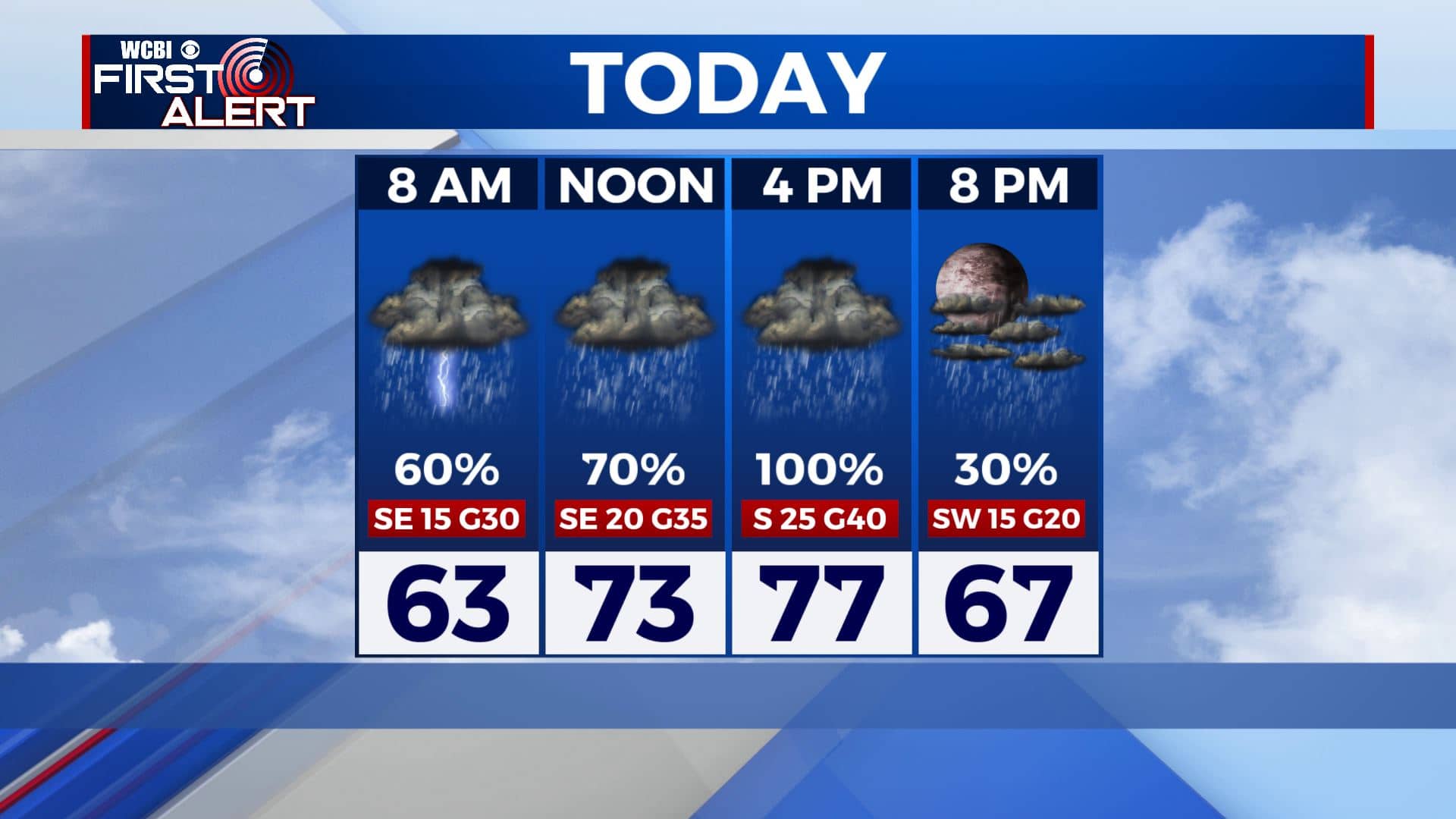
THURSDAY: Widespread rain and storms are likely. The greatest severe threat will be from about midday through 8pm. All modes of severe weather are likely, including tornadoes. There could be some significant severe weather including golf ball size hail or larger, wind gusts over 75 mph and strong, long-track tornadoes. Rainfall between 1-3″ with higher amounts could also lead to flooding. Southerly winds 15-25 with gusts over 40 mph are possible all day, even outside of any storm. A Wind Advisory is in effect from 7am to 7pm. Look for highs in the mid to upper 70s.
THURSDAY NIGHT: Partly cloudy and quiet once storms move out. Overnight lows in the upper 40s to lower 50s by sunrise Friday. Winds should calm down.
FRIDAY: A pretty nice and sunny day overall with a few friendly clouds. Highs in the mid to upper 70s.
FRIDAY NIGHT: Some storms are possible late in the evening through the week hours of Saturday morning. Some isolated strong storms with hail could once again be an issue. Lows in the upper 50s.
SATURDAY: Warm with highs near 80 degrees. More rain and storms could develop during the afternoon and evening hours. Lows around 60 Saturday night.
SUNDAY: Some rain and clouds may linger. Cooler with highs in the upper 60s to lower 70s.
Stay connected with @WCBIWEATHER on Facebook, Twitter, Instagram, and the WCBI News App. We’ll provide LIVE tornado warning coverage on TV and ONLINE if it occurs in our coverage area.


Leave a Reply