Hot & Humid, Watching The Gulf
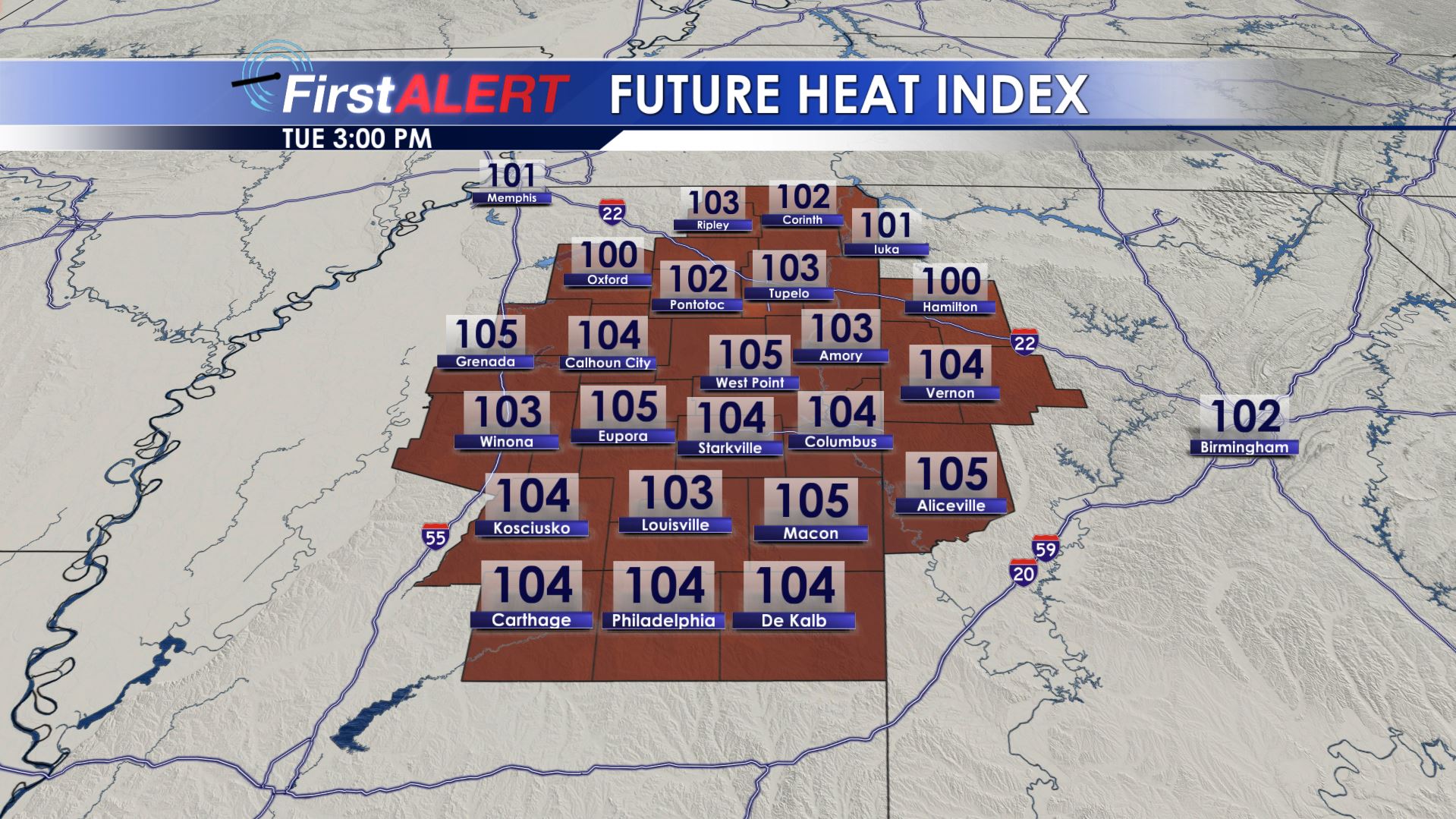
Heat Index
SUMMARY: Hot and humid conditions are here for the next few days. Pop-up showers and storms are possible through Thursday but not everyone will get one. Rain chances may go up Friday and through the weekend due to a weak frontal boundary and a potential tropical system that may develop in the Gulf. Our weekend forecast will likely be based on what actually happens in the tropics.
MONDAY NIGHT: Mainly clear after any isolated evening showers and storms dissipate. Look for lows in the low to mid 70s with calm wind.
TUESDAY-THURSDAY: Partly cloudy, hot, and humid. Daytime highs will be in the mid 90s with heat index values over 105 at times during peak heating hours. Overnight lows stay in the 70s. Daily rain chances between 20-30% exist but not everyone is going to get a storm each day. Any storm this time of year may produce gusty winds, frequent lightning, and torrential rainfall.
FRIDAY-SATURDAY: All eyes turn to the Gulf of Mexico and what could become a tropical system. If it develops into a tropical storm it would be called Barry. Recent model data suggest SOMETHING will form in the northeastern Gulf and potentially drift back to the west before coming inland. Suffice to say it’s hard to tell what will happen considering a system hasn’t even formed yet; however, we’re going to bump up the odds of rain in our area due to the potential that some of this moisture may come up here with time. Just keep an eye on the forecast each day going forward this week because changes will be occurring.
Follow @WCBIWEATHER on Facebook, Twitter, and Instagram


Leave a Reply