Hot July Weather Continues; Possible Tropical Activity In The Gulf.
TODAY: Standard summer weather on tap today. Highs in the low to perhaps mid 90s in a few spots. The heat index will soar into the 100s this afternoon, with a few spots seeing that number exceed 105°. A few storms will pop up in the afternoon heat. Rain coverage will be about 30%. Storms fizzle out in the evening. Lows drop into the low 70s.
TUE/WED: Brutal heat in store for the middle of the week. Temperatures top out in the mid 90s, with a few spots potentially hitting the upper 90s. The heat index will be in the 104-108° range. We’re starting to get into those heat index numbers that are dangerous here, so plan to limit outdoor activity and if you must be outside, attempt to stay in shade and take plenty of breaks from the heat. Staying hydrated is crucial in this kind of weather. There will be the potential for a few isolated storms, which might bring some much needed relief from the heat to some, but many other spots will miss out on the rain and bake in the July sun.
Chance For Tropical Development
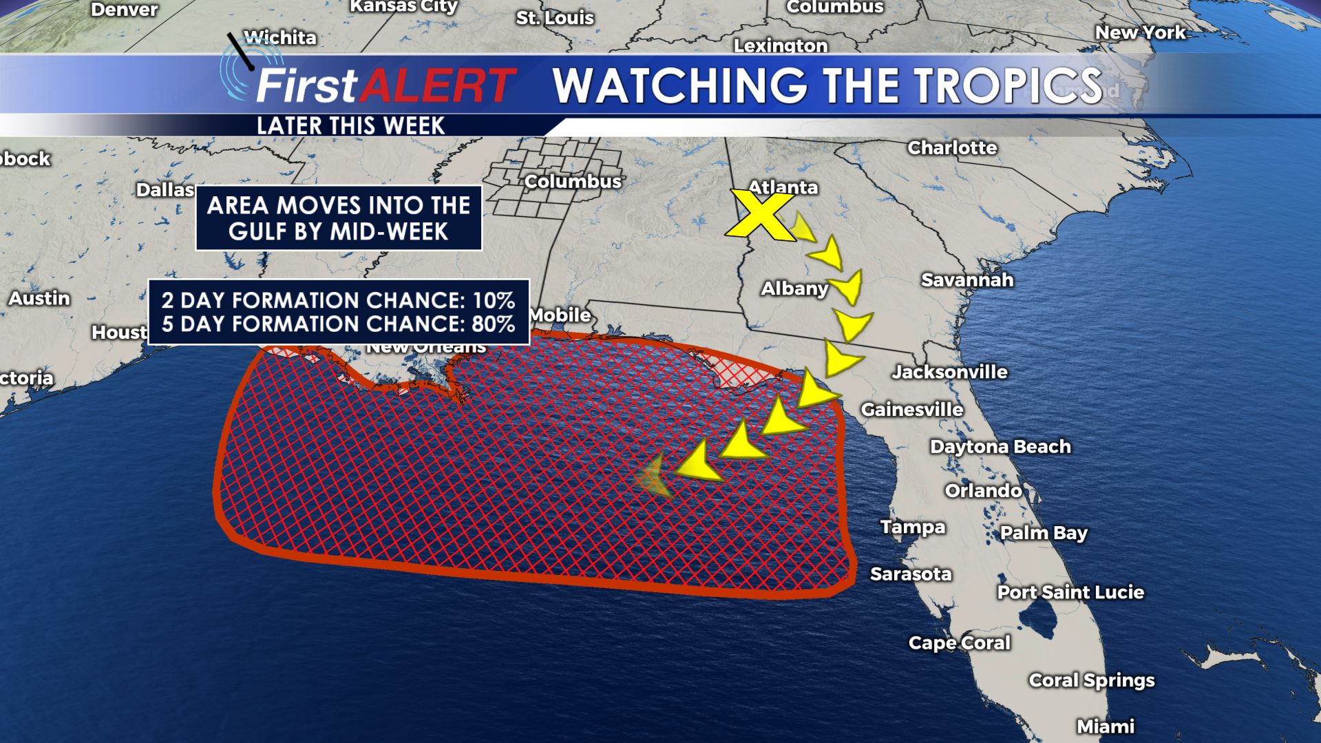
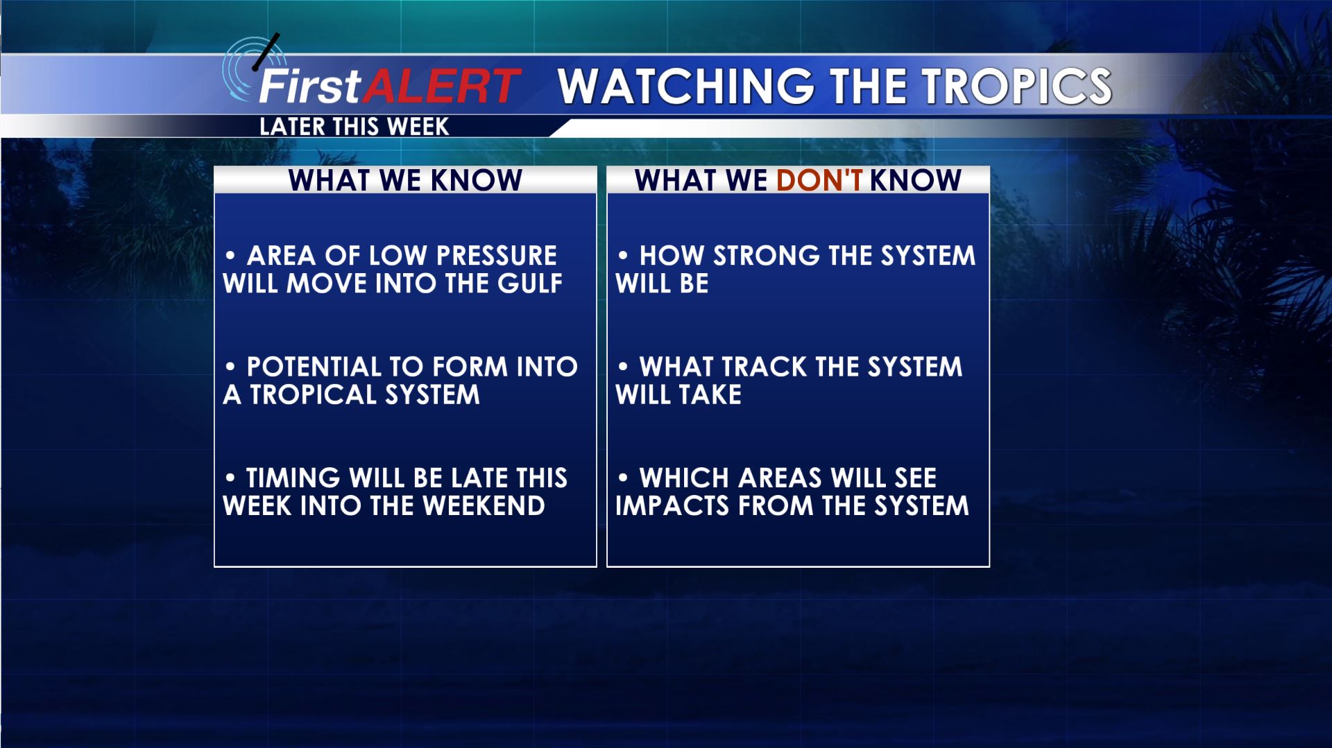
THE REST OF THE WEEK AND THE TROPICS: The forecast as we head into the end of this week is a bit up in the air as it will depend on how any potential tropical development behaves through the end of this week. As of this morning, satellite imagery showed a piece of atmospheric energy we call a Mesoscale Convective Vortex, or MCV for short, over Georgia. This MCV will drop south into the northern gulf over the next couple of days, where it will likely develop some tropical characteristics and has a high chance of becoming a tropical depression by Friday. At this time, there are still a wide range of scenarios as to how this system could track and intensify, but for now this is still just something to watch. As for our area, the track of this system would have a fairly large impact on our forecast, particularly as we head into the weekend. For now, I expect the general pattern of hot and humid weather with scattered storms to hold through Thursday, with slightly higher rain chances and slightly lower temperatures Friday into the weekend due to additional tropical moisture in the region. The weekend forecast is likely to change some based on forecast tweaks to the tropical development, so stay tuned. If you have beach plans this weekend, don’t cancel them just yet, but keep an eye on things over the next few days.


Leave a Reply