Hot For Now…But Is Relief Coming?
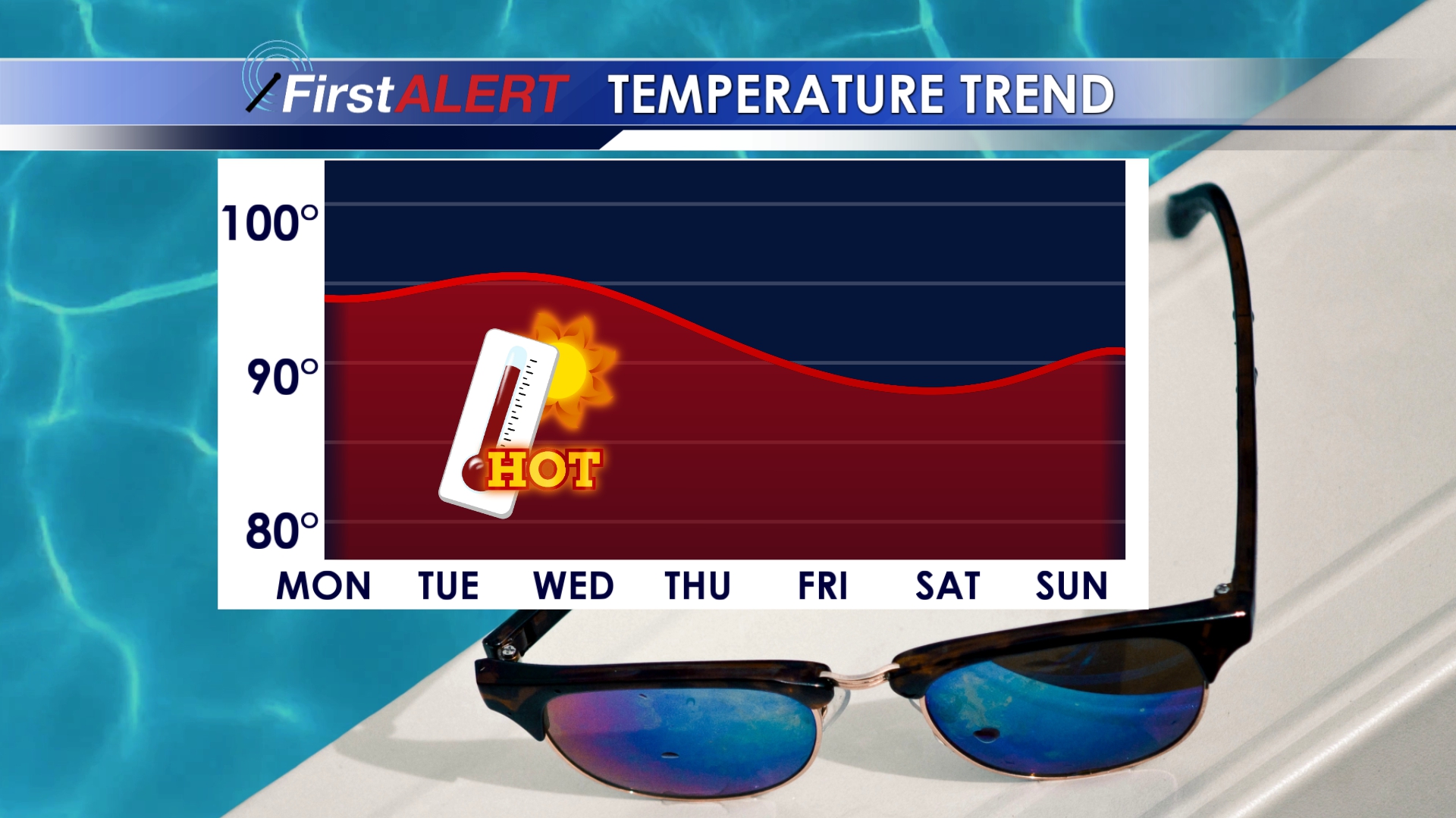
Hot weather is going to continue for the start of the week with highs in the mid to upper 90s. Heat index values will be close to 100°. Slightly more comfortable air returns to the area by the end of the week with highs dropping a few degrees. Rain chances will remain limited over the next few days, but a shower or storm here or there isn’t out of the question.
SUNDAY NIGHT: Another mostly clear and quiet night. We’ll be staying pretty mild and muggy with temperatures staying in the 70s overnight.
MONDAY-WEDNESDAY: Temperatures are going to stay hot for the first half of the week. Highs will be in the mid to upper 90s across the area with heat index values between 100°-105° in the afternoon. If you plan to be outside, be sure you have a way to stay cool and drink plenty of water. Rain chances are basically non-existent, but a quick sprinkle can’t be ruled out.
THURSDAY-SUNDAY: We’ll notice a slight drop in temperatures for the end of the week with highs in the low 90s. Some areas may see highs in the 80s, especially on Friday and Saturday. Rain chances will stay minimal, but we’ll throw in a 20% chance for an isolated shower or storm. No substantial rain is expected, but you may have to dip inside for a few minutes if one of those showers happens to pop up over your location.
Follow @WCBIWEATHER on Facebook, Twitter, and Instagram


Leave a Reply