Hot & humid Friday; Showers & storms for the weekend
SUMMARY: Another typical summer day ahead for your Friday with just a very scattered chance for showers and storms. Most of us will stay dry. Staying pretty warm & humid. Rain chances will bump up as we go into the weekend as a front will stall to our north. Next week will start off wet with widespread rain chances. More typical summertime scattered storm chances will return midweek next week.
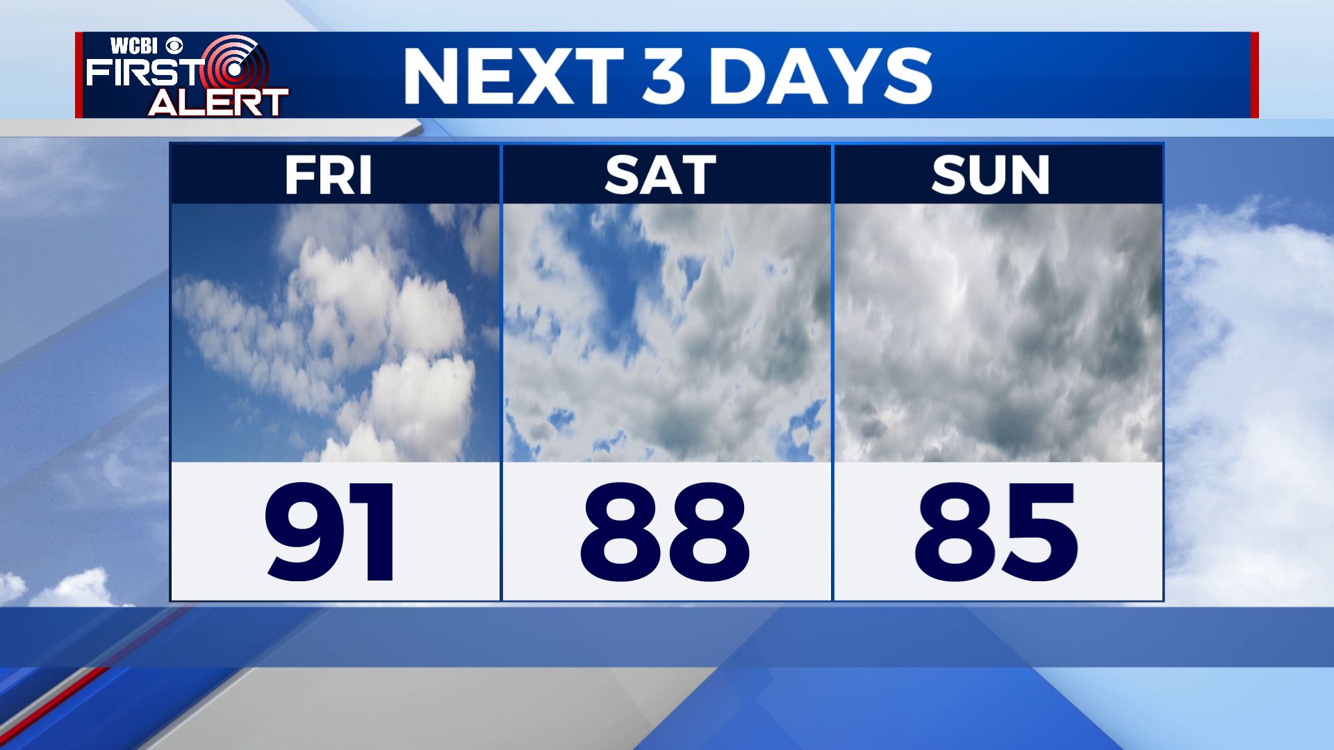
FRIDAY: Most of the area will stay dry, but can’t rule out the chance of seeing an isolated shower or storm. Hot and humid with highs in the lower 90s. The heat index will make it feel like 100 degrees out there. Stay cool & hydrated!

FRIDAY NIGHT: Clouds will increase overnight. A few showers could start moving in early Saturday morning. Overnight lows in the lower 70s.
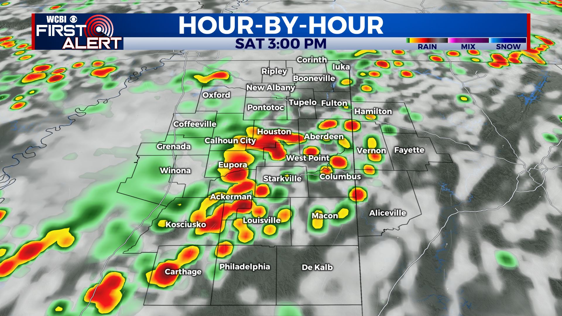
SATURDAY: Chances of those showers & storms starts increasing as a cold front nears us. Staying warm & humid overall. Highs in the upper 80s to lower 90s. Overnight lows in the lower 70s.
SUNDAY-TUESDAY: A cold front will stall out on Sunday, bringing us more widespread chances showers and storms as we head into the new workweek. The cloud cover will keep those high temperatures a bit cooler in the mid to upper 80s. Overnight lows will be right around the 70 degree mark.
WEDNESDAY-THURSDAY: We’ll still have a chance of scattered afternoon showers and storms. A mix of sun & clouds and highs in the upper 80s.
Stay connected with @WCBIWEATHER on Facebook, Twitter, Instagram and the WCBI News App


Leave a Reply