Labor Day Weekend Forecast
SUMMARY: Aside from a slim chance of a shower or storm Sunday-Monday our area is looking like it’ll be pretty sunny and warm for the next 7 days. Hurricane Dorian is expected to make landfall somewhere in Florida next Monday or Tuesday and then head up the East Coast. It should have no bearing on the weather here.
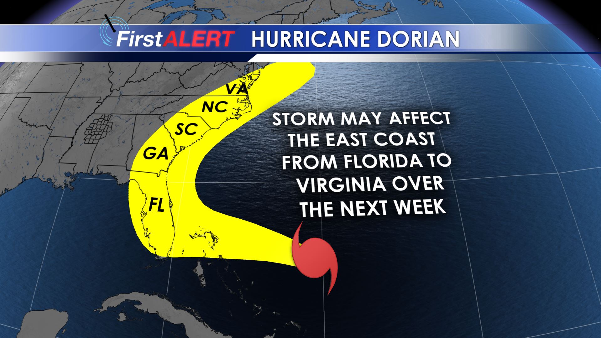
Dorian’s Track
FRIDAY NIGHT: Clear, quiet, and comfortable. Lows in the mid to low 60s.
SATURDAY: Bright sunshine with warm highs in the low 90s. Winds from the ESE between 4-8 mph. Pack your sunglasses, a hat, and some sunscreen if you’ll be heading out to the Prairie Arts Festival in West Point or the Ole Miss game up in Memphis.
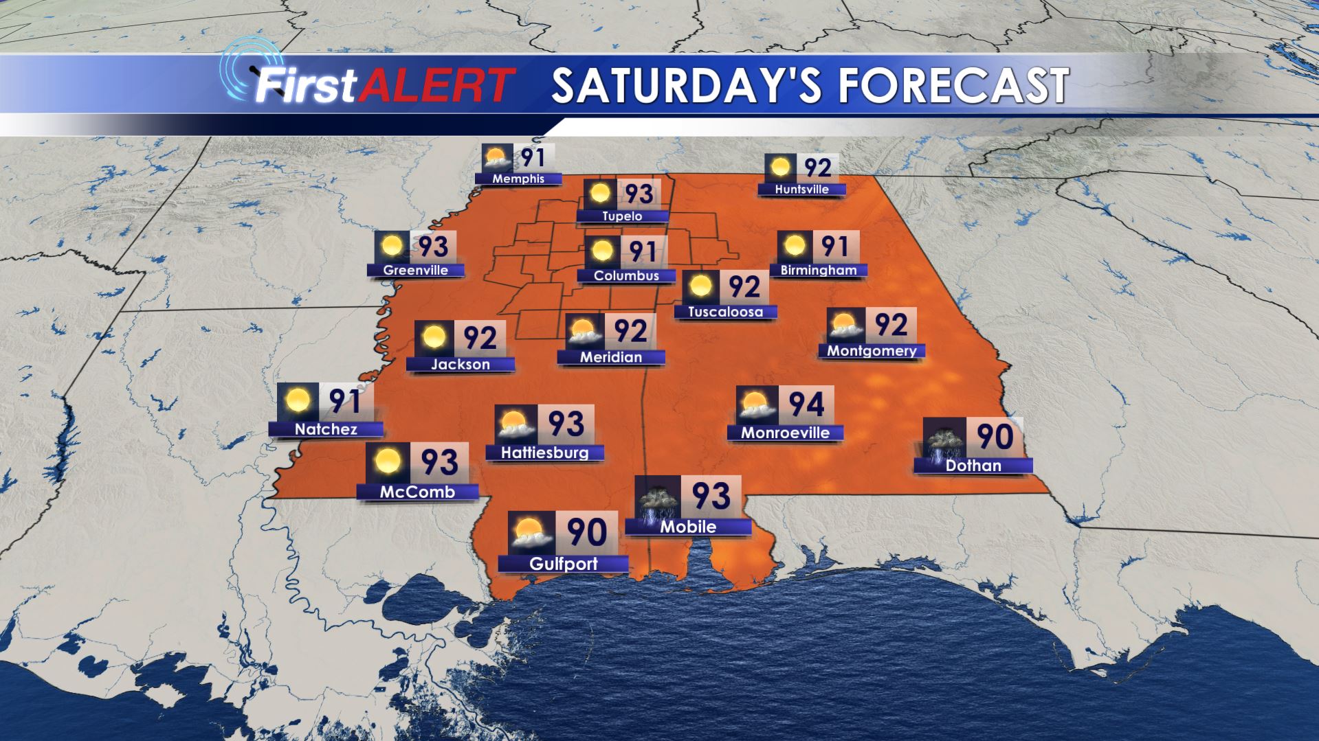
Saturday’s Forecast
SATURDAY NIGHT: Partly cloudy and quiet. Lows in the mid to upper 60s.
SUNDAY-MONDAY: Partly cloudy and warm. Highs in the low 90s. There is a 10-20% chance of a spotty shower or storm both days, especially across our southeastern counties. Most locations in our area will not have any rain.
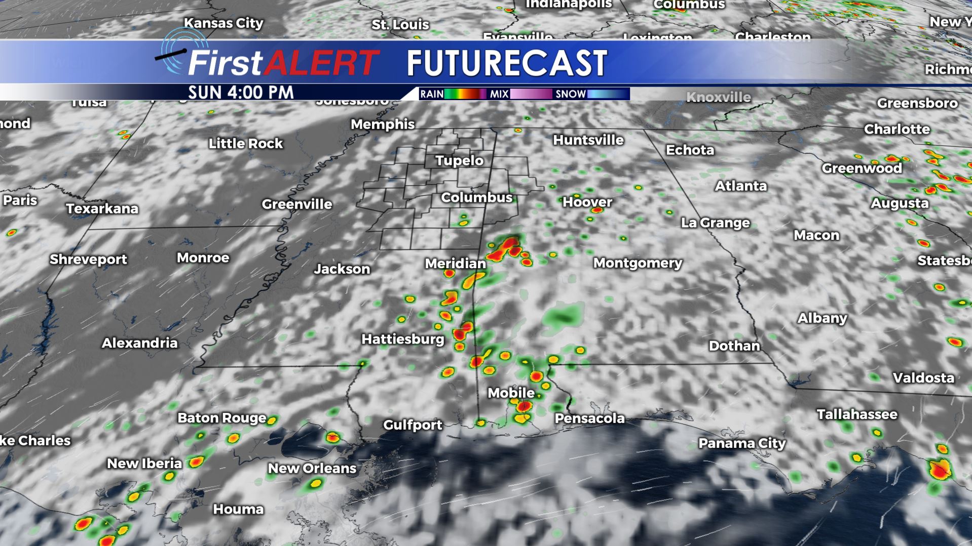
Sunday Afternoon Futurecast
TUESDAY-FRIDAY: Mainly sunny and hot. Temperatures may be in the mid 90s by Wednesday. A weak cold front will usher in cooler temperatures by the end of the week but at this point moisture is expected to be limited at best.
Follow @WCBIWEATHER on Facebook, Twitter, and Instagram


Leave a Reply