Light at the end of the tunnel as late-week sunshine leads the way for warming
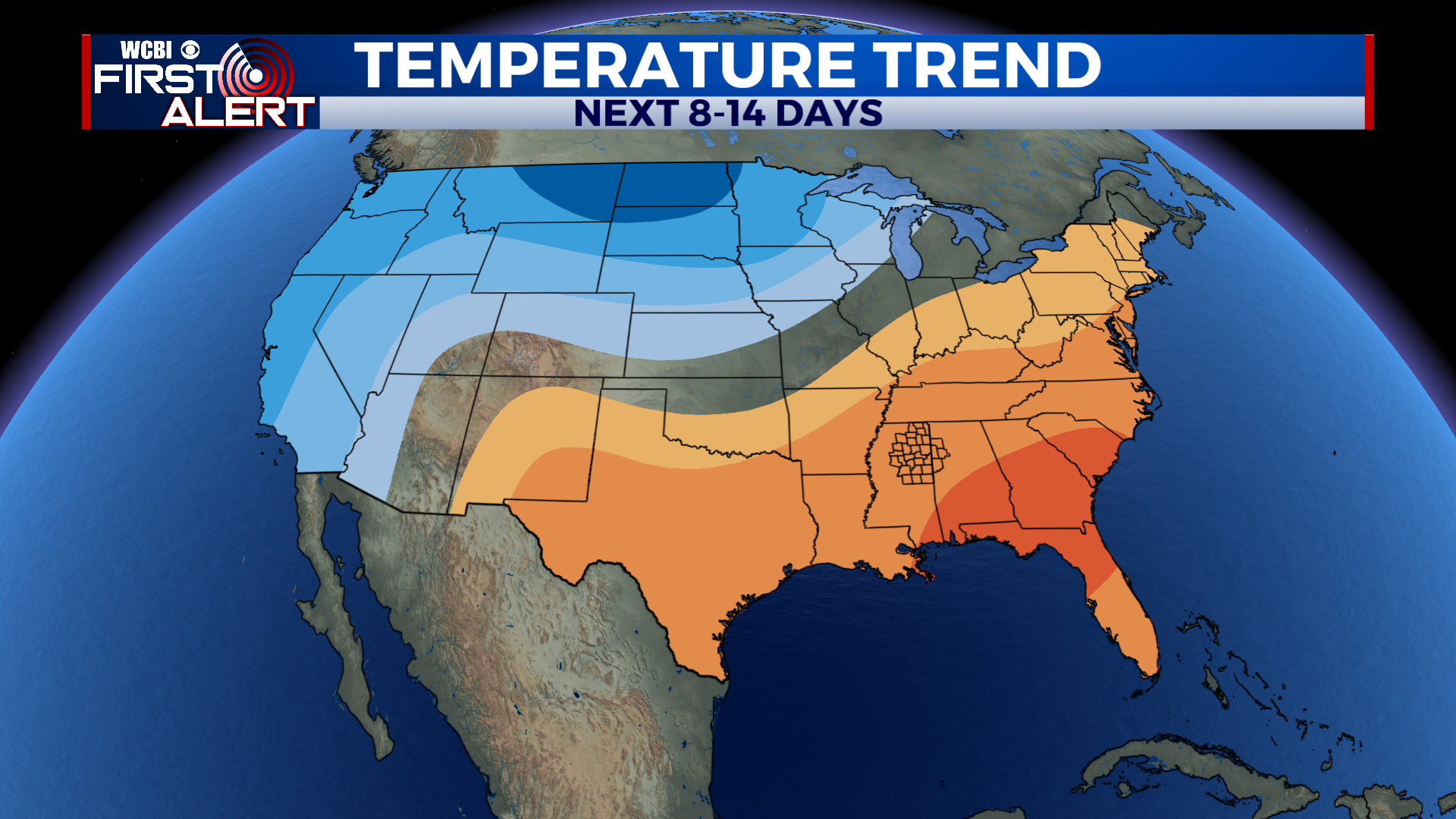
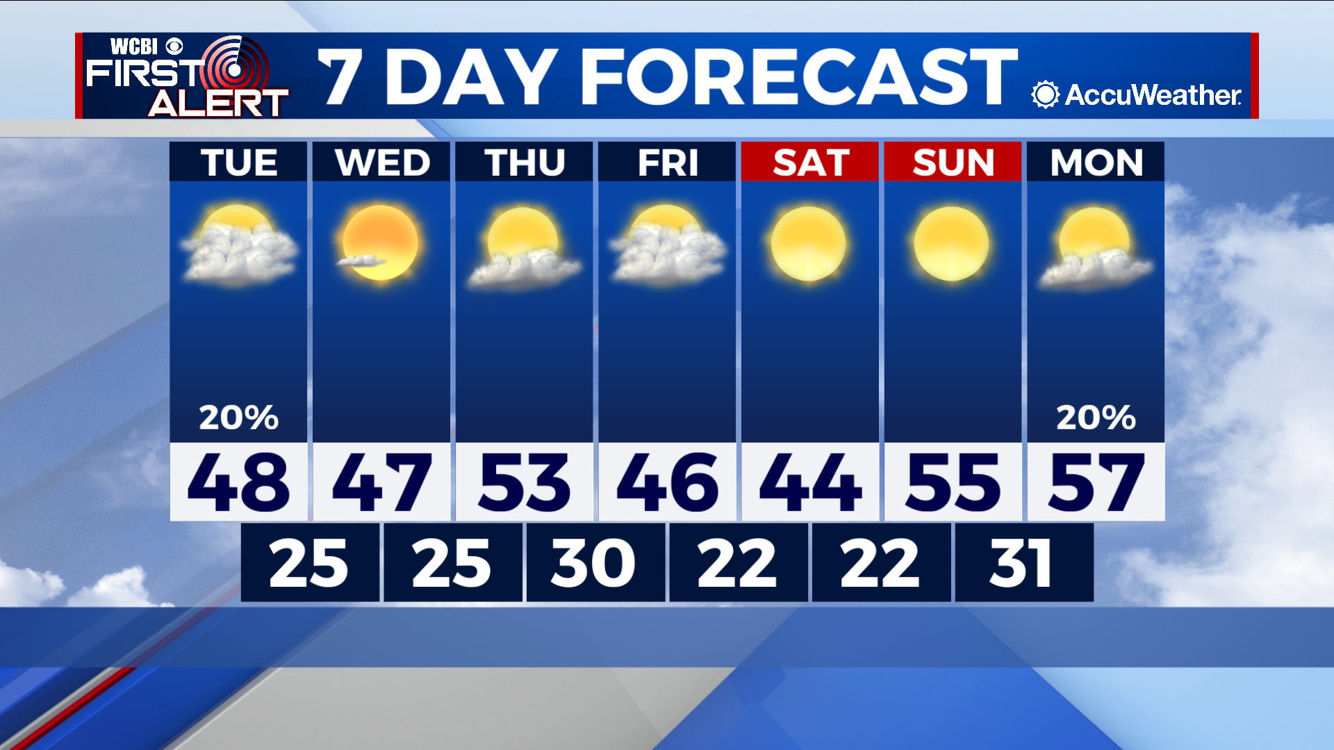
COLUMBUS – SUMMARY: Some positive signs ahead as the beginning of next week looks to start out in in the high 50s. In the meantime however, two rounds of cold fronts on Tuesday and Friday keep highs around 50 and lows in the 20s.
TUESDAY: Rain chances Tuesday remain minimal as a cold front passes through the region during the morning and early afternoon. Any rain that does fall should be concentrated in counties south of Starkville and Columbus, with accumulations no higher than a quarter of an inch. The biggest impact here will be the tremendously cold air brought into the area. Lows will drop into the mid 20s overnight.
WEDNESDAY: Little recovery temperature-wise is expected in the immediate aftermath of Tuesday’s front. Highs will remain similar to what was seen Monday, topping out in the upper 40s. Significantly clearer skies will be the big one here, which will facilitate some warming before Friday’s front makes an appearance. Lows bottom out in the mid 20s once again.
REST OF THE WEEK: Highs will reach into the lower 50s before Friday’s cold front turns the temperature knob once more. Expect lows to stay below freezing throughout the rest of the week and into Monday. Clear skies over the weekend will open the door for more drastic temperatures increase into the mid to high 50s by next Monday. The week also remains dry after Tuesday with the next rain chance coming up on deck the next Monday.


Leave a Reply