Mild start to February
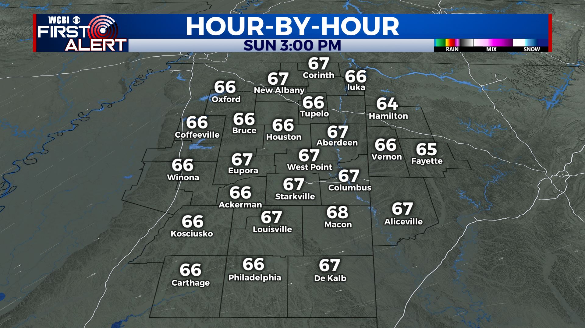
SUMMARY: Clouds hang on for the start of the weekend but they’ll go away by Saturday evening. Many folks will have spring fever Sunday with temperatures pushing back into the upper 60s under sunny skies. Rain and storms return to the region Tuesday and Wednesday. Several more inches of rain are possible in addition to some strong storms.
FRIDAY NIGHT: Mostly cloudy. Lows in the upper 30s to lower 40s. Light and variable winds.
SATURDAY: Mostly cloudy to start with gradual clearing during the day. An isolated shower or two remains possible. Highs should top out in the mid 50s. Winds WNW 5-15 mph.
SATURDAY NIGHT: Clear and chilly. Lows in the mid 30s.
SUNDAY: Bright sunshine. Highs in the mid to upper 60s.
SUNDAY NIGHT: Mainly clear. Lows in the mid 40s.
MONDAY: Increasing clouds. Highs in the upper 60s.
MONDAY NIGHT: Mostly cloudy with a chance of showers. Lows in the mid 50s.
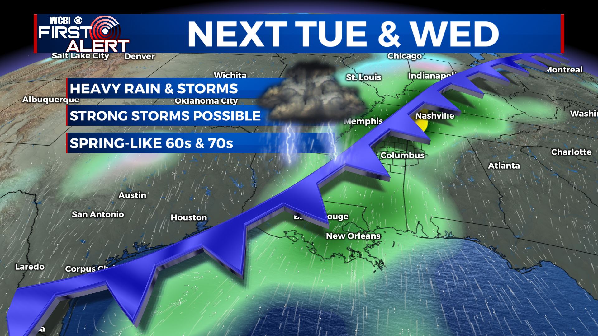
TUESDAY-WEDNESDAY: Areas of rain and storms. Several inches of rain may fall in addition to some strong storms. It’s still uncertain if all of the ingredients will team up for severe weather but we’re definitely going to be watching. Highs stay in the 60s to low 70s.
THURSDAY-FRIDAY: Cooler, more seasonable air returns to the region. Highs should be in the upper 40s to mid 50s with lows in the 30s. Some showers may linger Thursday.
Stay connected with @WCBIWEATHER on Facebook, Twitter, Instagram, and the WCBI News App


Leave a Reply