A mild Thursday is ahead before next cool down
SUMMARY: A warmer day is ahead for our Thursday, but it will be short lived as our next cold front will usher in some breezy conditions and cooler air for Friday and the weekend. We’ll stay mostly dry before rain chances return midweek next week.
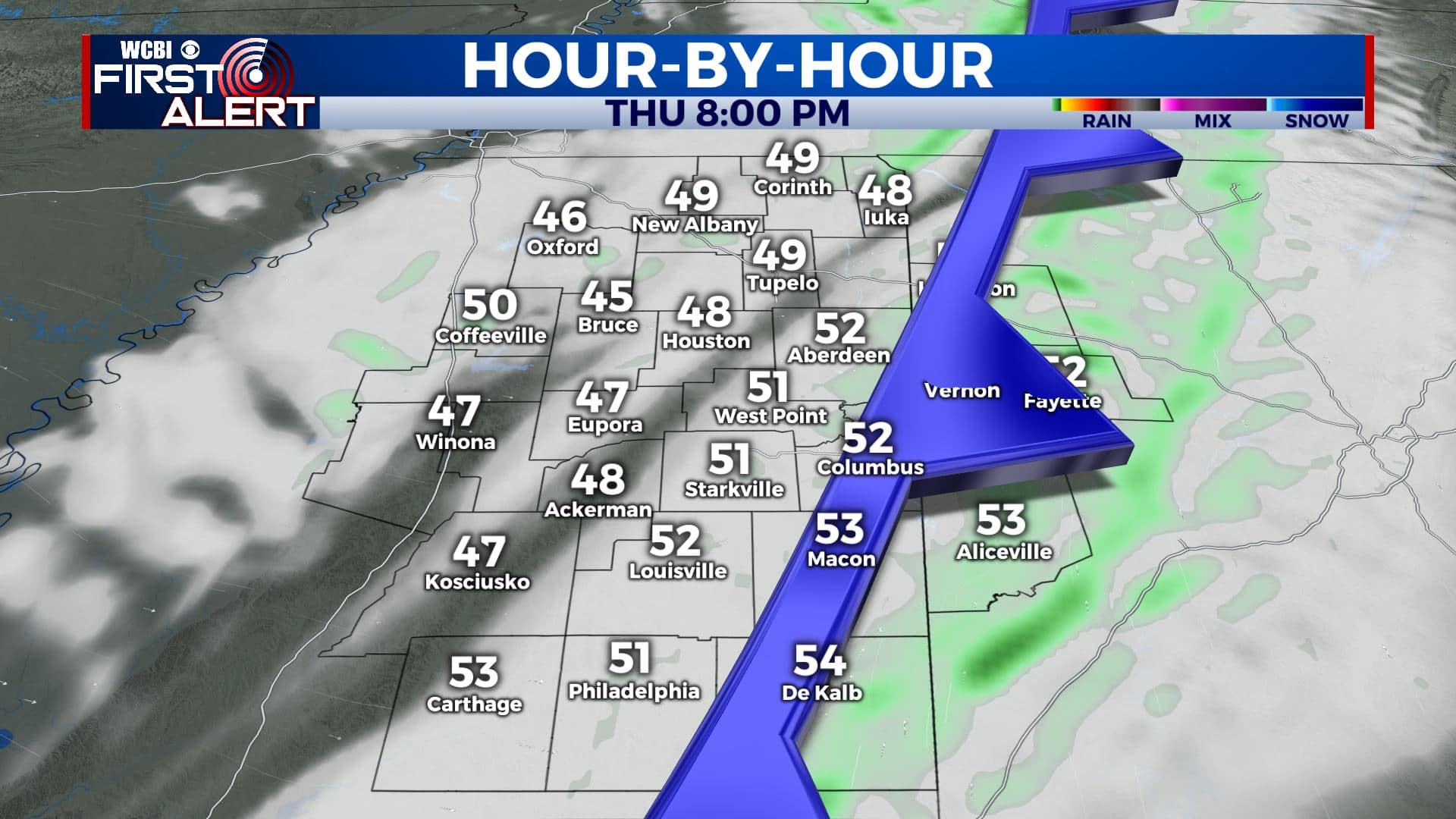
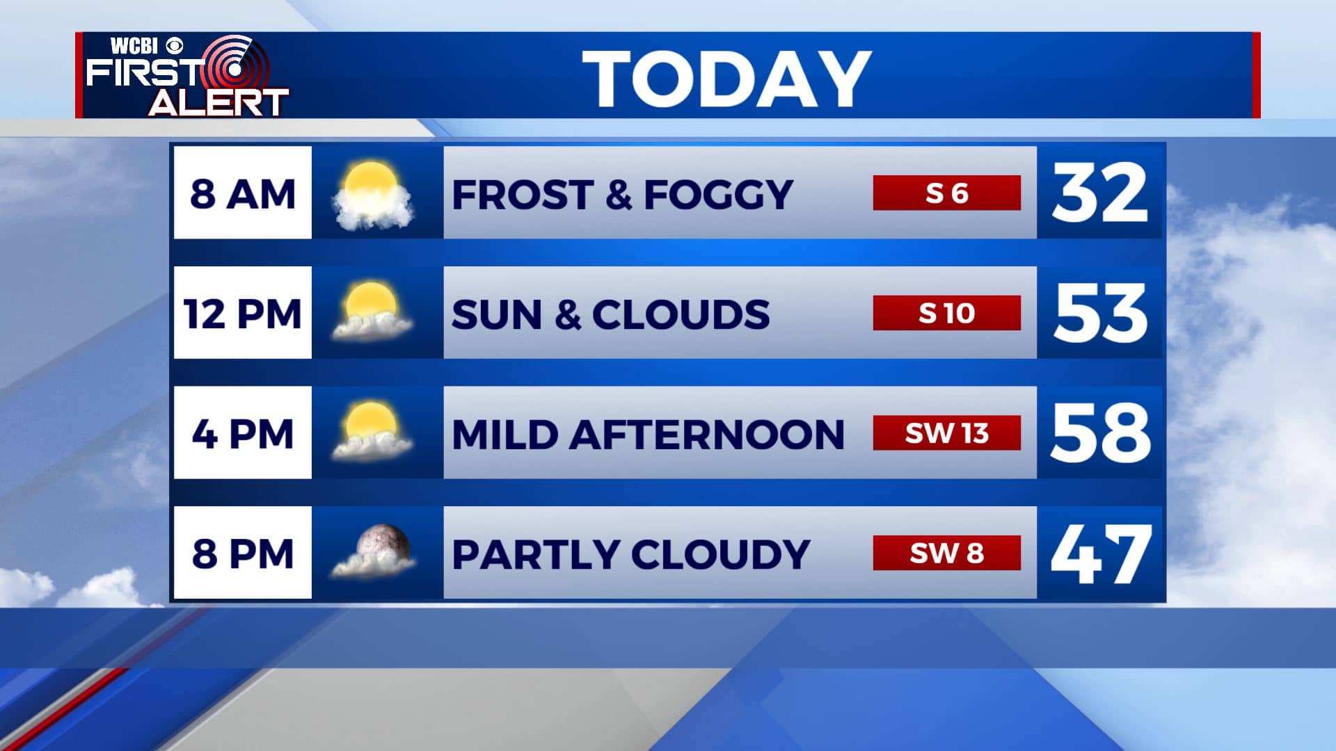
THURSDAY: After a cold start this morning, a milder day is ahead as a SW wind at 5-15 mph will allow highs to climb into the upper 50s to 60 degrees. We’ll have a mix of sun & clouds throughout the day before our next cold front pushes through this evening.
THURSDAY NIGHT: Partly cloudy skies overnight behind our cold front. Lows in the lower to mid 30s. Winds WNW 5-10 mph.
FRIDAY: A mix of sun & clouds. Much cooler with highs near 50. It will be a windy day with westerly winds 10-20 mph with gusts over 30 mph possible. Cold overnight lows in the upper 20s Friday night.
SATURDAY: Staying quiet with a mix of sun & clouds. Highs remaining cool and below average in the mid to upper 40s. Overnight lows around 30 Saturday night.
SUNDAY: Mostly cloudy with a slight chance of a shower or two. Highs in the upper 40s to around 50. Lows around 30 Sunday night.
MONDAY: Mostly sunny skies to start off the new workweek. Highs in the low 50s. Lows near freezing Monday night.
TUESDAY: Mostly cloudy. A few isolated showers are possible. Highs in the mid 50s. Milder 40s for lows Tuesday night.
WEDNESDAY: Areas of rain. Highs in the upper 50s.
Stay connected with @WCBIWEATHER on Facebook, Twitter, Instagram, and the WCBI News App


Leave a Reply