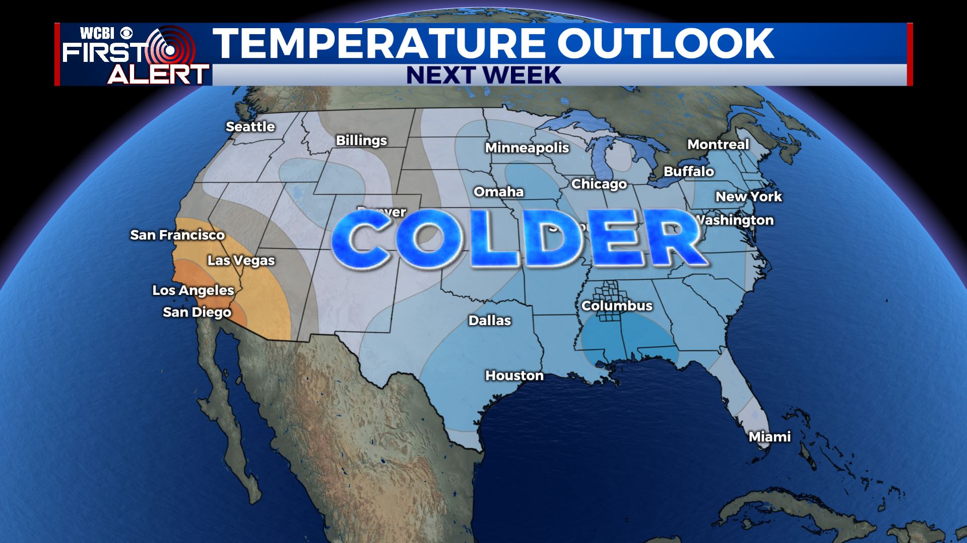
Mild & unsettled through Saturday
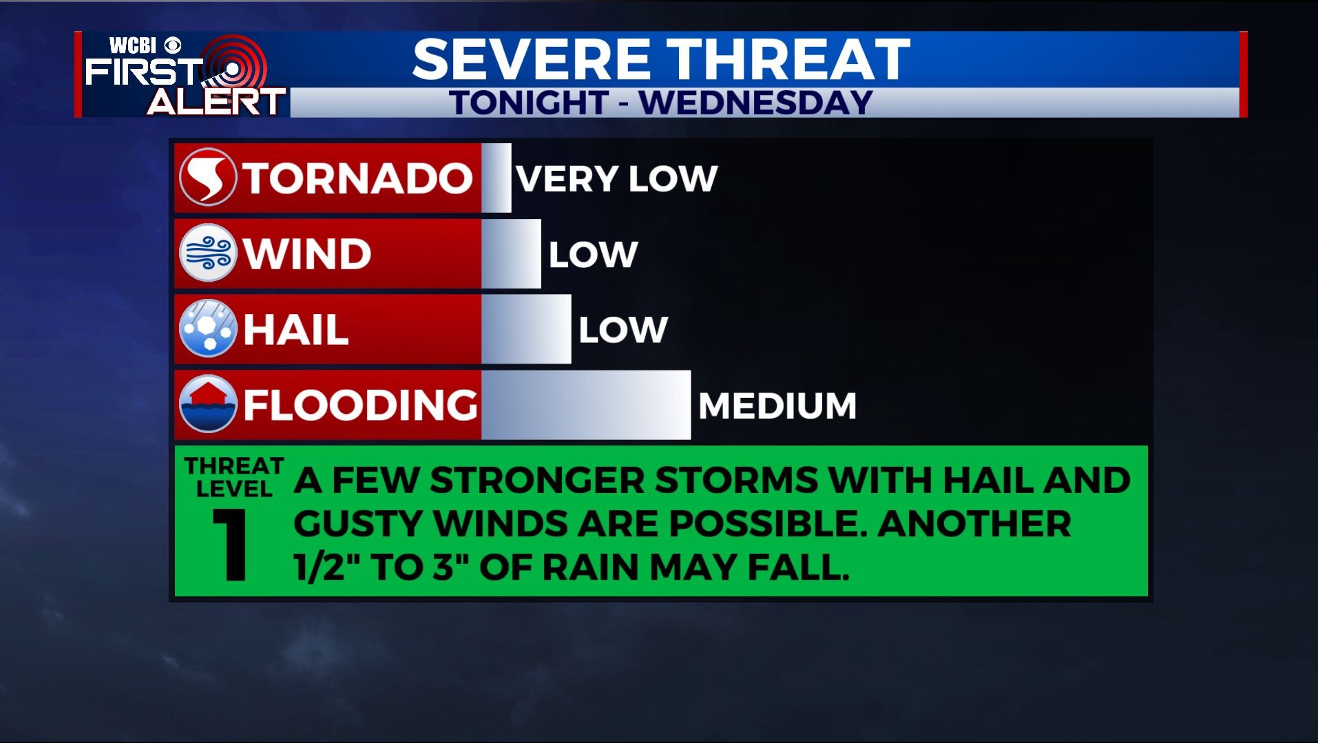
SUMMARY: Additional showers and storms are possible tonight through Wednesday. A few could be strong with isolated pockets of hail and gusty breezes. More flooding is possible with another 1/2” to over 3” of rain not out of the question. A strong cold front will move through Saturday and it will usher in a weather pattern change that will set up much cooler and drier air going into next week. We’ll keep watching the front for any potential signs of strong storm activity.
MONDAY NIGHT: Areas of rain and storms. A few could be strong with hail to the size of quarter and heavy rainfall. Temperatures will slowly warm from the 50s into the low 60s by sunrise. Winds 5-10 mph.
TUESDAY: Mostly cloudy with an 80% chance of showers and storms. A few could be strong with hail and gusty breezes. Pockets of heavy rain may lead to more flooding issues. Unseasonably mild with highs in the upper 60s to lower 70s.
TUESDAY NIGHT: Mostly cloudy with a few lingering showers and storms. Lows in the low 60s.
WEDNESDAY: Mostly cloudy. A 60% chance of showers and storms. Very mild for January with highs in the low to possibly mid 70s.
WEDNESDAY NIGHT: Turning cooler with lows in the 50s. Mostly cloudy skies continue.
THURSDAY: Partly to mostly cloudy. A 20% chance of showers. Cooler highs in the low 60s as NE winds develop.
THURSDAY NIGHT: Variably cloudy and cool. Lows in the mid to upper 40s.
FRIDAY: Variably cloudy with just an isolated shower or two possible. Highs in the low to mid 60s. Lows in the 50s Friday night.
SATURDAY: Areas of showers and perhaps a few storms. We’ll keep watching the system for any signs of strong storm activity. Highs look to be in the 60s.
SATURDAY NIGHT: Clearing skies and much colder lows in the mid to low 30s.
SUNDAY: Mostly sunny and much cooler. Highs in the upper 40s to around 50.
Follow @WCBIWEATHER on Facebook, Twitter, Instagram, and the WCBI News app


Leave a Reply