Mix ends Tuesday evening, Sunny Wednesday
SUMMARY: A mix of rain, sleet, and wet snow will end during the evening. Ground temperatures remain too warm for any significant issues but we’ll have to watch out for some slick spots on bridges tonight, especially those that are less traveled. Sunny skies return Wednesday.
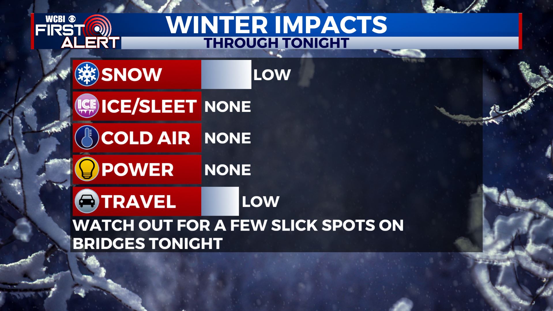
TUESDAY NIGHT: Evening rain and snow will taper off by midnight. Look for clearing late tonight with overnight lows ranging from the upper 20s to lower 30s. Northerly winds 5-15 mph will continue.
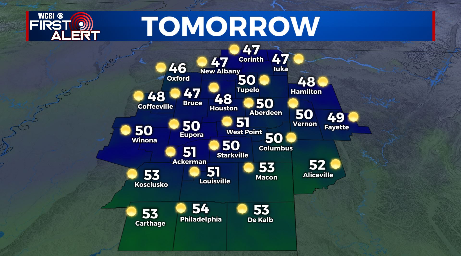
WEDNESDAY: Bright sunshine and seasonable highs near 50. Lighter winds from the NNE between 5 and 15 mph.
WEDNESDAY NIGHT: Mainly clear and quiet. Still chilly with lows near 30.
THURSDAY: Overall partly cloudy with an increase in cloud cover during the afternoon. Highs top out in the 50s. Mostly cloudy with milder 40s Thursday night.
FRIDAY: Mostly cloudy with a 30% chance of showers. Highs stay in the 50s. Lows in the 40s Friday night.
WEEKEND: Pretty nice in general but there will be some additional cloud cover on Sunday. Highs both days should be around 60. Lows mainly in the 40s.
MONDAY: Our next storm system is set to push through the region bringing chances of showers and thunderstorms. Highs in the 60s.
Follow @wcbiweather on Facebook, Twitter, Instagram, and the WCBI News app


Leave a Reply