More Rain By Mid-Week
TODAY/TUESDAY: Upper level ridging and surface high pressure across the deep south to kick off the work week means dry conditions and relatively quiet weather. Scattered clouds today, then mostly sunny tomorrow. High temperatures in the upper 50s and low 60s. Relatively quiet nights, with lows in the mid to upper 30s.
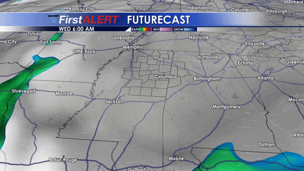
WED/THU/FRI: A deep trough across the southern plains deepens into an upper level low by Thursday morning as it approaches the deep south. At the surface, a deepening surface low will track northeast across the mid-south. This surface low will be occluding as it rides north, meaning it will be cut off from the warmest air source to the southeast. Showers begin with this setup for us during the second half of Wednesday, and continue through the night, into Thursday and Thursday night, and into Friday morning. Some thunderstorms will also be possible Thursday. High temperatures in the mid to upper 50s Wednesday and Thursday, with some colder air moving in by Friday behind the low with highs in the upper 40s. Lows in the upper 40s Wednesday night, upper 30s Thursday night, and low 30s Friday night.
SAT/SUN: Models are in decent agreement on upper level ridging and surface high pressure winning out over the weekend, so we’ll keep partly cloudy to mostly sunny skies and mild weather in the forecast with highs in the 50s, with lows above freezing Saturday night.


Leave a Reply