More Rain On The Way
TONIGHT: Increasing clouds with lows in the upper 20s to lower 30s.
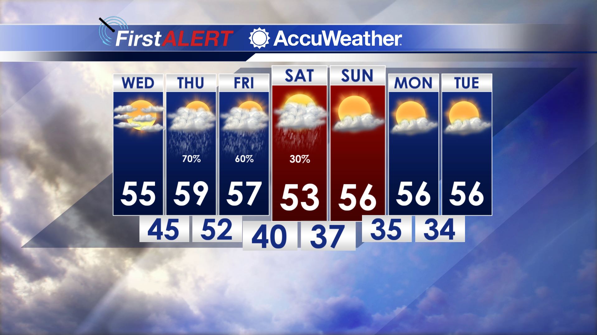
WEDNESDAY: We’ll have more clouds than sun but no rain will occur. Southerly winds should boost highs back into the middle 50s.
WEDNESDAY NIGHT: Temperatures fall only into the 40s as clouds continue to thicken around the area.
THURSDAY: Look for mainly cloudy and breezy conditions with developing rain showers during the afternoon and evening. We’re keeping the chance of rain at 70%. Highs are going to be in the upper 50s to around 60. Southeasterly breezes rise into the 10 to 20 mph range.
FRIDAY: Showers linger around the region with the chance of rain at 50-60%. Highs top out in the 50s.
FRIDAY NIGHT: Additional showers are possible with lows around 40. It’s worth noting that a cold pocket of air aloft will be moving through the region and this kind of situation sometimes can produce snow showers. Recent data suggest that the lower atmosphere will remain too warm for that to happen this time but we’ll continue to watch it.
SATURDAY: Rain chances lower to 30% but that means showers are still possible. Highs stay in the 50s.
SUNDAY-TUESDAY: High pressure builds back into the region and that is going to mean brighter skies and seasonable temperatures.
Follow @WCBIWEATHER on Facebook, Twitter, Instagram, and Snapchat


Leave a Reply