More rain on the way for Tuesday
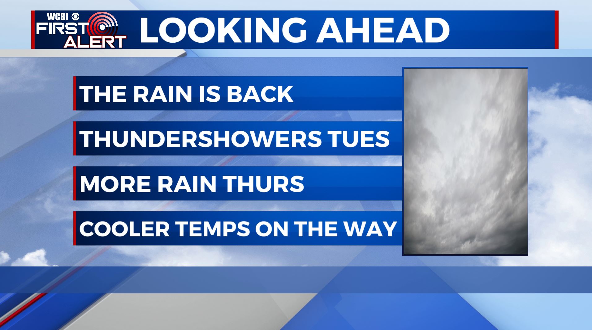
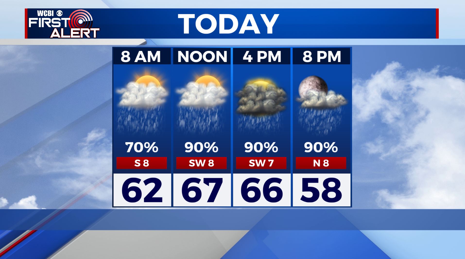
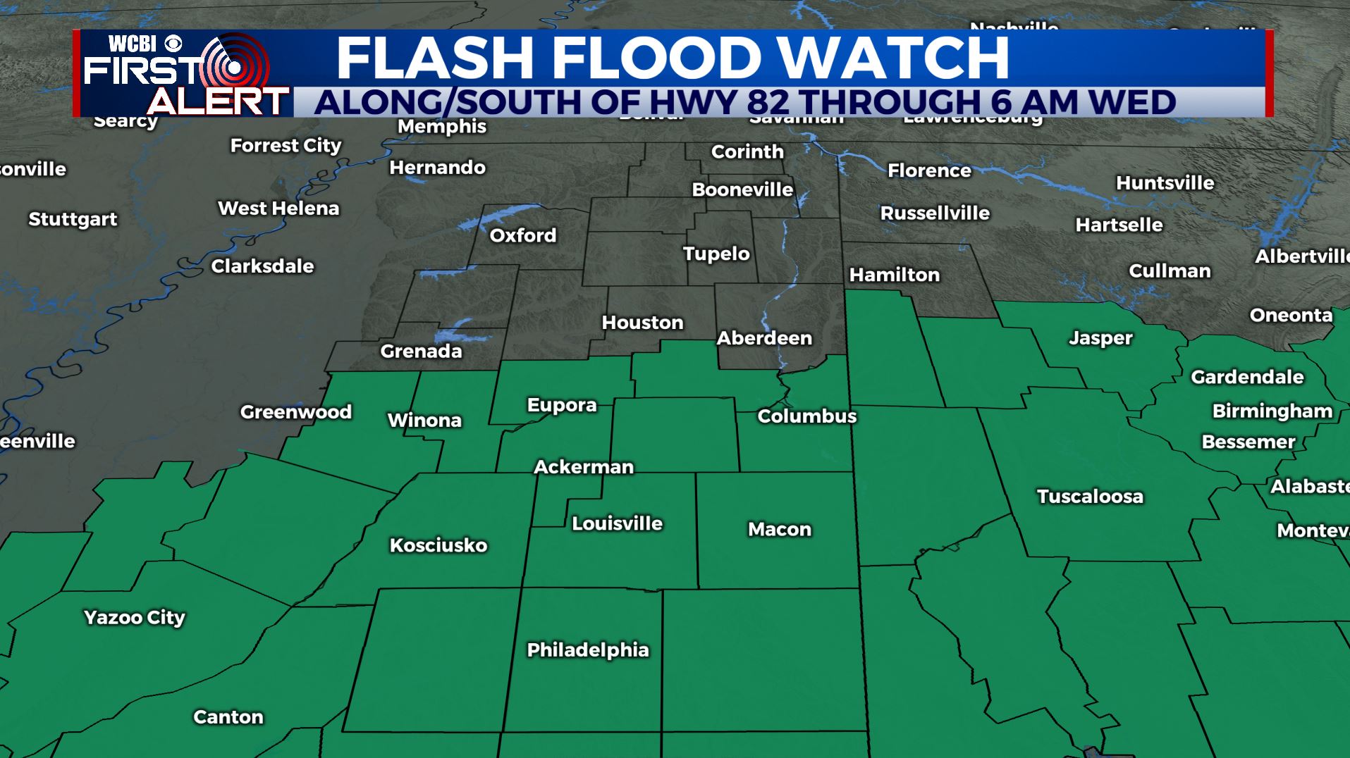
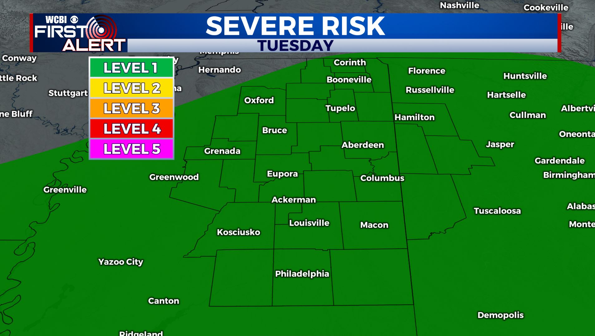
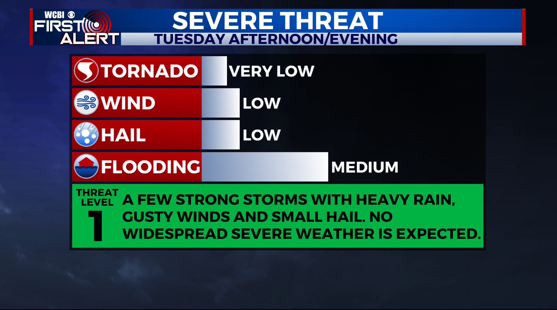
TUESDAY: More rain & thunderstorms are on the way for Tuesday. Temperatures climb into the upper 60s. Morning fog will give way to a cloudy sky with widespread rain. A Flash Flood Watch is in effect until 6:00am Wednesday for areas along and south of Highway 82. No widespread severe weather is expected and river levels shouldn’t be affected as they continue to stay low. We’re under a Level 1 as a few strong storms are possible this afternoon with gusty winds and some small hail.
WEDNESDAY: There may be some lingering showers Wednesday morning south of US-82, but the day overall trends drier but cloudy weather. Highs cooler in the mid 50s. On Wednesday evening more rain moves in, becoming widespread Wednesday night. Lows in the upper 30s.
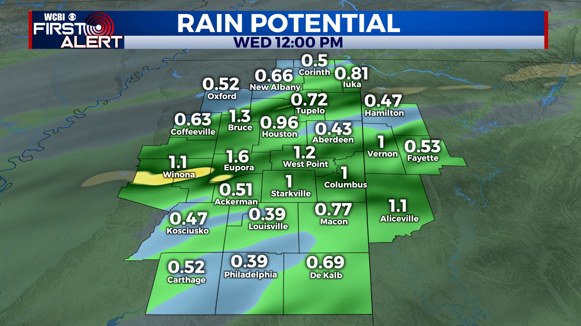
THURSDAY: Another round of widespread rain showers continue into Thursday. By the time the rain ends late Thursday night, the median is to see between 0.5″ and 1″ of rain in total for the week. Look for highs in the upper 40s. Lows at night are in the 30s.
FRIDAY – SATURDAY: Things trend dry with sunshine Friday and Saturday. Look for more sunshine than not, with highs in the 50s and lows in the 20s and 30s.
SUNDAY – MONDAY: A third system winds up and heads this way. Uncertainty remains in how things play out but this will bring more unnecessary rain somewhere into the region. We’ll mark highs in the 50s into the 60s and lows in the 40s with a mostly cloudy sky, and at the minimum scattered showers. We’ll watch closely and keep you updated.
Follow @WCBIWEATHER on Facebook, Twitter, Instagram, and the WCBINEWS app


Leave a Reply