Morning Showers Monday, Isolated Rain Chances Continue
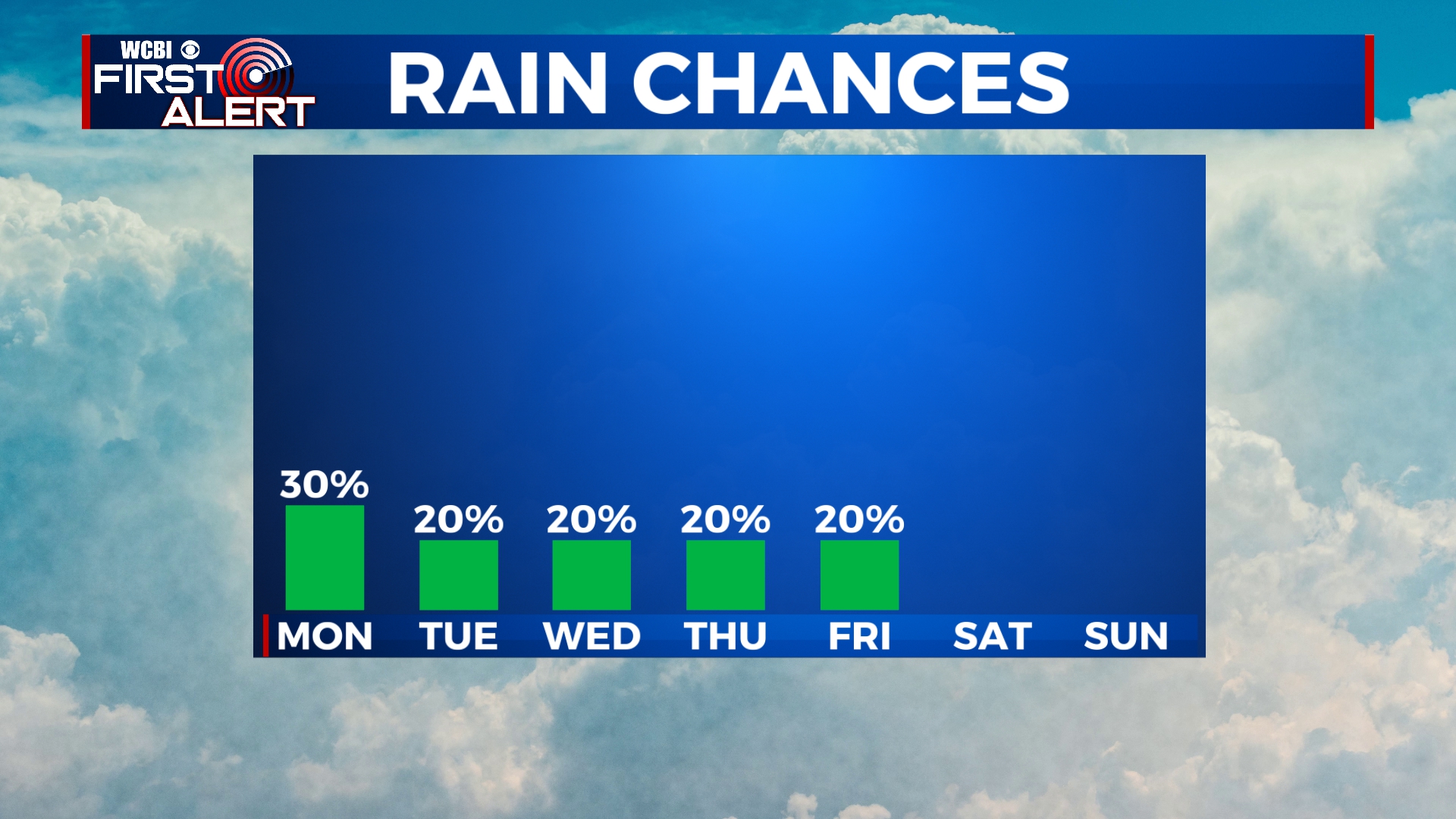
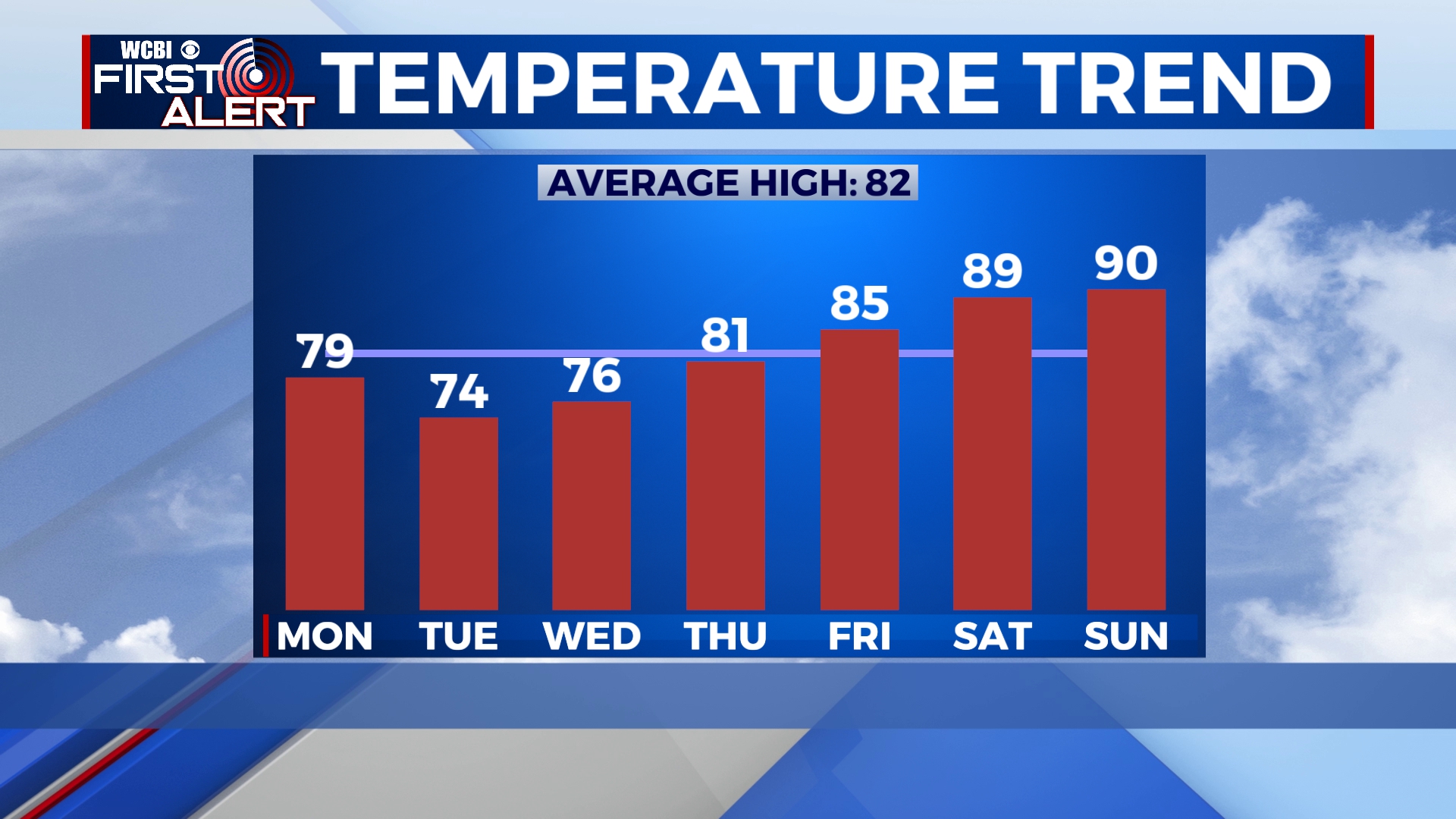
Chances for hit-or-miss showers will continue for the next several days with temperatures below average for the first half of the week. We’ll quickly warm back into the 80s by the end of the week and into the weekend.
SUNDAY NIGHT: The chance for showers and maybe a rumble of thunder will continue overnight as a low pressure system continues to exit to our east. We’ll remain mostly cloudy with lows in the mid 60s. Winds will be out of the southeast at 5 to 10 mph.
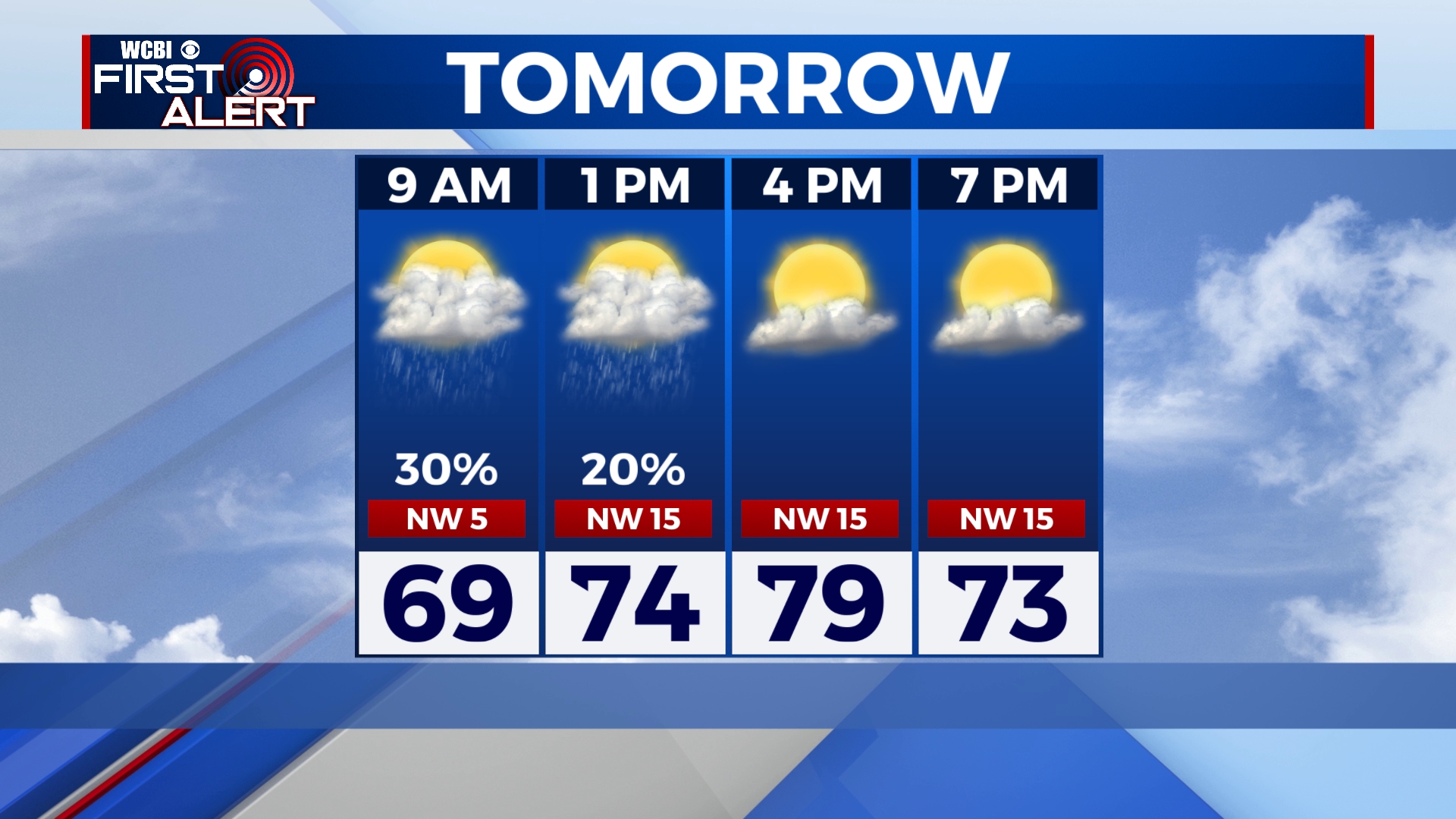
MONDAY: A cold front will pass through the area in the early morning hours, switching our winds to the northwest and keeping us a little cooler. Some showers are possible before lunchtime, especially in West Alabama. Afternoon highs will be in the upper 70s. The day will begin mostly cloudy but we’ll see some sunshine into the afternoon and evening.
TUESDAY-WEDNESDAY: Cooler than average temperatures will continue for the middle of the week with highs in the mid 70s and morning lows in the mid 50s. We’ll see a mix of sunshine and clouds with the chance for a stray shower or two.
THURSDAY-SUNDAY: Temperatures will rapidly warm up through the end of the week and weekend. Highs will be near 80 on Thursday before warming into the mid and upper 80s for Friday and Saturday. High temperatures will likely hit 90 on Sunday with morning lows in the 60s. Clouds will continue with some off-and-on peeks of sunshine and the chance for a few showers, especially on Friday.


Leave a Reply