Much cooler & sunny weather returns Thursday
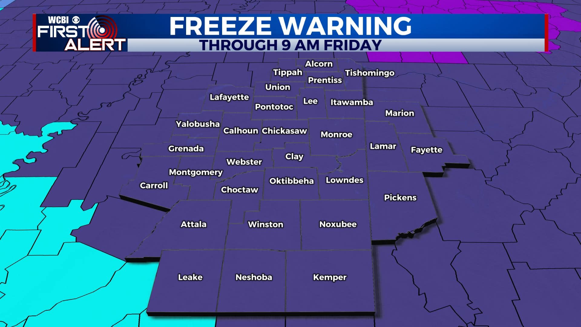
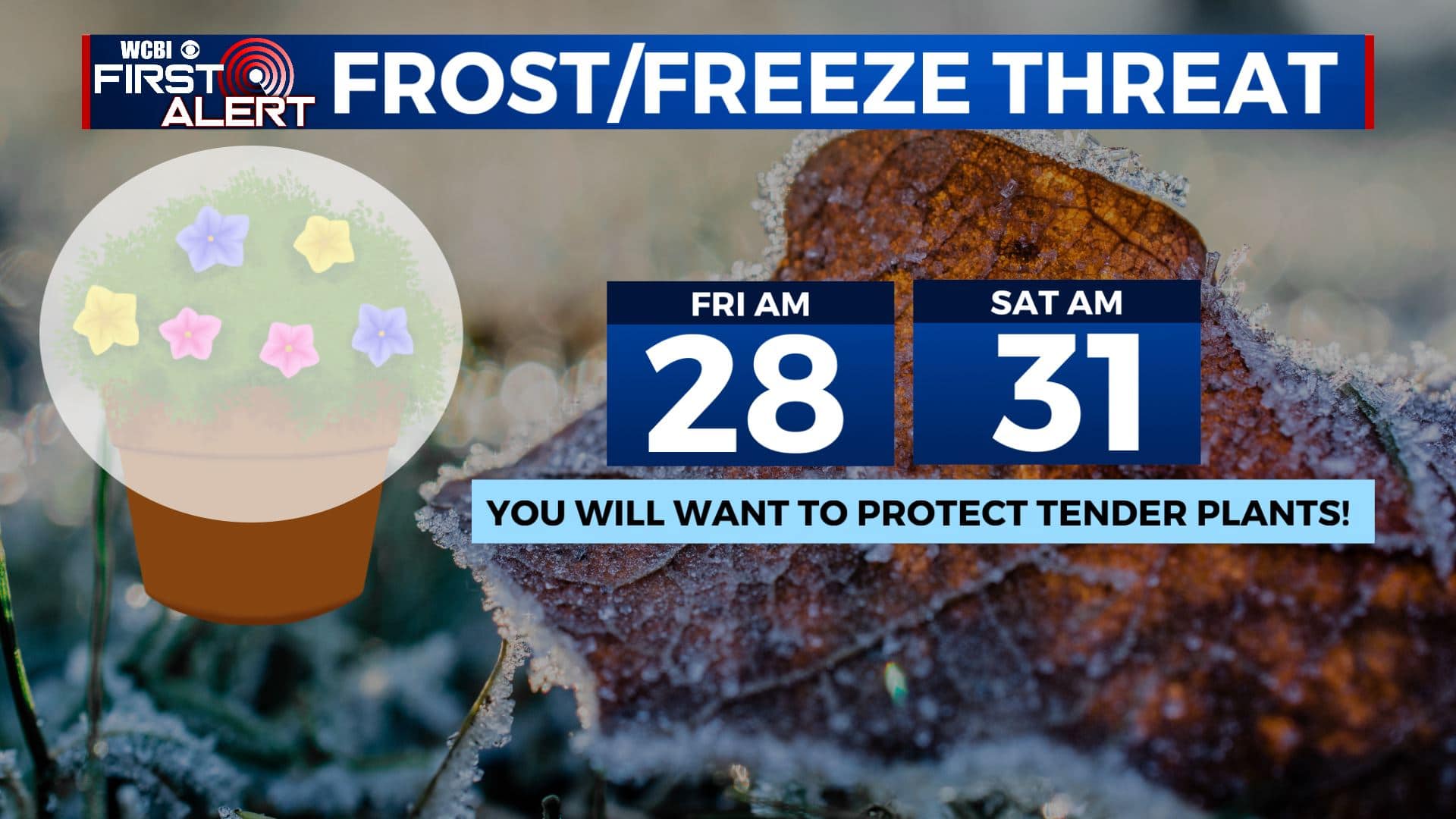
SUMMARY: We are finally going to take a much needed break from rain, storm chances and severe weather over the next week as the sunshine and quiet weather returns to the region. A frost/freeze threat will continue for the next few mornings as much cooler, drier air invades the Deep South. A Freeze Warning is in effect through 9 am Friday. Frost and freeze conditions will kill crops and other sensitive vegetation. Bring them inside or cover them up if need be. Nice spring weather is on tap for the upcoming Easter weekend.
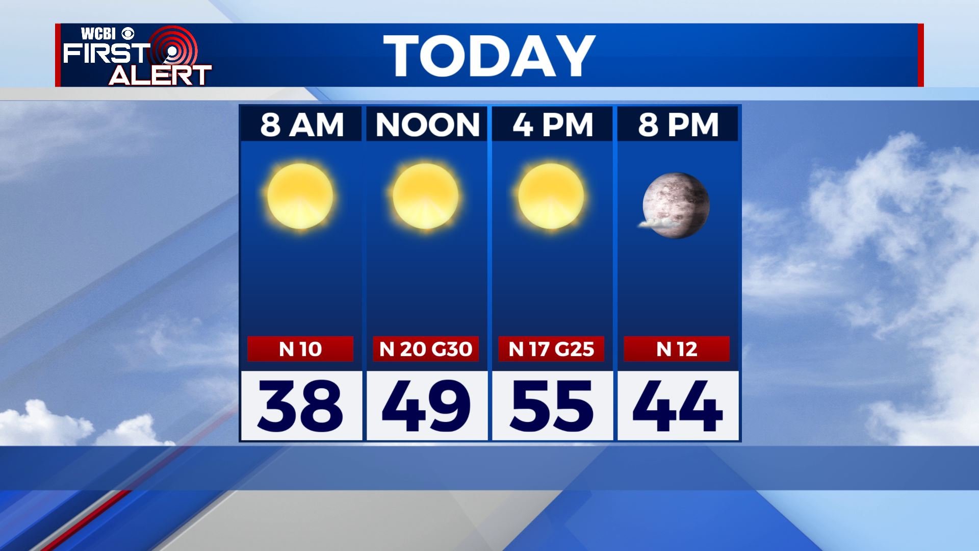
THURSDAY: A bit cooler but an overall beautiful day with lots of sunshine. High temperatures in the mid to upper 50s. Breezy NW winds 10-25 mph, gusting up to 30-35 mph at times.
THURSDAY NIGHT: Clear skies and cold. Overnight lows in the upper 20s. A widespread hard freeze is possible so you will want to protect any tender vegetation.
FRIDAY: Sunny skies once again. Highs in the upper 50s. NE winds 5-10 mph.
FRIDAY NIGHT: Clear and chilly. Lows in the lower 30s. Areas of frost are possible again.
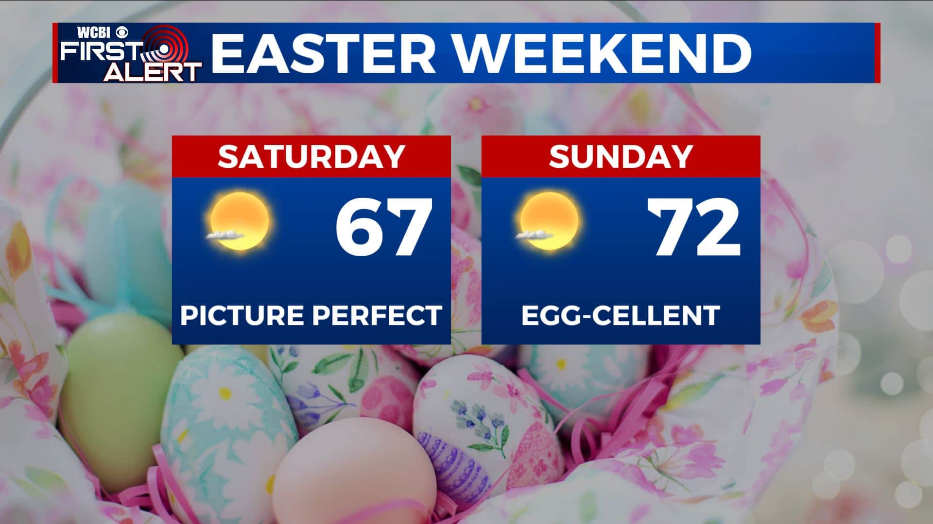
SATURDAY: Mostly sunny skies for most of the day. Highs near the mid 60s.
SATURDAY NIGHT: Mainly clear. Lows in the upper 30s to around 40.
EASTER SUNDAY: Sunshine sticks around and a bit warmer with highs in the lower to mid 70s.
EARLY NEXT WEEK: We’ll stay in our quiet weather pattern with sunshine and a few clouds. Temperatures will continue to warm up to the mid 70s to near 80 degrees.
Stay connected with @WCBIWEATHER on Facebook, Twitter, Instagram, and the WCBI News App.


Leave a Reply