Next Cold Friday Friday
SUMMARY: A few showers & t-showers are possible Thursday but better rain and storm chances exist Friday afternoon & night with another 1/4” to over 1” possible. Much cooler air slides in for the weekend with highs in the 60s and lows in the 40s. Additional rain chances are possible going into early next week.
WEDNESDAY NIGHT: Partly cloudy and quiet. Lows in the 60s.
THURSDAY: A mix of sun and clouds with spotty showers or storms possible during the day. The chance of rain is 20%. Above normal highs in the mid to upper 80s can be expected. Winds SSE 5-15 mph. Conditions should be OK for any of those high school football games slated for the evening.
THURSDAY NIGHT: Variably cloudy and mild. Lows in the 60s.
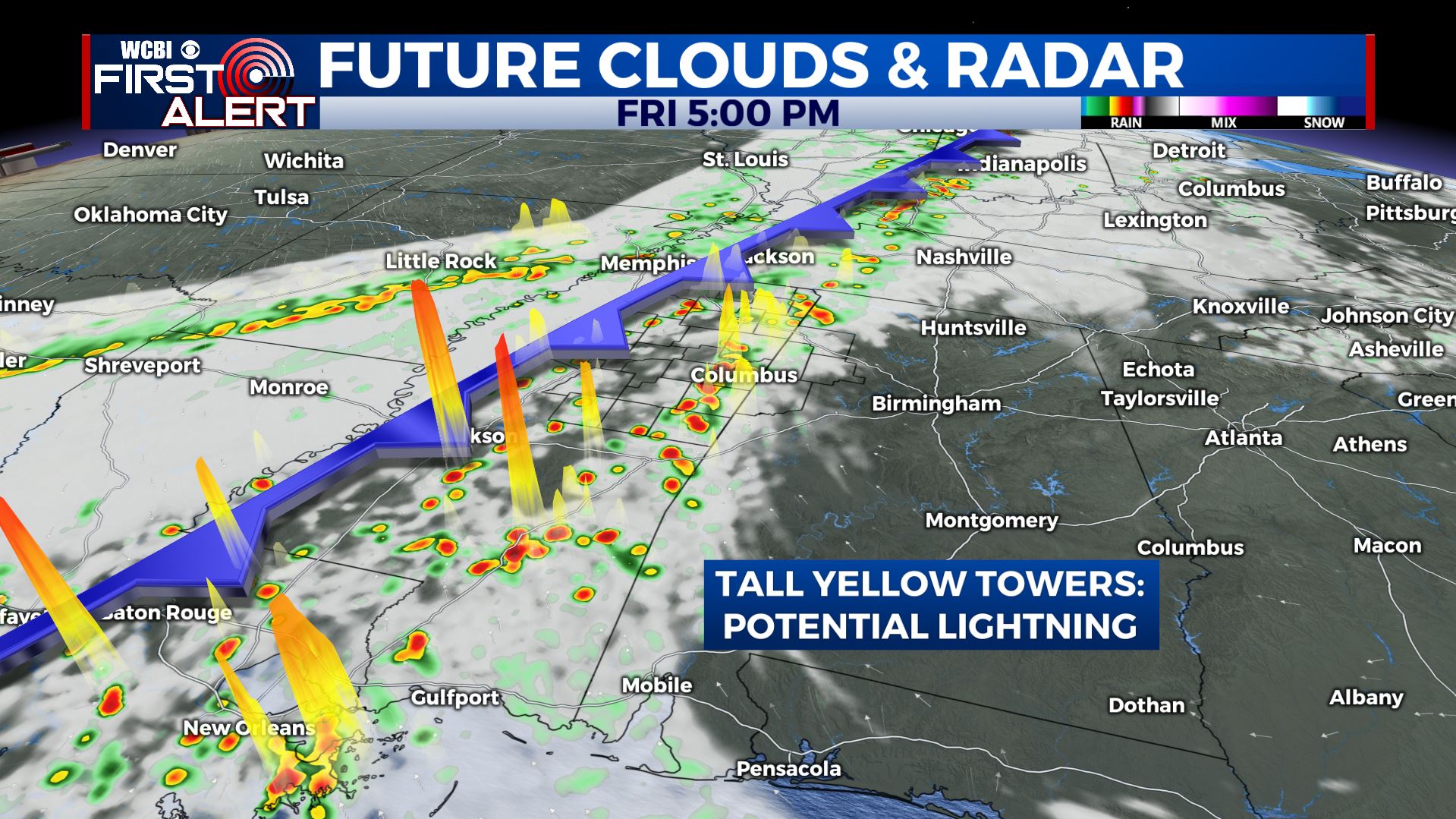
Friday Afternoon Futurecast
FRIDAY: A fall cold front is going to push across the region. Out ahead of it temperatures will rise back into the 80s with moist southerly breezes developing. A line of showers and storms will cross the area from west to east during the afternoon and evening. Some gusty storms with lightning are possible but widespread severe weather appears unlikely at this time.
FRIDAY NIGHT: Mostly cloudy with showers continuing. Lows in the low 50s and upper 40s.
SATURDAY: Much cooler 60s may be the best we can do in the wake of the cold front. Some lingering showers may exist during the morning hours before the sun returns. Lows Saturday night may drop to around 40 and that means some of those cooler spots may dip into the upper 30s.
SUNDAY-TUESDAY: Data continue to suggest that additional showers and perhaps a few storms may develop. Temperatures should moderate back closer to seasonal norms by Monday and Tuesday.
Stay connected with @WCBIWEATHER on Facebook, Twitter, and Instagram


Leave a Reply