Nice Friday & Saturday; Storms return Sunday
SUMMARY: Drier and less humid air is settling back in for Friday and Saturday. Showers and storm chances return starting Sunday and they’ll continue through at least midweek. Several rounds of heavy rain and strong to severe storms are possible at times.
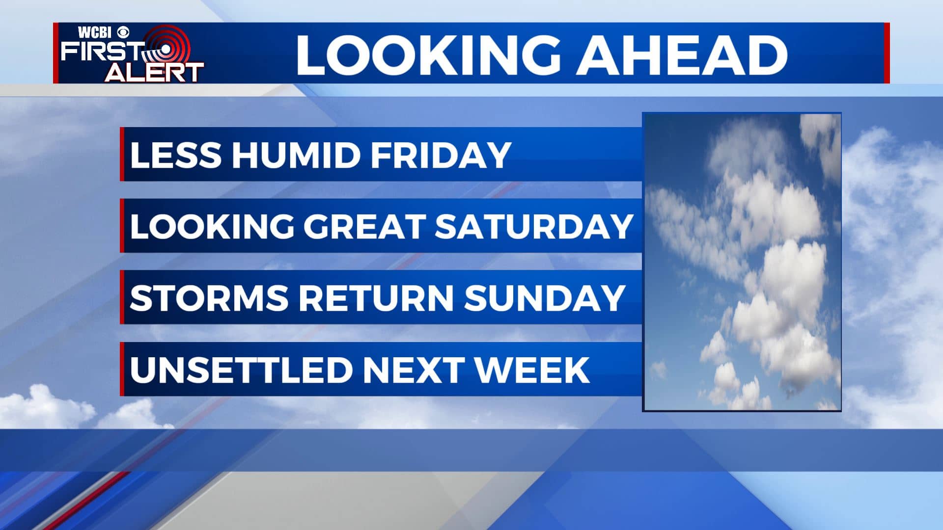
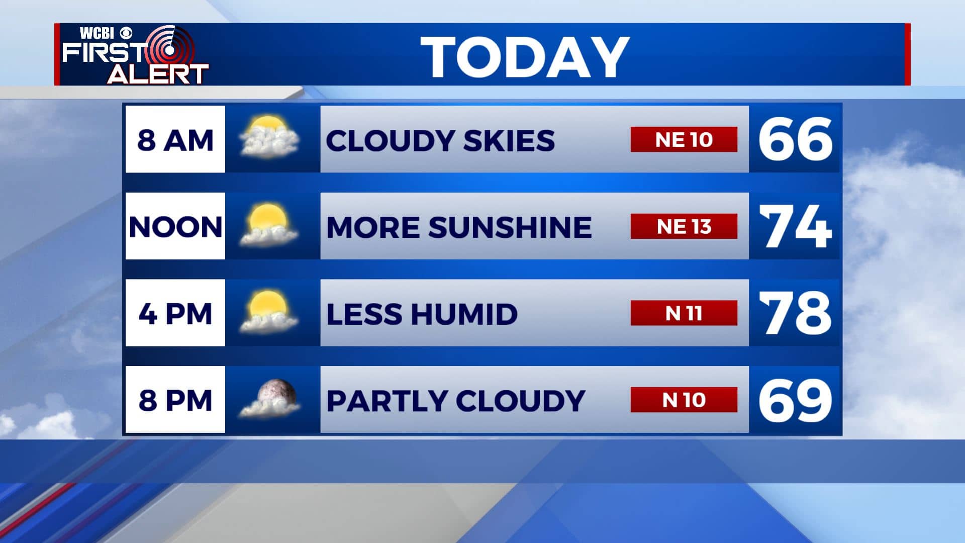
FRIDAY: Morning clouds will give way to more sunshine developing during the afternoon. Lower humidity levels. Highs in the mid 70s. Winds NE 5-15 mph.
FRIDAY NIGHT: Mostly clear skies and cooler. Overnight lows in the lower 50s.
SATURDAY: Mostly sunny skies and pleasant. Get outside and enjoy it! Highs near 80 degrees. NE/SE winds 5-10 mph.
SATURDAY NIGHT: A few clouds. Milder overnight lows near 60 degrees.
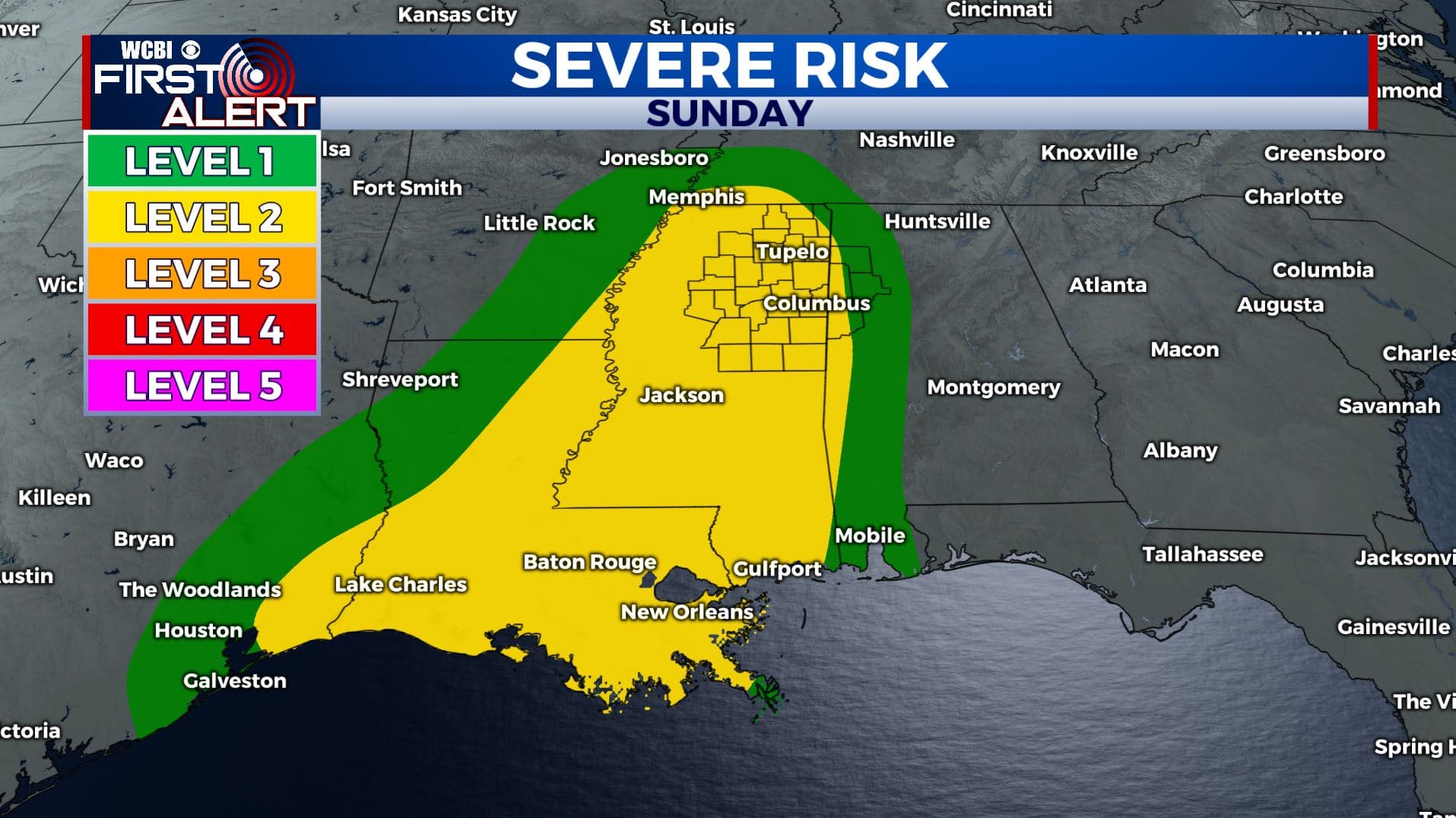
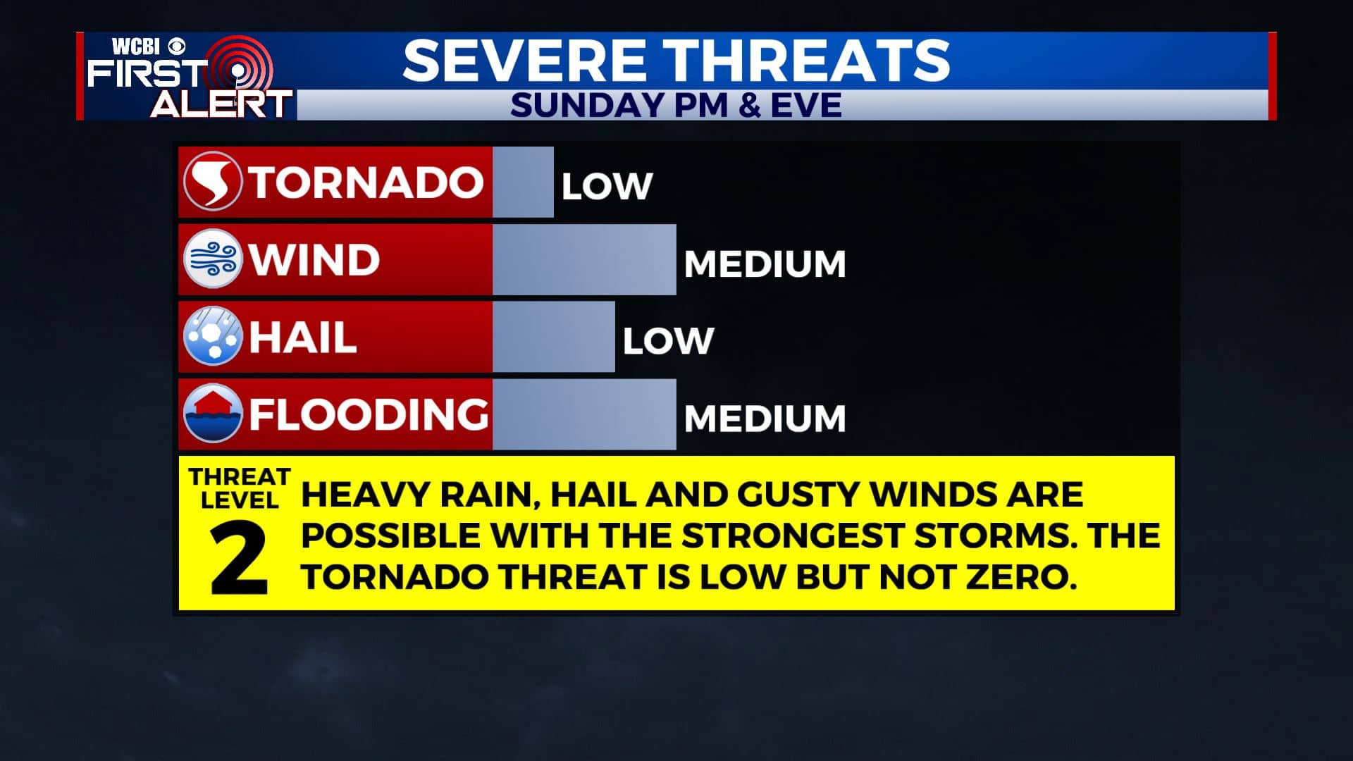
SUNDAY: Increasing clouds with afternoon and evening showers & storms likely. Some could be on the strong to severe side so something we’ll be watching & keeping you updated on. Highs in the low 80s with much higher humidity.
MONDAY: A unsettled weather pattern continues as we head into a new workweek. Mostly cloudy with some showers possible. Highs in the low 80s.
TUESDAY: Rain and storms chances. Highs in the 80s. Some storms could be on the strong side.
WEDNESDAY: Mostly cloudy. A few scattered showers or storms could linger. Highs in the upper 70s to around 80 degrees.
THURSDAY: A mix of sun & clouds with a few isolated showers. Highs in the mid to upper 70s.
Stay connected with @WCBIWEATHER on Facebook, Twitter, Instagram, and the WCBI News App.


Leave a Reply