A nice & pleasant day ahead for Wednesday
SUMMARY: Relatively dry and less humid air will lead to some pretty amazing early August weather for the second half of the workweek. Plan on comfortable summer nights and warm summer days. The summer heat and humidity will return for the upcoming weekend and that may lead to afternoon pop-up storm chances and head indices over 100°.
WEDNESDAY: A mix of sun and clouds. We can’t totally rule out a stray shower, but it will be a nice day overall. Highs top out in the mid to upper 80s with light NNW winds.
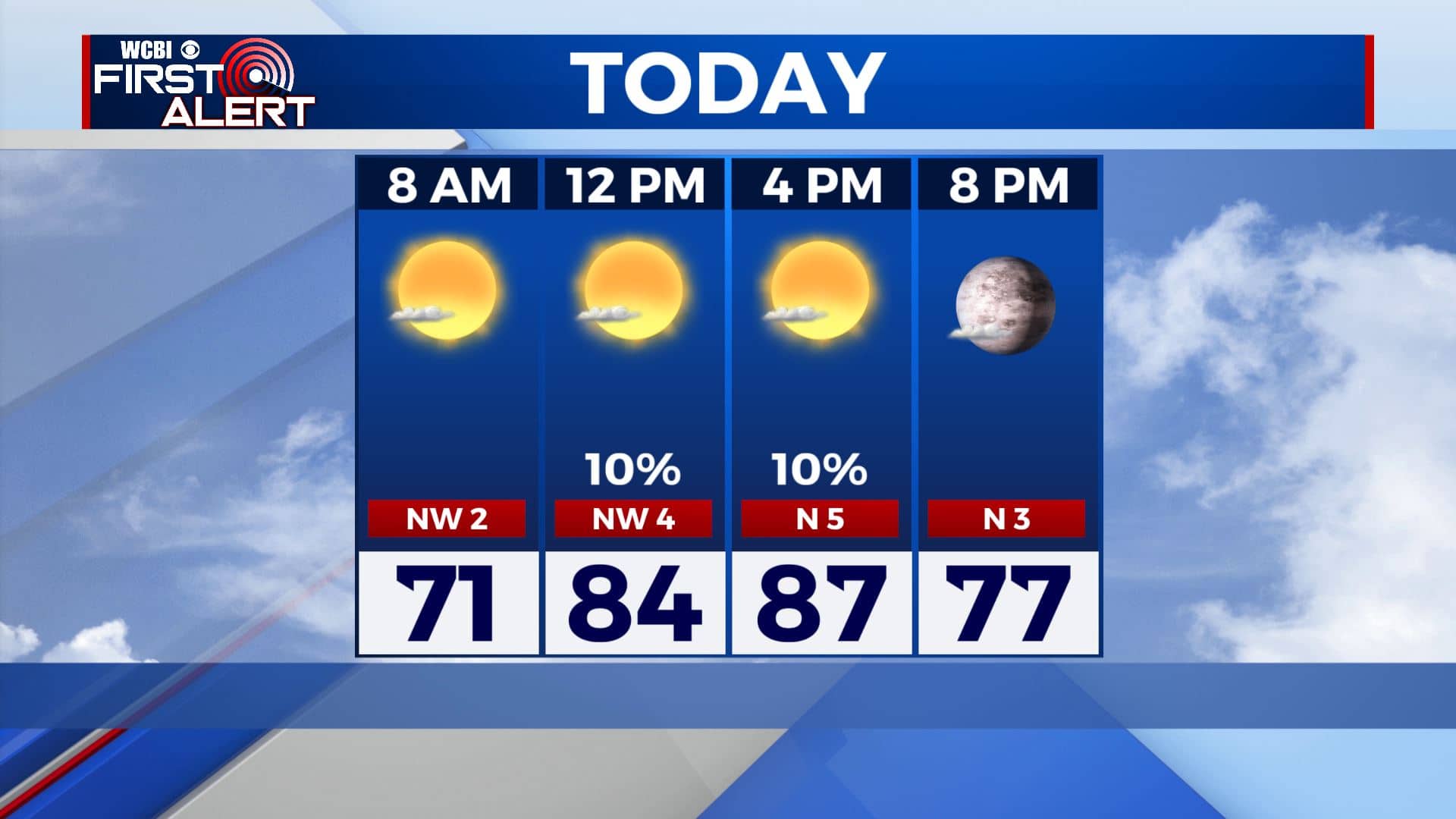
WEDNESDAY NIGHT: Mostly clear skies and quiet. Overnight lows in the mid 60s.
THURSDAY-FRIDAY: Mostly sunny skies and dry as we end the workweek. High temperatures will start warming back up into the upper 80s to lower 90s.
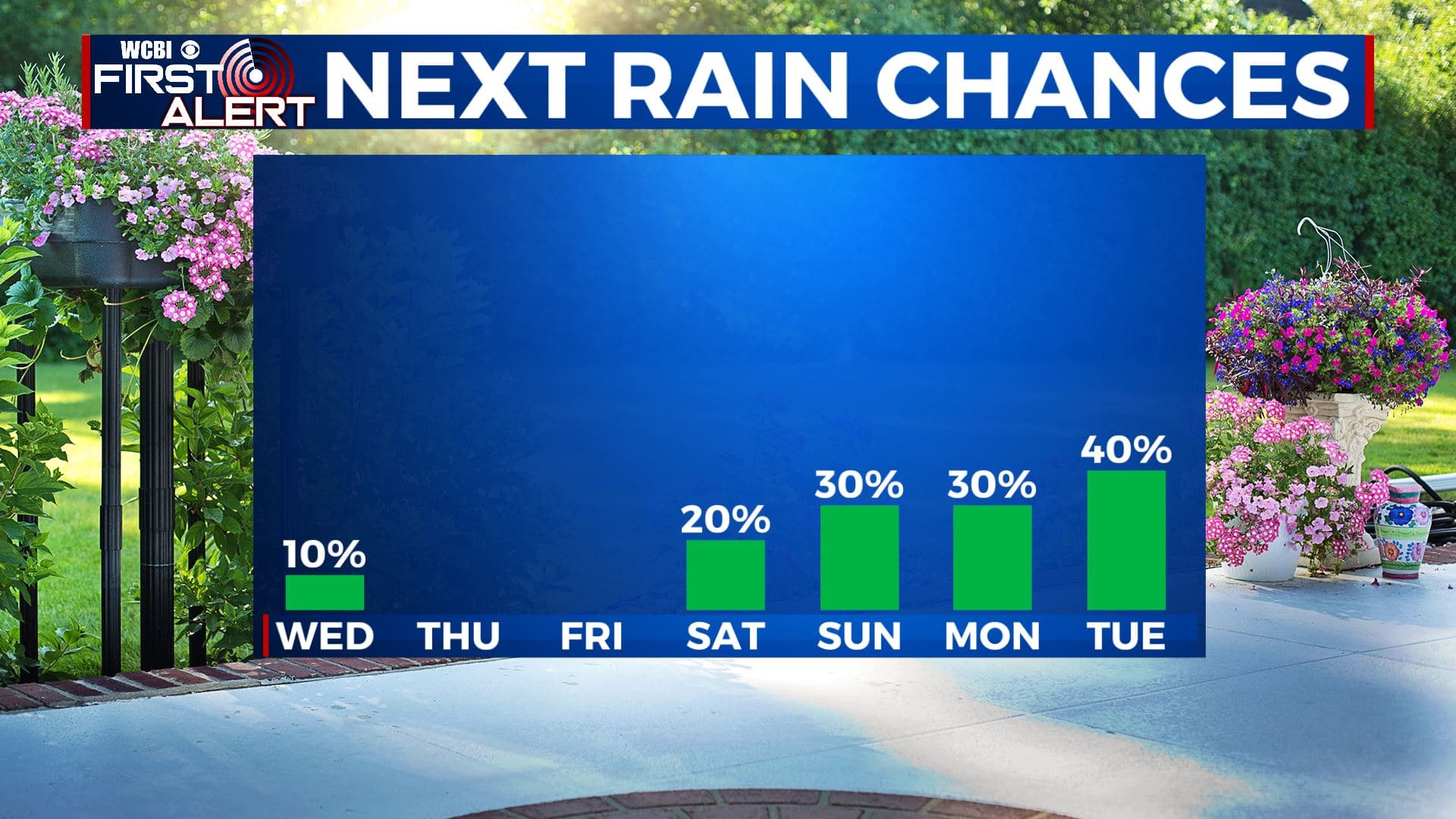
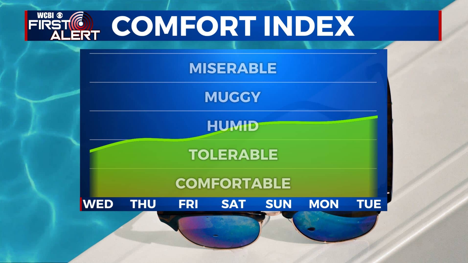
WEEKEND: A mix of sun and clouds, hot and humid. Temperatures will be hot & humid with highs in the mid 90s with heat indices over 100°. There’s also a chance of afternoon pop-up showers and storms due to the heating of the day. Muggy overnight lows in the 70s.
NEXT WEEK: We’ll be back to seasonably hot and humid conditions for early August. Highs in the 90s with daily rain and storm chances. Lows in the 70s.
Stay connected with @WCBIWEATHER on Facebook, Twitter, Instagram, and the WCBI News App


Leave a Reply