Nice Wednesday, Severe Threat Thursday
TUESDAY NIGHT: Mainly clear to partly cloudy with lows in the lower 50s. Winds become light.
WEDNESDAY: There will be more clouds than sun but overall it’s shaping up to be a nice day with highs in the upper 70s to around 80. Southerly winds continue in the 5 to 15 mph range. Lows only fall to around 60 Wednesday Night.
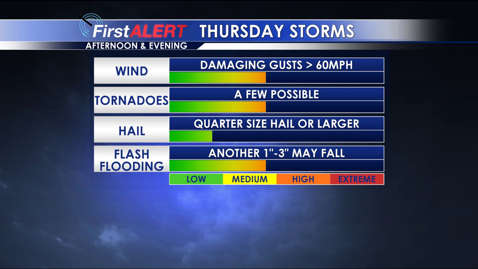
Thursday Severe Threats
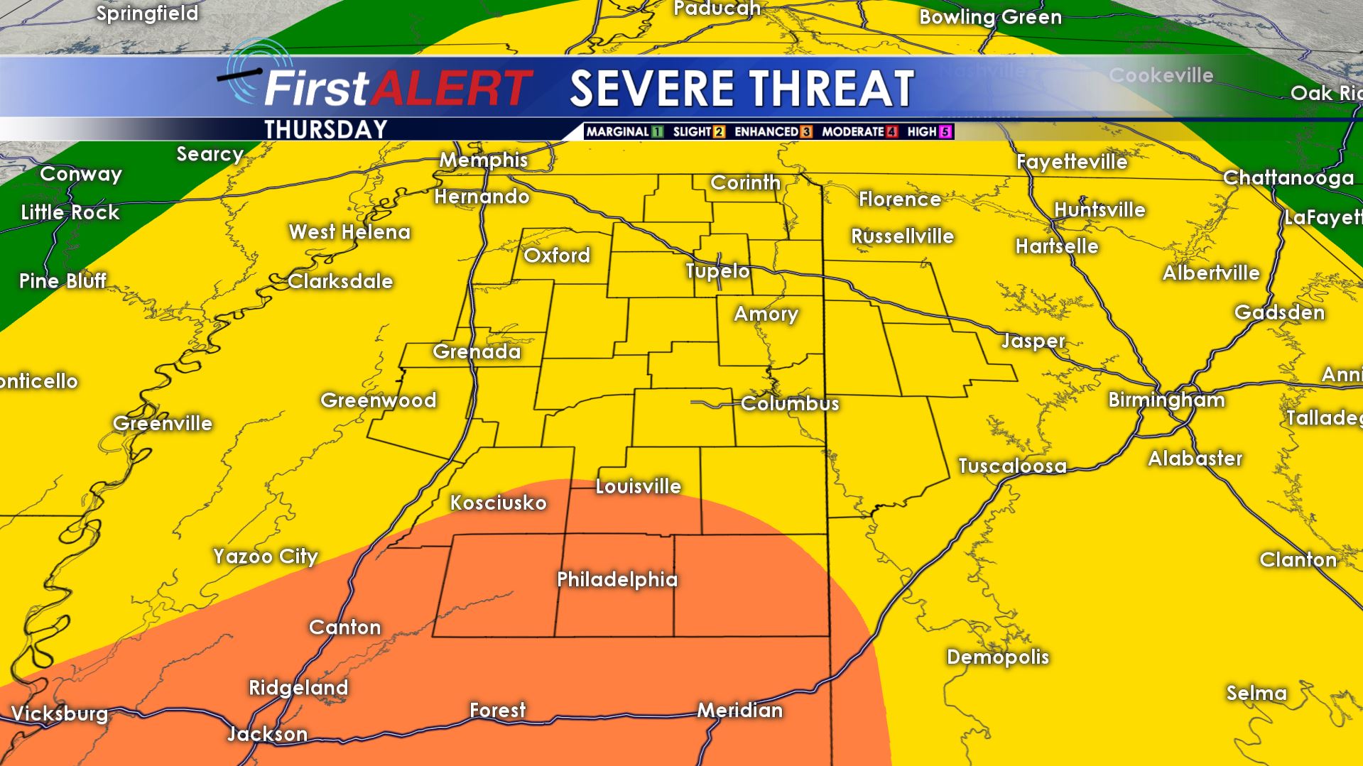
Thursday Severe Outlook
THURSDAY: A batch of storms may approach from the west in the morning but they are expected to run out of steam as the near our area. Additional storms are likely during the afternoon and evening. These have the potential to produce damaging wind gusts, hail, isolated tornadoes, and another 1-3″ of rain. You’ll need to stay weather alert all day long Thursday.
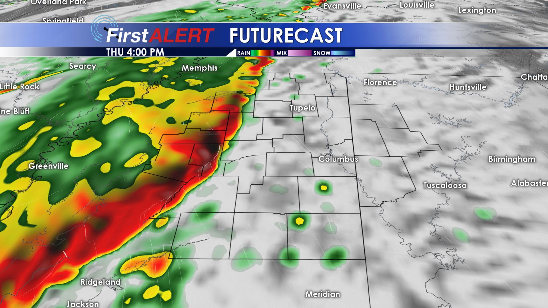
4 PM Thursday Futurecast
FRIDAY: A mostly cloudy and cool day is likely with a few passing showers. Highs may only top out in the upper 50s to around 60. Breezy northwesterly winds should develop as well.
EASTER WEEKEND: Lots of sun is on tap (hallelujah!) and that bodes well for all things out doors. Highs will be around 70 Saturday with near 80° temperatures Sunday. Cool overnight lows in the 40s can be expected.


Leave a Reply