Nice while it lasted
COLUMBUS, Mississippi (WCBI) – The dry days are over. Moisture will build and the rain chance increases. The team is keeping our eyes on Friday and the weekend.
TUESDAY NIGHT: A mostly clear sky with a few passing clouds is in store for our Tuesday night. Mild overnight lows will fall into the middle 60s.
WEDNESDAY: Moisture from both sides will increase cloud coverage Wednesday morning. As an upper level low rotates in the eastern Gulf, the chance for isolated showers look to increase Wednesday afternoon and into the evening. Nothing too crazy. High temperatures will hold into the upper 80s, lows drop into the upper 60s.
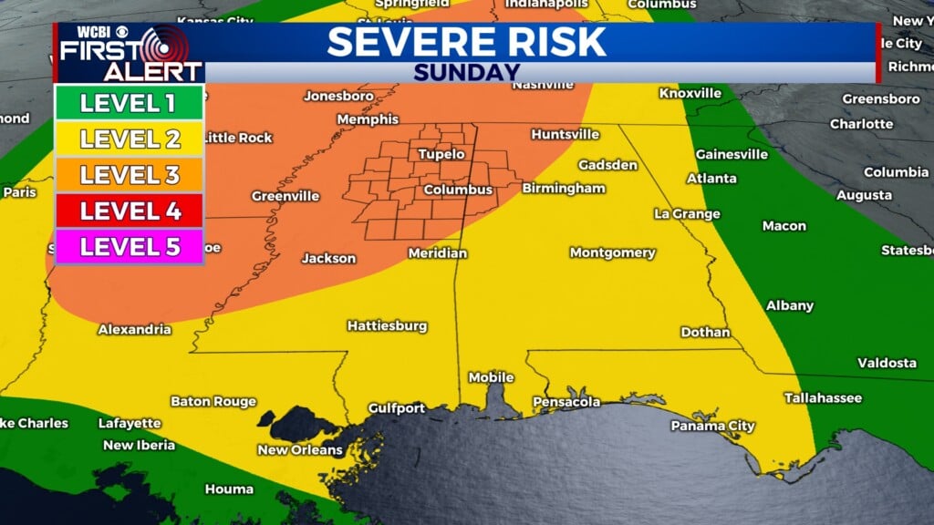
THU/FRI: High temperatures will stay high and lows will become slightly uncomfortable. Continuing an isolated chance for rain Thursday, as we stay sandwiched between a stalled front to our NW and that upper level low in the Gulf. Humidity will keep rising. Friday looks to be building up the chance for strong to severe storms in the evening, with slight movement from the front to our NW. The northern third of our coverage area is within a Level 2 – Slight Risk for severe weather. Damaging wind and hail are likely the main threats.


WEEKEND: Into the weekend, showers and storms will continue. There is some concern of severe weather Saturday and/or Sunday if timing lines up just right. The Level 2 – Slight Risk for severe weather continues across more of our coverage area on Saturday. Stay tuned as more details begin to align!