One more quiet day for Wednesday before active weather moves in
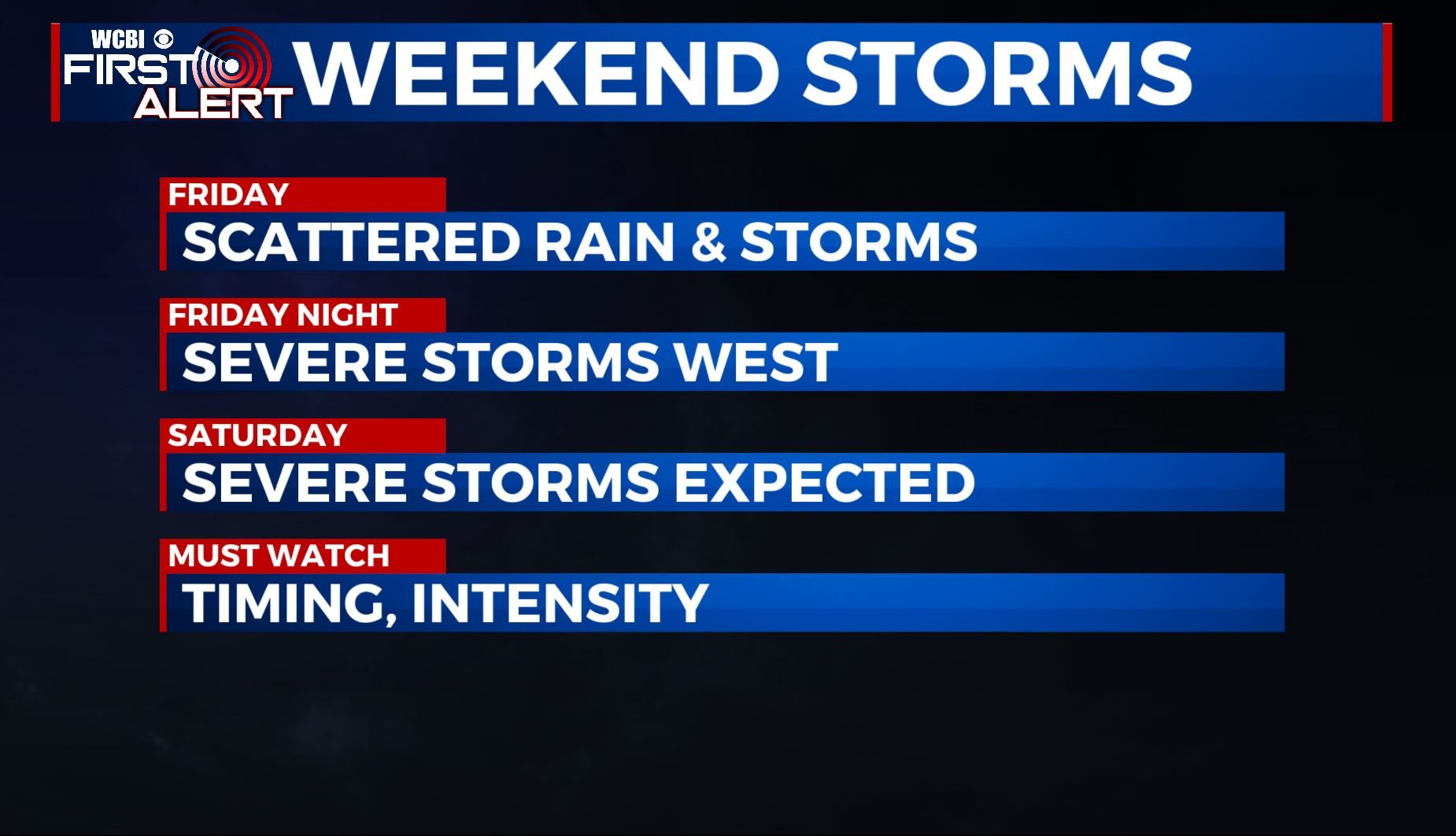
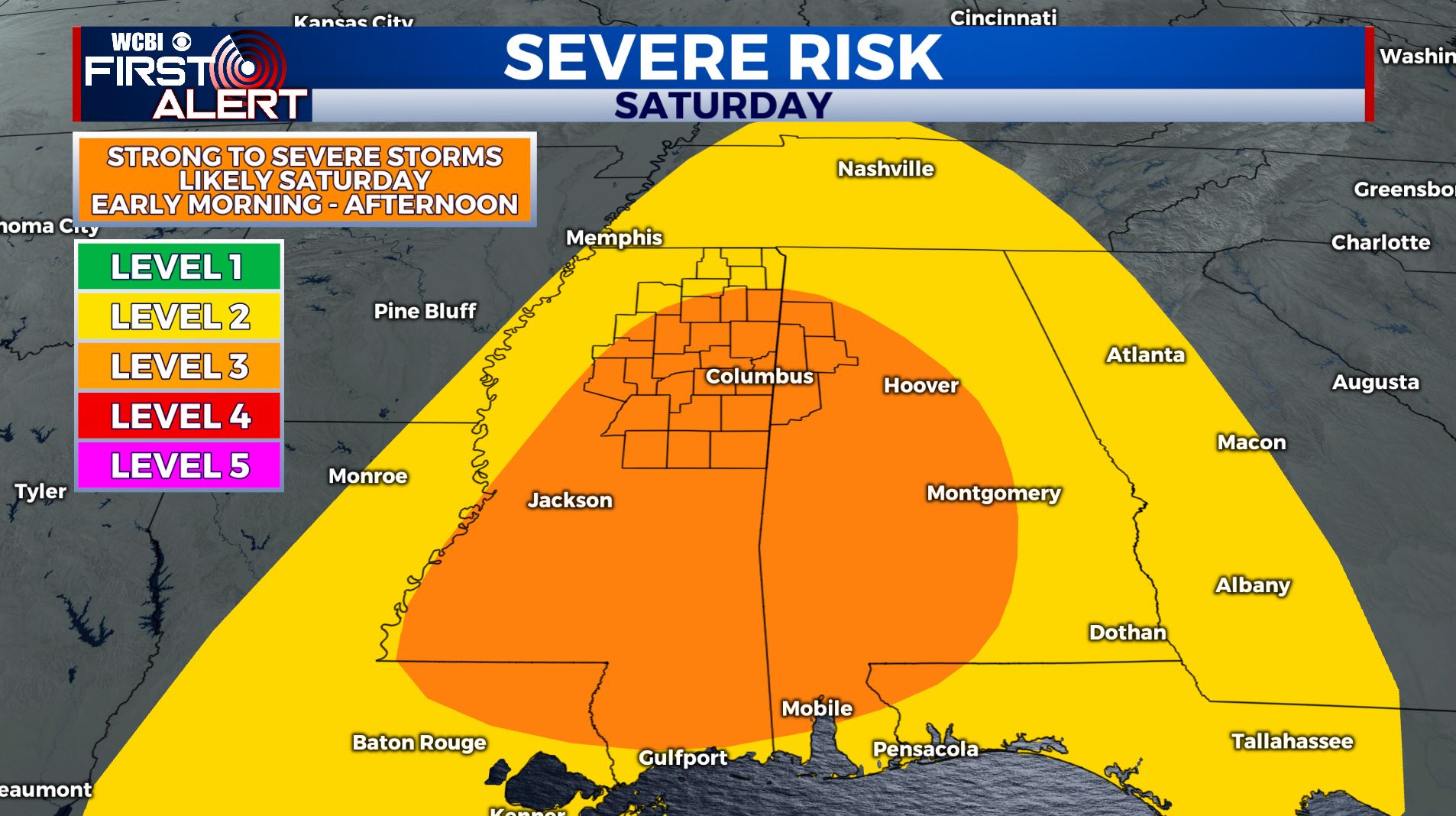
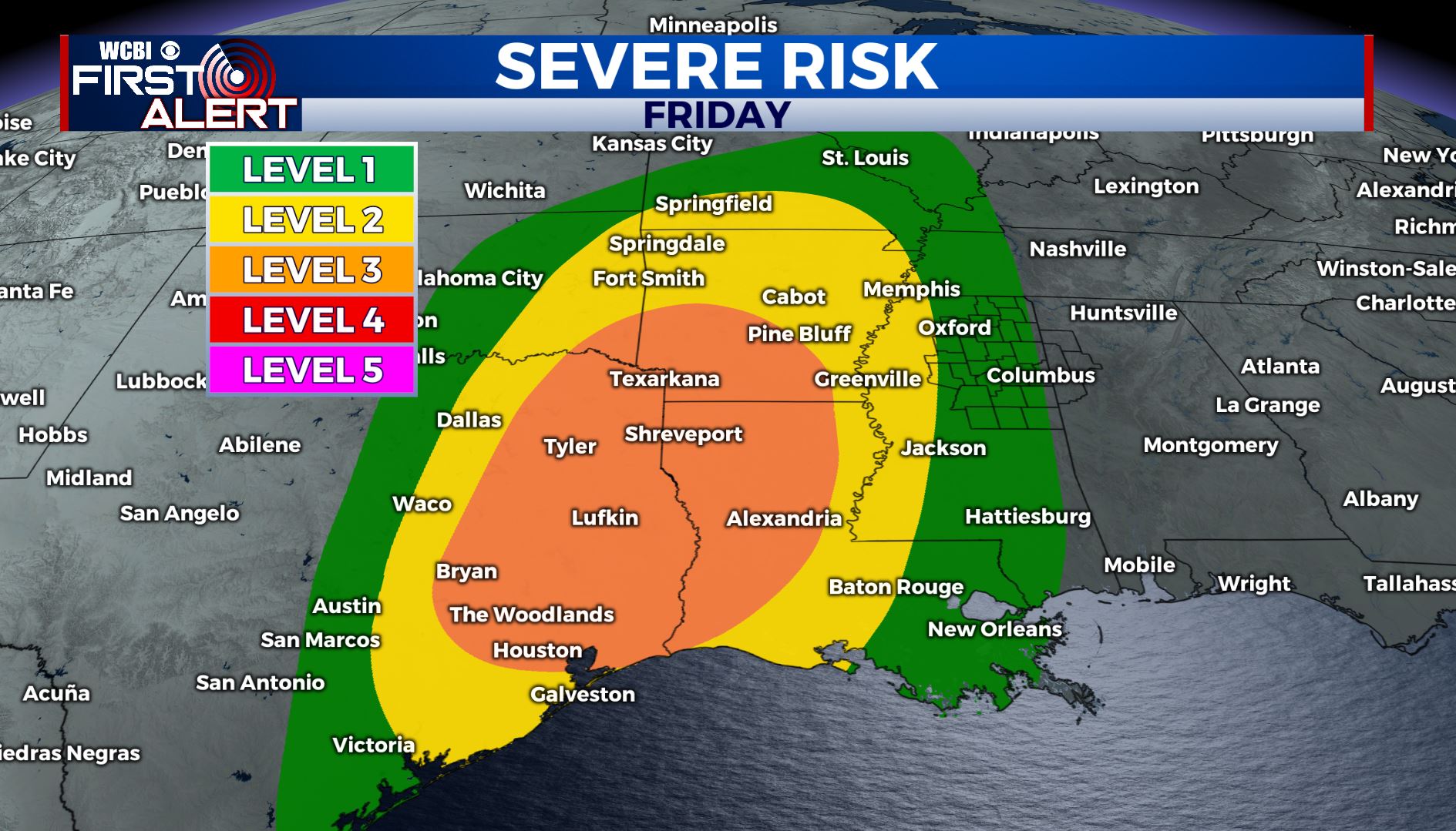
SUMMARY: We’ll have one more sunny day on Wednesday before clouds move back into the area on Thursday. We’re still tracking rain and thunderstorms for late Friday night into Saturday. Some of these storms will be strong to severe, with all modes of severe weather possible. Timing still remains a bit uncertain so stay tuned to WCBI as we’ll keep you updated as we near the event.
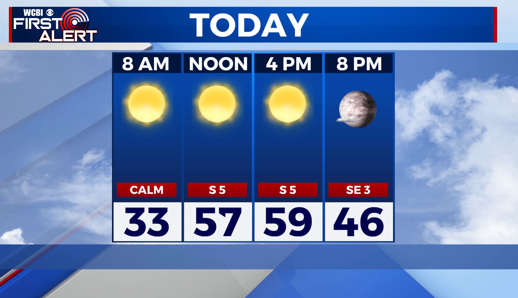
WEDNESDAY: Another quiet & sunny day with highs near 60 with a light S wind.
WEDNESDAY NIGHT: Mostly clear skies Wednesday night with lows in the upper 30s. Light SE wind.
THURSDAY: Clouds will increase on Thursday as our next storm system approaches. Highs will be in the lower 60s. Overnight lows in the 50s. A breezy SE wind picking up 10-15 mph.
FRIDAY-SATURDAY: Another strong storm system & cold front will approach the area from our west on Friday. Showers and thunderstorms could start as early as Friday afternoon. A few stronger storms can’t be ruled out, but odds are much better into the ArkLaTex region during the day into the night on Friday. The best chances for storms is looking more to be into early Saturday. As of right now, we’re in a Level 3 as a few of these storms could be strong to severe. Still too early on exact timing and specifics or impacts. Showers and thunderstorms will also have the potential to produce very heavy rain so flooding is once again looking to be a big concern. We’ll continue to monitor and revise the forecast as we near the event, but for now…plan accordingly. Highs will be near 70 on Friday then down to the upper 60s by Saturday.
SUNDAY: With our storm system having exited the area, we’ll see a mix of sun and clouds. Cooler temperatures with highs in the upper 50s to lower 60s.
MONDAY – TUESDAY: Another system looks to move into the area bringing more chances of showers and storms. Something else we’ll need to watch. Highs in the mid 60s.
STAY WITH @WCBIWEATHER ON FACEBOOK, INSTAGRAM, TWITTER AND ON THE WCBI MOBILE APP.


Leave a Reply