Patchy Frost Tonight, Sunny Next 2 Days
Tonight
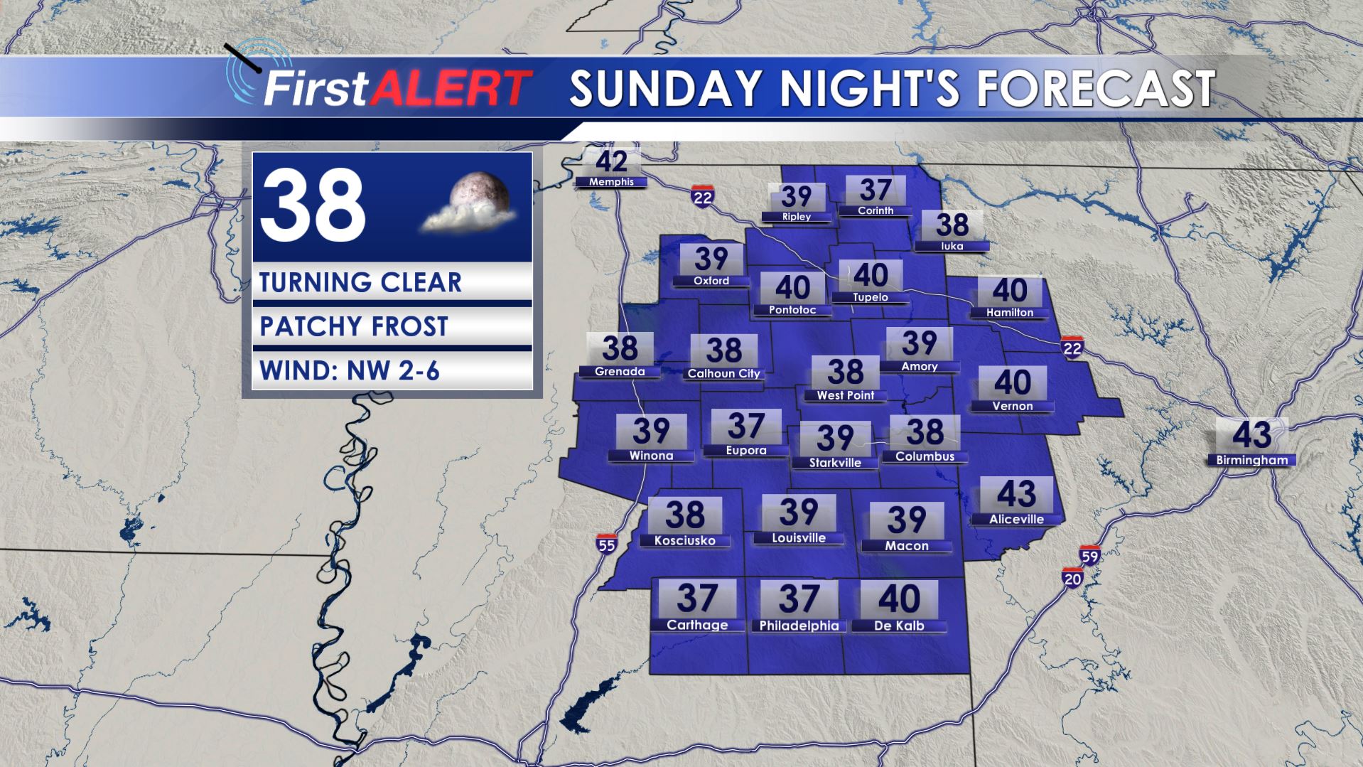
SUNDAY NIGHT: Look for thinning clouds with temperatures cooling into the low 40s and 30s. Some patchy frost is possible, especially in low lying spots. Winds taper off during the night.
MONDAY: Sunny and pleasant with light and variable winds between 5 and 10 mph. Highs climb back into the low 70s. Lows Monday night should dip back int the mid to upper 40s.
TUESDAY: Mostly sunny and warm with highs pushing 80. Lows Tuesday night will be in the 50s.
WEDNESDAY: Temperatures warm to around 80 under partly cloudy skies. The latest data suggest rain and storms may hold off during the day with a better chance of storms after sunset into Wednesday night. We’ll be on the lookout for more strong activity once again.
THURSDAY: Additional storms are likely and some could be strong to severe. At this point all modes of severe weather remain on the table. It’s definitely something to watch over the next few days. Highs stay in the mid to upper 70s.
FRIDAY-EASTER SUNDAY: Tame weather builds back into the area and that means no risk for severe storms during the holiday weekend. A few showers may linger Friday but that will be about it. It’ll be cool Friday & Saturday with milder air coming back for Easter Sunday.
Follow @WCBIWEATHER on Facebook, Twitter, and Instagram


Leave a Reply