The Pop-Up Storm Trend Continues
OVERALL PATTERN: An upper level high pressure is set up across the southern US. We’re on the eastern periphery of the high. Weak upper level disturbances will push around the high pressure system over the course of the next several days giving us a few rounds of scattered showers and storms.
TONIGHT: A few hit or miss showers and storms possible mainly before 10pm. Chance of rain around 30%. There’s a chance that some of these storms could produce hail and gusty winds in addition to heavy downpours and frequent lightning. A lingering shower or storm possible during the overnight hours. Lows will be in the low to mid 70s with wind out of the NW around 5 MPH.
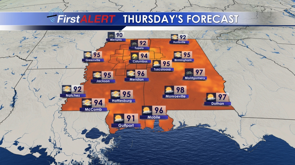
THURSDAY-SUNDAY: Scattered storms will be a bit more prevalent through the end of this week and into the start of next week. Highs in the low 90s, with perhaps one or two mid 90s Thursday. The heat index will range between 100° and 105°. Rain chances will climb to around 40-50%. Overnight, a shower or storm will remain possible, but less likely. Lows will range from the low to mid 70s.
MON/TUE: Quite, hot and humid. Highs in the low to mid 90s with a heat index between 105° and 110°. Hit or miss showers and storms possible. Rain chance around 30%. We will still see quite a bit of sunshine to start your week.
Follow us on social media @WCBIWeather on Facebook, Twitter, and Instagram


Leave a Reply