Quiet then getting active again this workweek
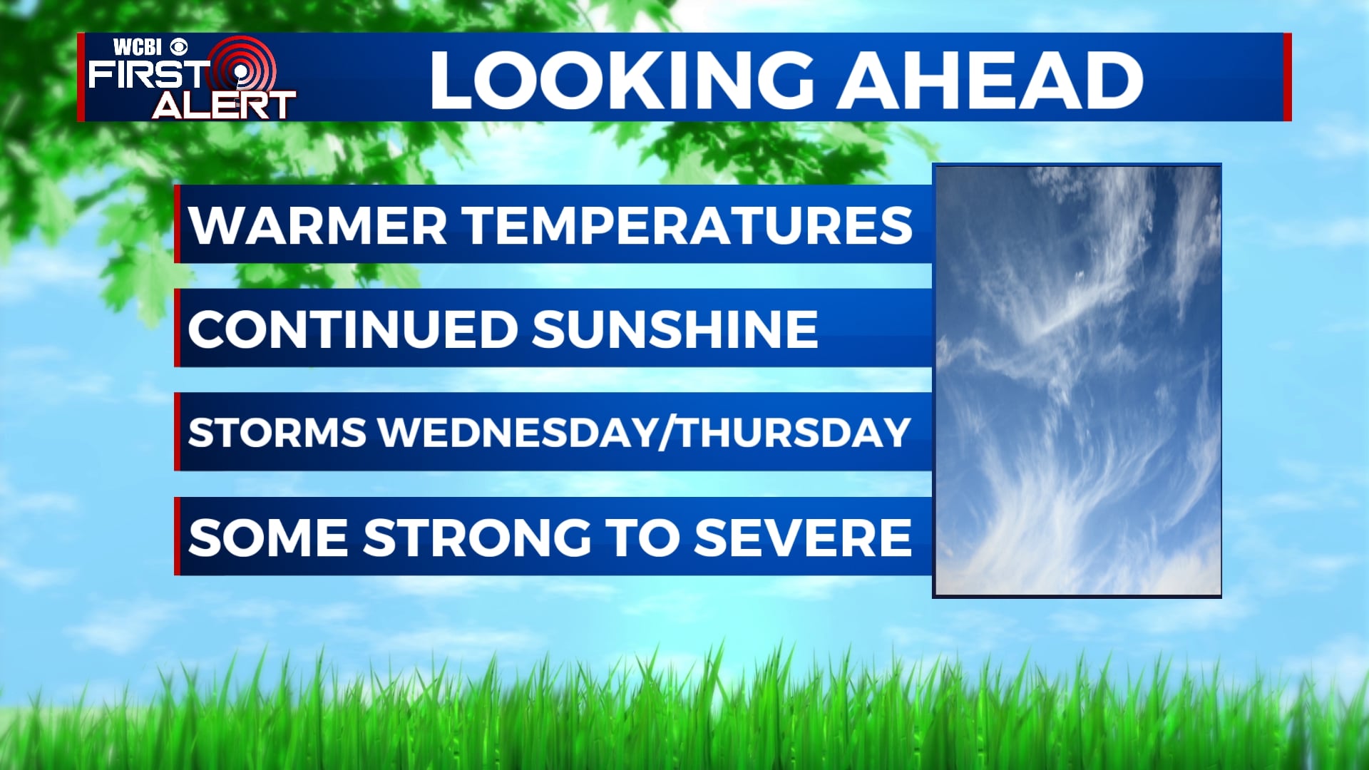
SUMMARY: After a beautiful Easter weekend, our sunny & quiet weather pattern will continue as we begin a new workweek. Temperatures will continue to warm up. Showers and thunderstorms will return into the area late Wednesday night into early Thursday morning. Some of those storms will be strong to possibly severe. We’ll keep you updated! Weather pattern should quiet down once again into the weekend.
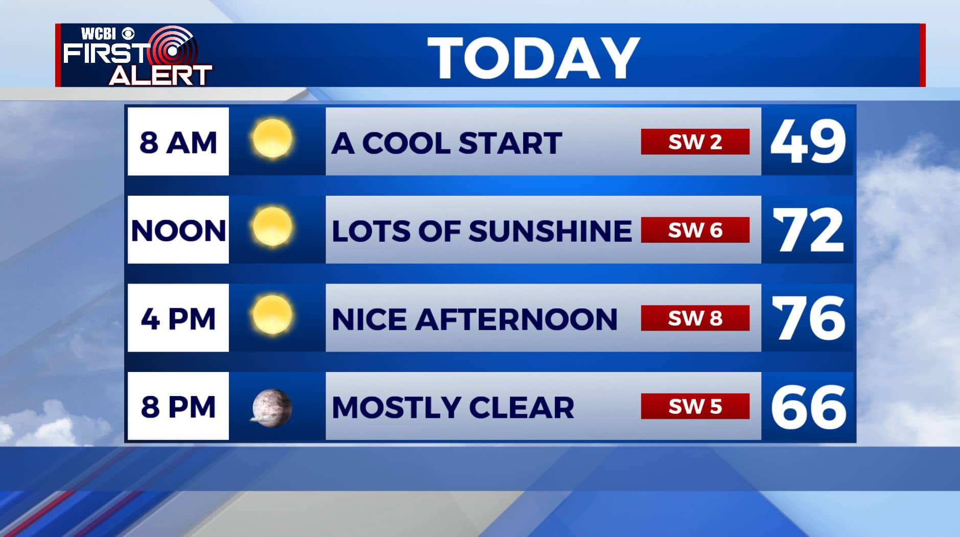
MONDAY: Lots of sunshine once again. High temperatures continue to warm up into the mid to upper 70s. SW winds 5-10 mph.
MONDAY NIGHT: Mostly clear skies. Overnight lows not as chilly as the last few previous mornings in the 50s.
TUESDAY: Sunshine mixing in with a few clouds. Highs in the upper 70s. Overnight lows in the 50s.
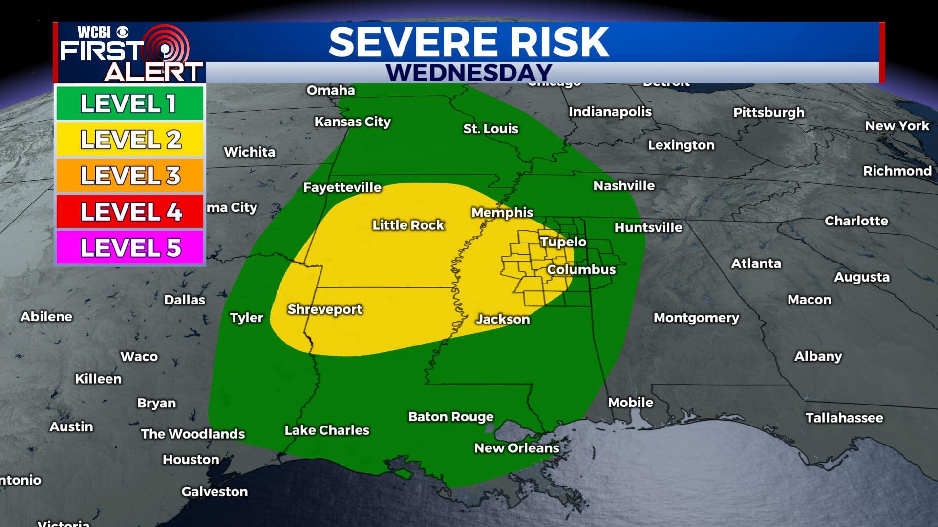
WEDNESDAY: Clouds will be on the increase throughout the day with showers and storms expected in the evening as our next cold front approaches. Highs will reach the upper 70s to near 80 degrees.
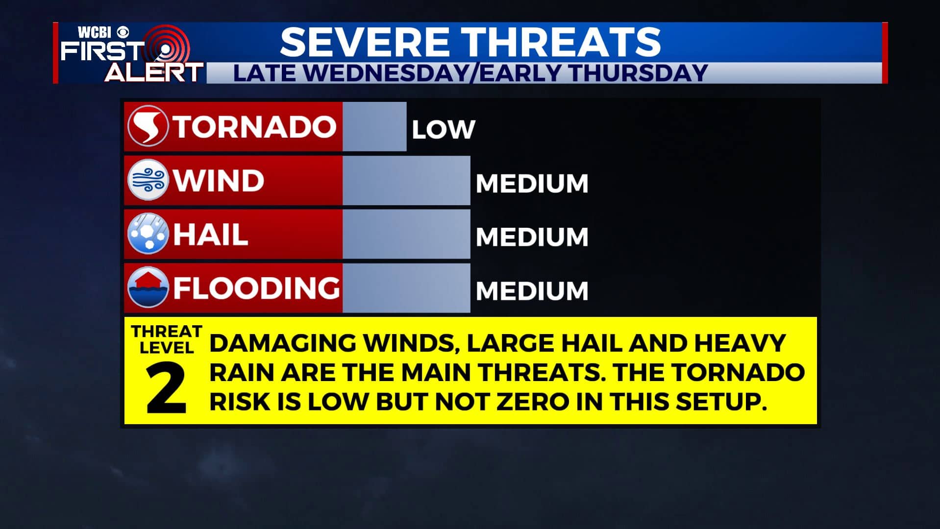
WEDNESDAY NIGHT THROUGH THURSDAY MORNING: Showers & storms continue overnight. Unfortunately, there’s also a severe weather threat with this round. Right now we’re under a Level 1-2 Risk for damaging winds, large hail and heavy rain. The tornado threat is low but not zero. We’ll be watching it! Overnight lows near 60 degrees.
THURSDAY: Showers and thunderstorms will move out early morning but we cannot rule out some scattered showers throughout the day. Highs in the upper 70s and overnight lows in the 50s.
FRIDAY-WEEKEND: High temperatures remain warm in the mid to upper 70s. Some showers are possible Friday into Saturday. More sunshine on Sunday.
Stay connected with @WCBIWEATHER on Facebook, Twitter, Instagram, and the WCBI News App.


Leave a Reply