Areas of fog tonight, Quiet Thursday
SUMMARY: Another weak weather maker may spark a few showers Friday but the weekend is still looking good. More rain and storms could arrive early next week.
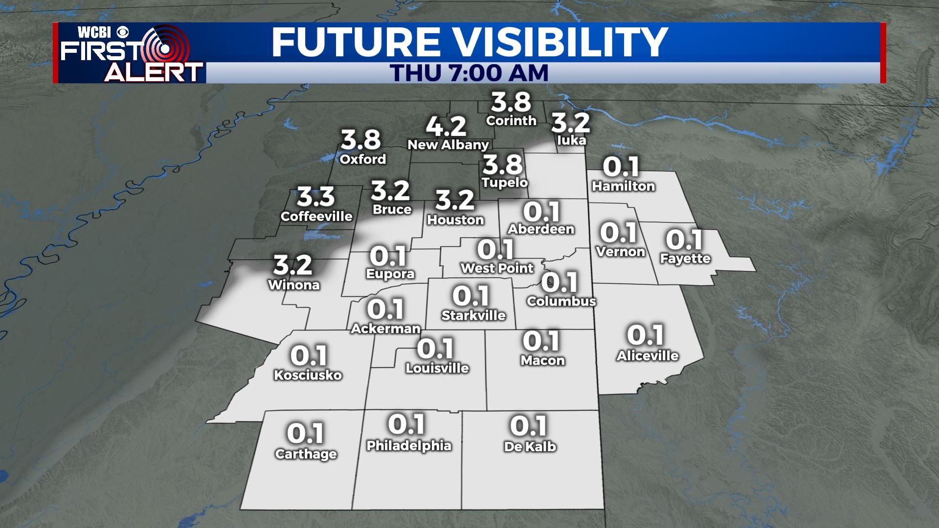
WEDNESDAY NIGHT: Mostly cloudy with areas of fog possible. Some could be dense. Lows in the upper 30s. Light wind.
THURSDAY: Clouds and sun. Highs in mid to upper 50s. Northerly winds 3 to 8 mph.
THURSDAY NIGHT: Variably cloudy. Lows in the low 40s.
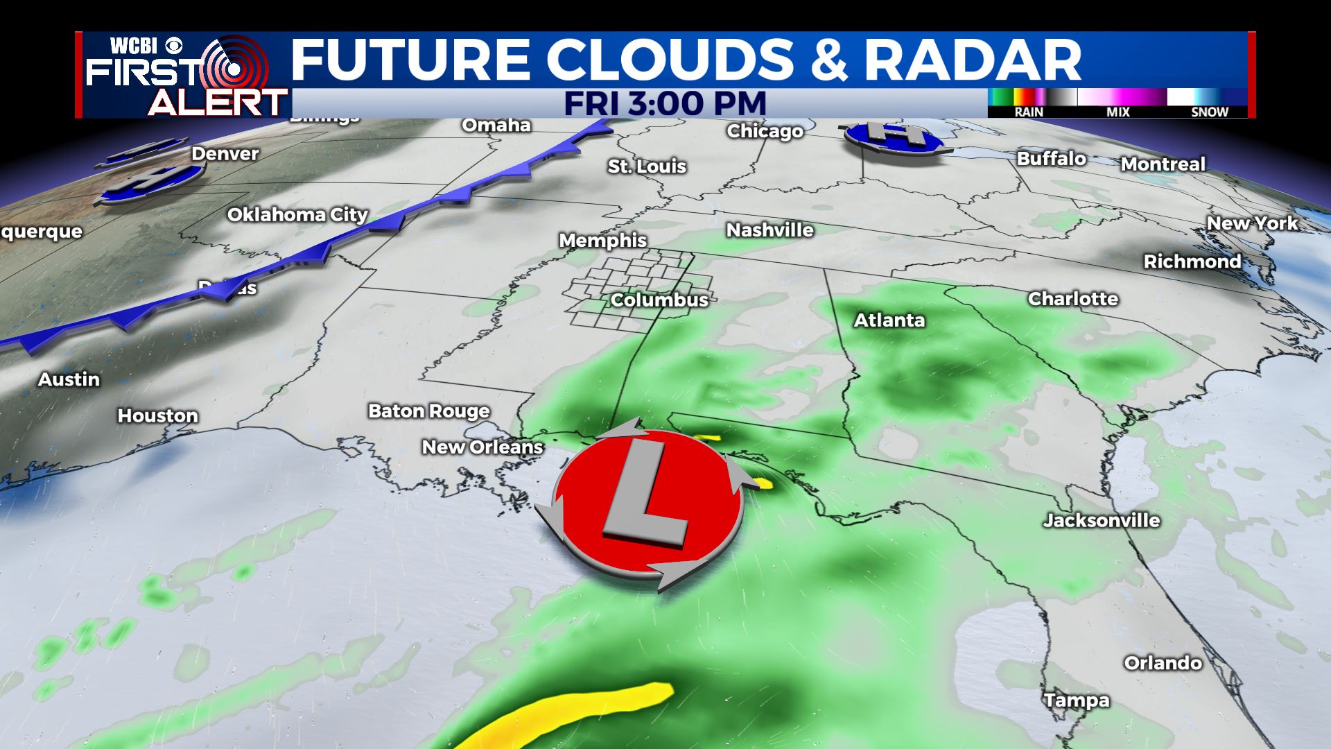
FRIDAY: Mostly cloudy with a 20% chance of showers. Highs in the mid to upper 50s.
FRIDAY NIGHT: Mostly cloudy. Lows in the low 40s.
SATURDAY: A fair amount of morning clouds with sun developing as the day wears on. Highs in the mid to upper 50s.
SATURDAY NIGHT: Mainly clear and quiet. Lows is in the 30s.
SUNDAY: Sunny and mild. Highs in the mid to upper 60s.
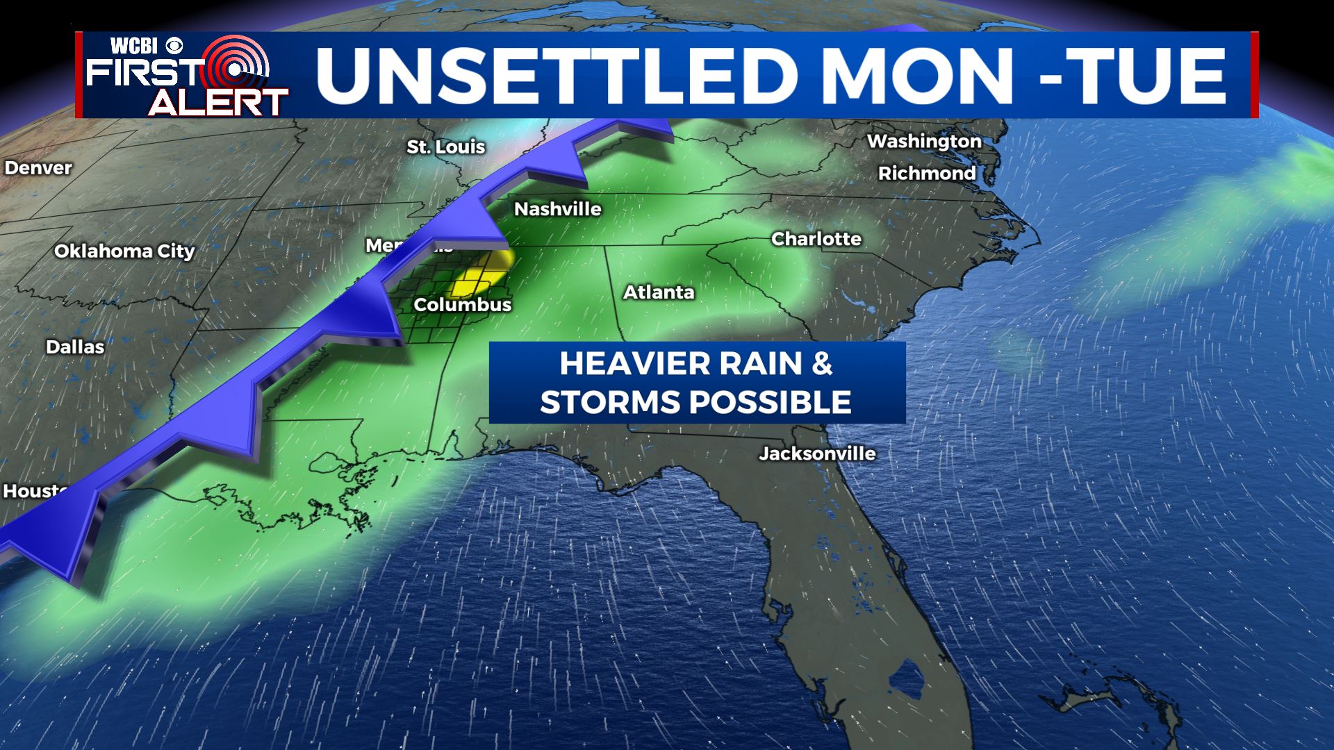
EARLY NEXT WEEK: Rain and even a few storms are possible Monday and Tuesday but the extent of it remains up in the air. Mild 60s to low 70s are also possible early in the week before more seasonable air returns Wednesday.
Follow @WCBIWEATHER on Facebook, Twitter, Instagram, and the WCBI News app


Leave a Reply