Quiet work week overall but watching stormy weather late week
SUMMARY: We’ll be mostly sunny & quiet this upcoming work week, but some light showers will push through Monday night. More rain and thunderstorm activity is possible Friday and Saturday. Some of those storms could be strong to severe. Something we’ll need to monitor as anything could change with the forecast.
FLOODING UPDATE: Most if not all local waterways have crested and water will slowly recede over the next few days. Rivers and creeks are expected to fall below flood stage by Thursday, but more heavy rain is possible after that. It doesn’t look like we’ll see quite as much rain with this next system, but we’ll have to keep an eye on things.
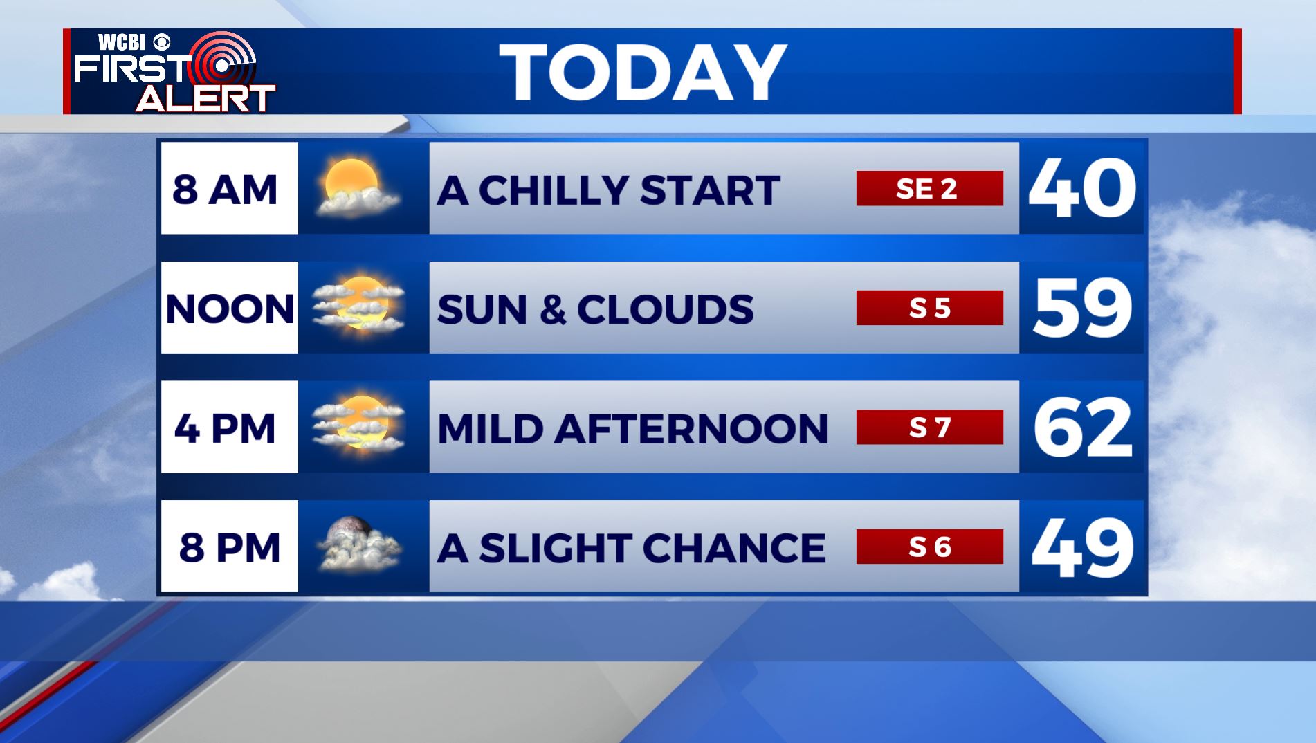
MONDAY: We’ll see a mix of sun and clouds throughout the day with temperatures reaching the lower 60s by the afternoon. S wind 5-10 mph.
MONDAY NIGHT: Areas of light rain. No storms are expected and all rain should exit the area by sunrise Tuesday. Overnight lows in the lower 40s.
TUESDAY-WEDNESDAY: Clouds will clear by Tuesday and we will be mostly sunny for Wednesday. Highs will be in the mid to upper 50s with breezy NW wind on Tuesday 10-20 mph. Overnight lows in the 30s.
THURSDAY: Clouds will increase on Thursday as our next storm system approaches. Highs will be in the lower 60s. Overnight lows in the 50s. A breezy SE wind 10-15 mph.
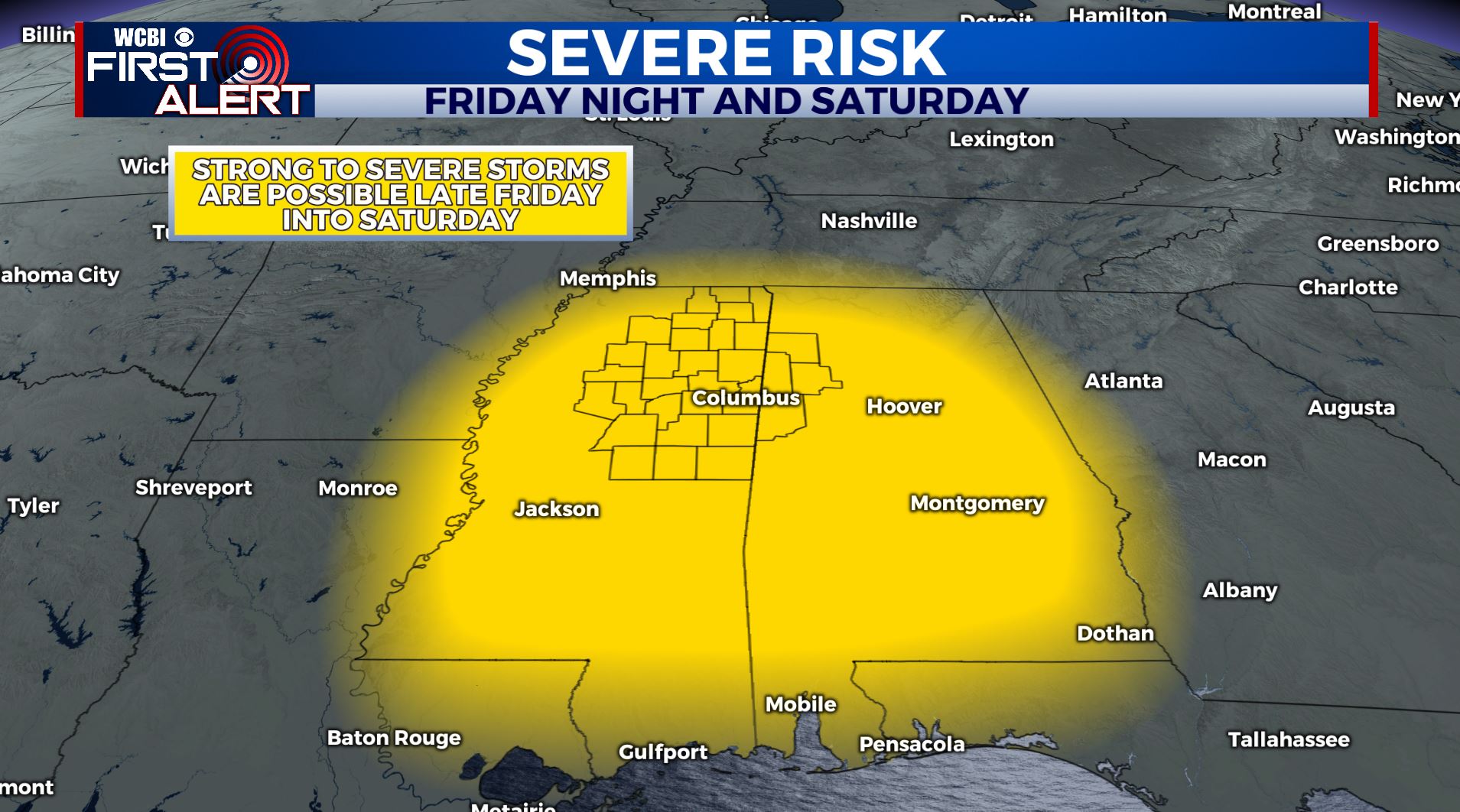
FRIDAY-SATURDAY: Yet another strong storm system & cold front will approach the area on Friday. It’s a bit too early to for the specific details, but storms could start as early as Friday afternoon. The best chances for stormy weather will be late Friday into early Saturday. A few of these storms could be strong to severe. The potential is there for more heavy rain, damaging winds and an isolated tornado. We’ll continue to monitor and revise the forecast throughout the work week, but for now…plan accordingly. Highs will be near 70 on Friday then cooling down to the mid 60s by Saturday.
SUNDAY: With rain having exited the area, we’ll see a mix of sun and clouds with highs in the lower 60s.
STAY WITH @WCBIWEATHER ON FACEBOOK, INSTAGRAM, TWITTER AND ON THE WCBI MOBILE APP.


Leave a Reply